Good Wednesday to one and all. Our weather pattern continues to turn more concerning as rounds of showers and storms target the Commonwealth. This setup can easily lead to flash flood issues and may even throw some big winds at us this weekend or next week.
There’s a disturbance pushing across the region today, igniting semi-spiraling bands of showers and thunderstorms. This continues into Thursday with the potential for hit and run flash flooding concerns.
This similar look continues into Thursday and Friday. The forecast models are putting down a lot of rain…


This is also about the time we have to watch for bigger complexes of thunderstorms to develop and roll in here from the northwest. That setup may very well go into the first half of next week…

The forecast models continue to really set the stage for torrential rains out of this…

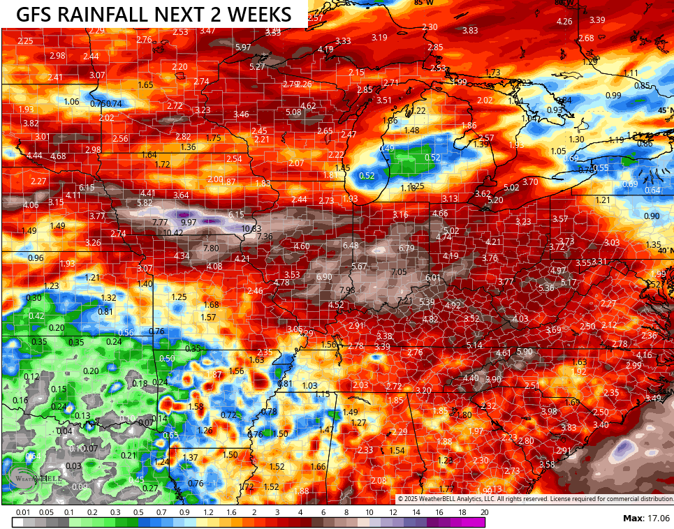
Additional complexes of storms may then work through here in similar fashion later next week into the following week. The GFS shows significant rain totals during this time…
In addition to the possibility of flash flooding, some of those storms can pack some big time winds.
Can we get moisture from a potential tropical system developing in the Gulf? Maybe.
This system shows up well on the satellite…

The National Hurricane Center continues to show an increased potential for development in this area…

I leave you guys with the Wednesday edition of your storm tracking tools…


Current watches

Possible Watch Areas

Make it a wonderful Wednesday and take care.

I’ll believe it when I see it.
Here in Maple we received about 0.30 ” in the past 48 hours. Every little bit helps to ward off any local drought situation. Next week the temperatures are trending warmer. Maybe approaching near 100 degrees. It use to be that we would receive a pleasant break in the heat, three or four times during the Summer months. Not any more.