Good Saturday, everyone. This super soaker and super stormy pattern continue to rock the Commonwealth of Kentucky. Rounds of strong storms are putting down torrential rains, creating flash flooding this weekend into early next week.
This pattern has been on the KWC radar for the past several weeks and it continues to show no signs of slowing down. Repeat showers and storms drop in from northwest to southeast today, Sunday and into early next week.
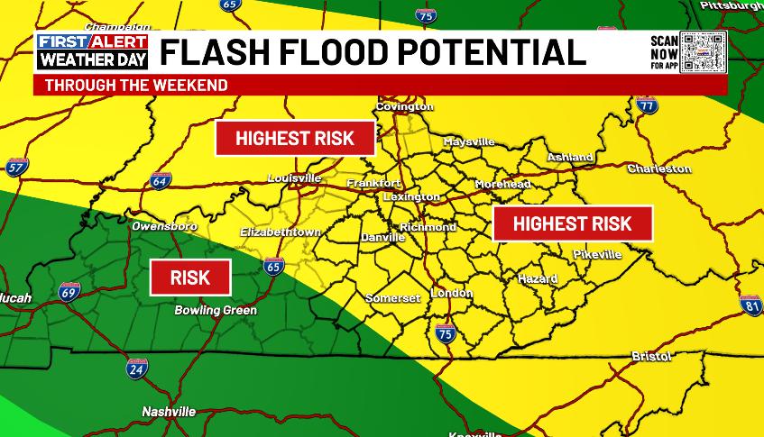
I have no changes to this map I made several days ago to give you a heads up on what we are now dealing with…
The EURO has struggled this year to pick up on all the rain and storms, but even this model is seeing what’s happening today through Tuesday…
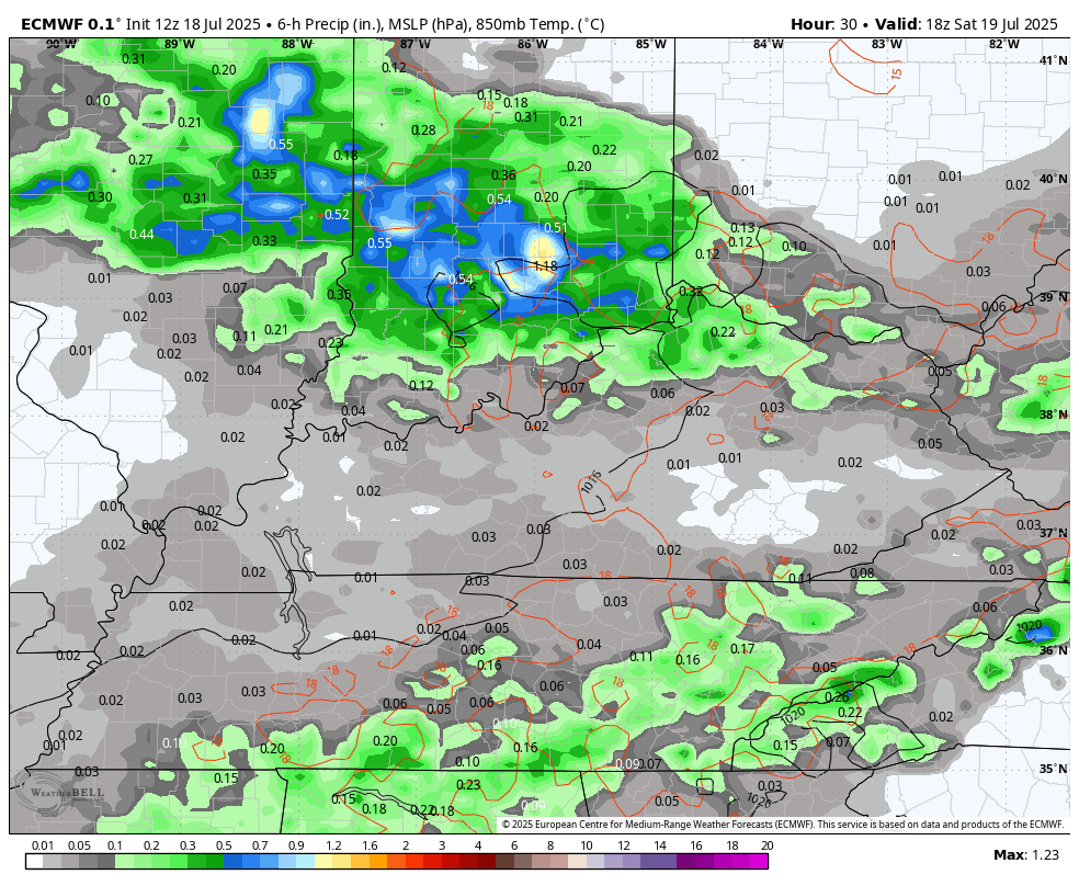
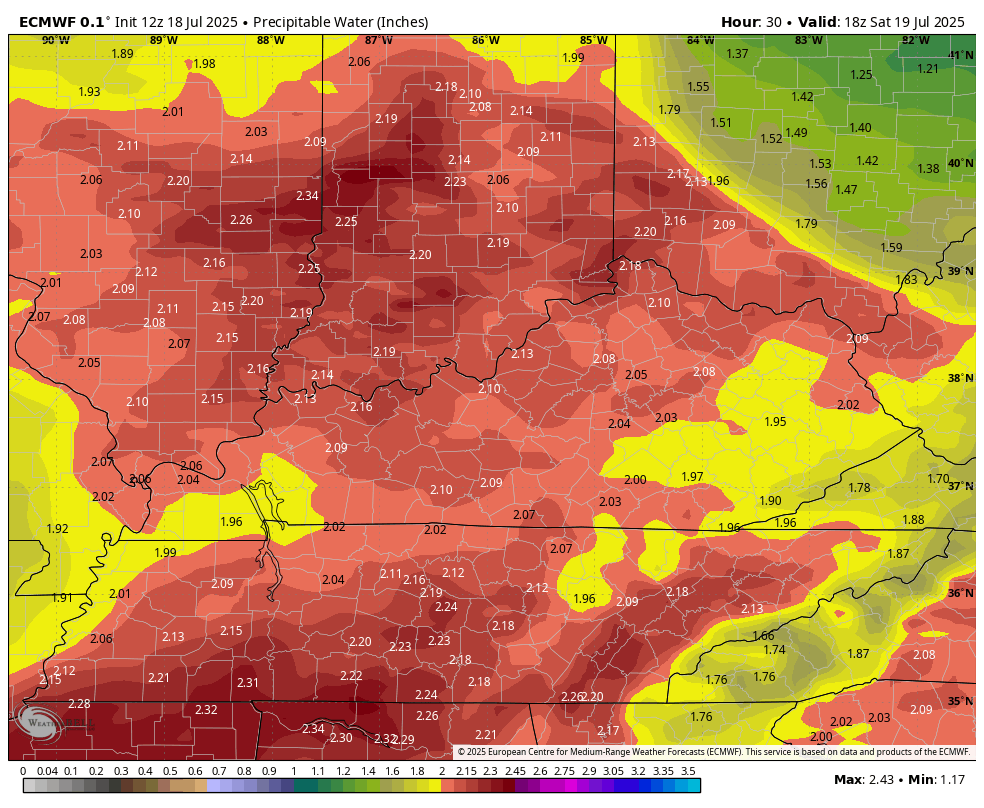
These waves of thunderstorms are rolling along a semi-stationary boundary oriented from northwest to southeast across the region. Along and south of this boundary, we have a tremendous amount of tropical moisture. One of the best ways to see this is by using the Precipitable Water. Anything above 1.5 is juicy. Getting into the 2 to 2.5 range and you’re just asking the sky to produce flash flooding rains…
Notice how the drier air FINALLY wins the battle by Tuesday night and Wednesday.
Given all the rain and flash flooding we’ve seen and with all the torrential rains yet to come, Flood Watches should be out for the entire area through the weekend and early next week. It’s been disappointing to see the NWS offices covering central and western Kentucky not have these up.
Here’s hoping those go up today…

The current warnings map…

In addition to the flash flood potential, some of these storms may be strong or severe with damaging winds as the main player.
Here’s today’s Severe Weather Outlook from the Storm Prediction Center…

This threat continues into Sunday…

the day…


Current watches

Possible Watch Areas

Make it a sensational Saturday and take care.

Thanks Chris. My area has been spared from the very heavy Rains. So far this month we have received 1.27 inches, which is about normal for July in my area. Temperatures are about normal too. Highest temperature so far this Summer was 92 degrees, but very high dew points make it uncomfortable. Will be glad when we start Autumn talk.
Have a Great Weekend Everyone !
We need sunshine and warmth, not this garbage.
LOL…. I could use more Sunshine and the plant life out there too, but I’m enjoying the beautiful tropical clouds. It’s very interesting to see these cloud types this far North.
Since a number of you use your name in your handle, I thought I ought to follow suit. So following the example of MarkLex, my former handle of LexingtonYardGuy is now JimLex.