Good Sunday, everyone. The worst of our stormy setup is likely coming later today through Monday. That’s when the severe storms threat and flash flood threat look to reach their peak before calming down for a bit.
I don’t like the setup from this afternoon through Monday evening as it can produce some areas of significant flooding. The models are seeing this potential and are REALLY amped up now that we are here.
The NAM and Hi Res NAM are both seeing the potential for streaks of torrential rainfall…
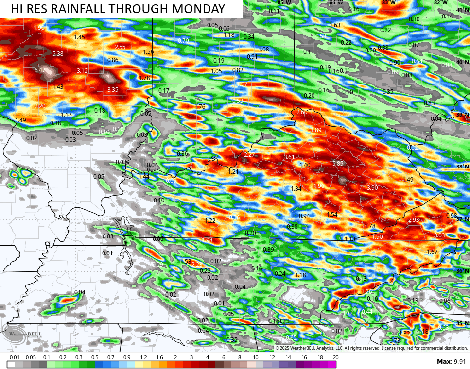
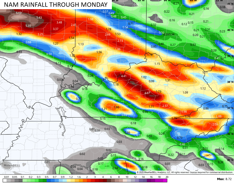
Those maps pretty much match the map I made last Wednesday…
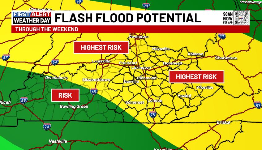
The potential for major flash flooding is there across parts of our region. In terms of knowing exactly where these areas are will be determined by where the storms decide to train.
In regard to the severe storms threat, damaging wind is the primary threat. Today’s Severe Weather Outlook from the Storm Prediction Center looks like this…

Here’s the Severe Weather Outlook for Monday…

Can we get Flood Watches issued for the threats of today and Monday? On Saturday, the Weather Prediction Center, a branch of NOAA, was accurately portraying the heavy rain and flood threat in our region. Still, none of the local NWS offices would put up a Flood Watch, yet they were forced to issue numerous Flash Flood Warnings. Several of those warnings came with a “considerable flooding” or “life-threatening flooding” tag.
Let me say this… I am 100% in support of fully funding NOAA and the NWS. Every office needs to be fully staffed, and these folks need some pay raises while we are at it!! I could really say a lot more on this subject, but I’ll spare you guys. ha
Here’s a look at today’s watches and I hope we see some green…

The Current Warnings map…

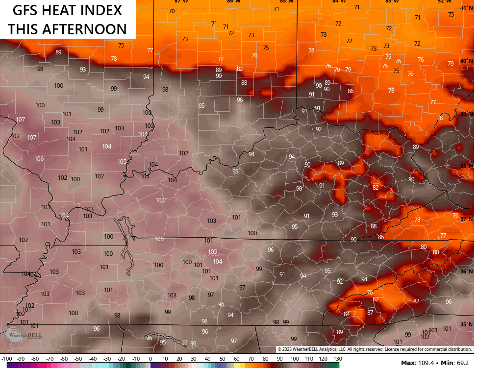
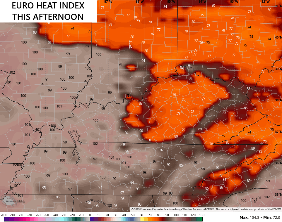
The storms out there today and Monday are forming and racing around the outer edge of heat and humidity from western Kentucky into the Plans and lower Mississippi Valley.
Heat Index numbers in the west can go reach 105 in some areas. Notice the big drop across central and eastern Kentucky…
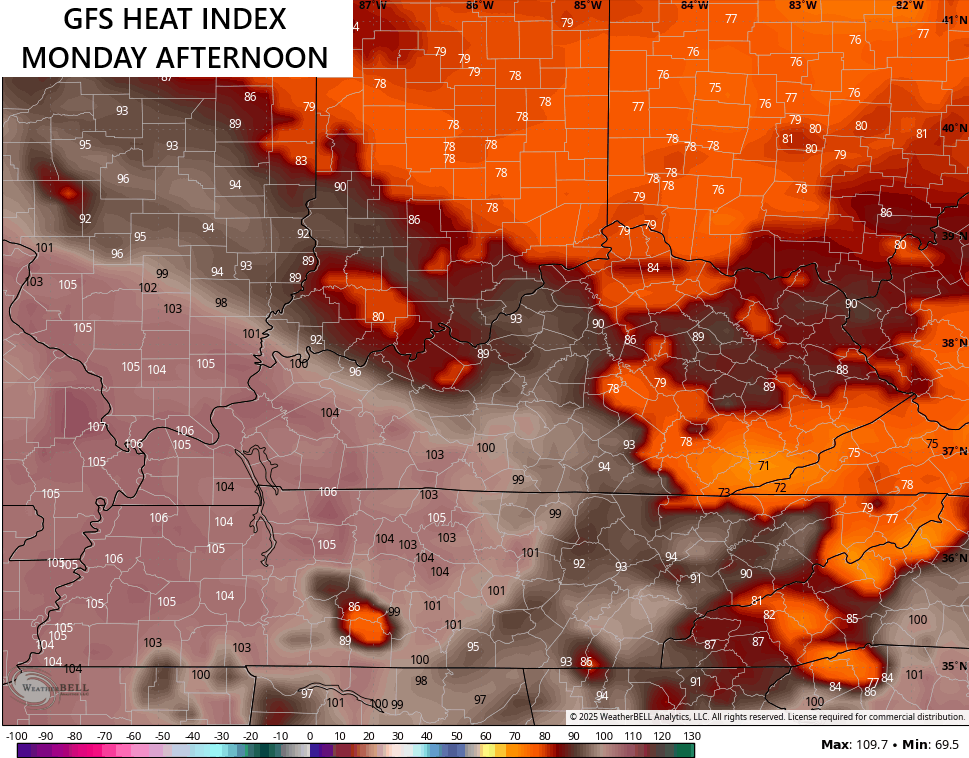
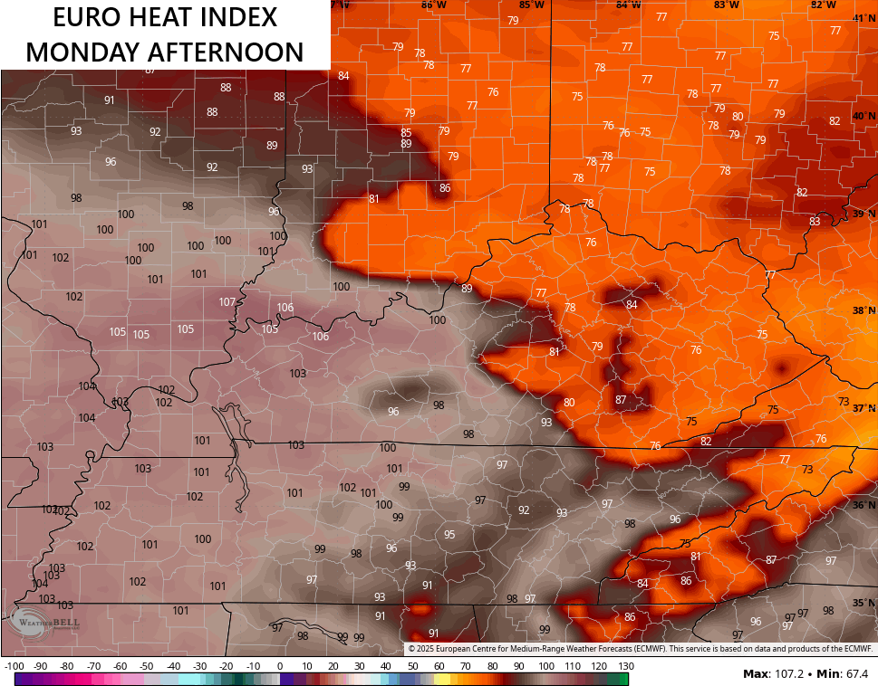
This same general look carries us into Monday…
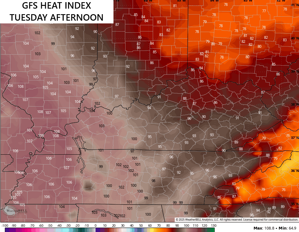
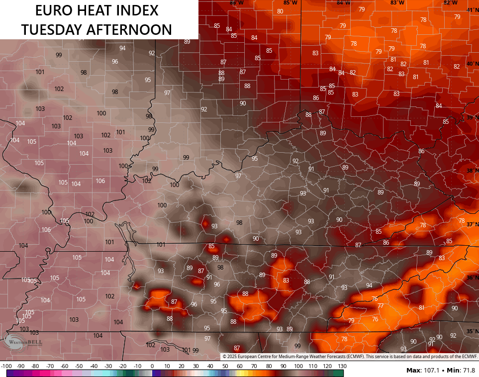
The central and eastern parts of the state continue to be in really good shape for Tuesday as the west bakes…
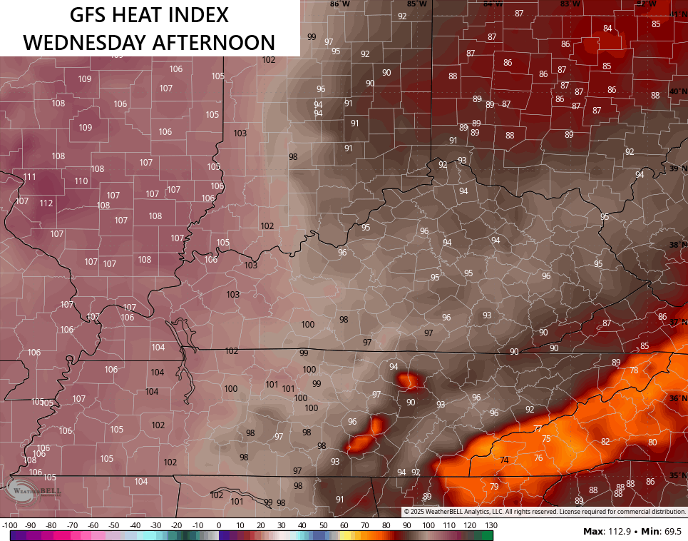
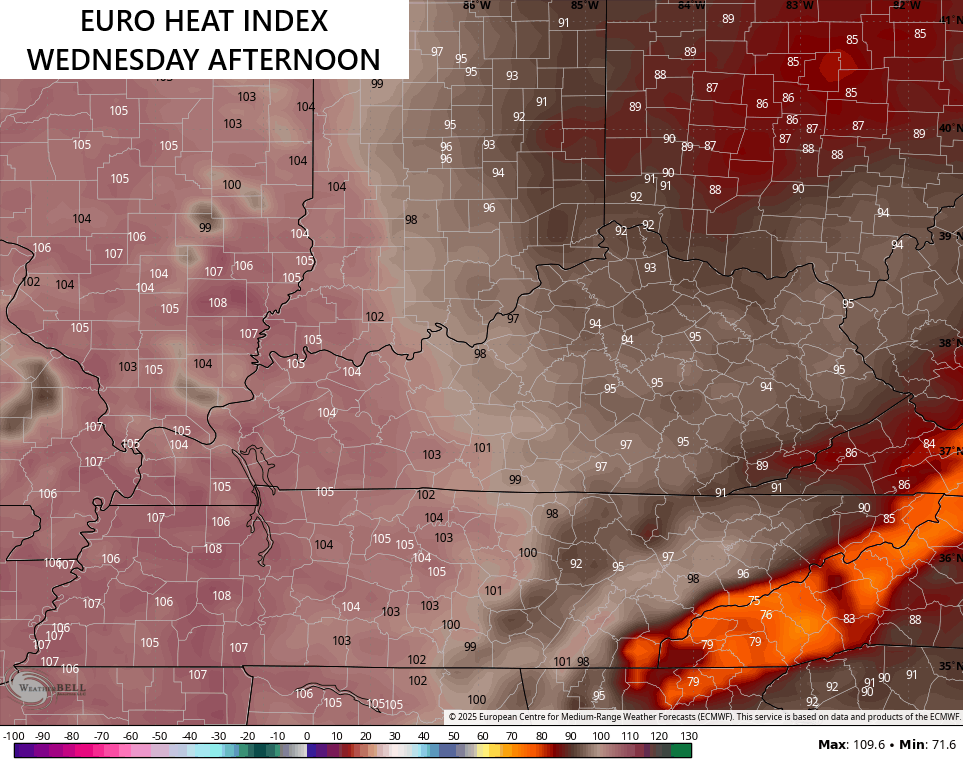
The numbers in the central and east come up a bit on Wednesday, but that’s pretty typical for late July…
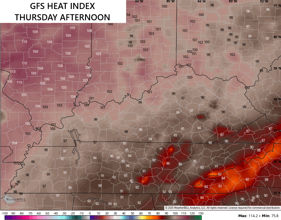
Thursday finds the heat in
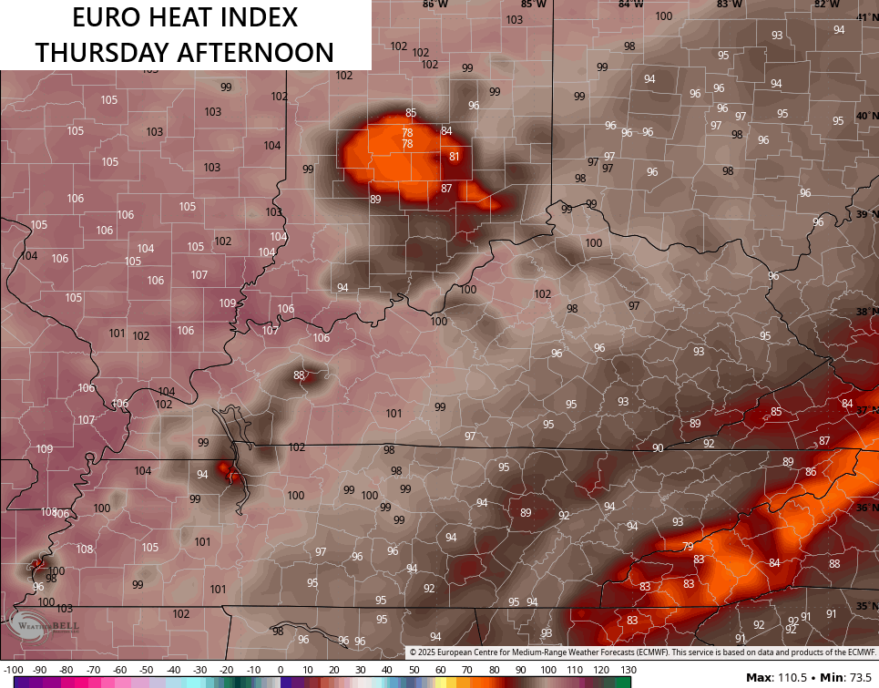
I leave you with your full complement of Sunday storm tracking tools…


Current watches

Possible Watch Areas

Make it a sensational Sunday and take care.

We need sunshine and heat, not a lot of rain.
Agree on the Sunshine with highs in the 70’s
It was another hot, steamy day in Bowling Green. At 3:30 pm, we hit a high temperature of 94.5°F, a dewpoint of 80.4°F, and the heat index maxed out at 115.1°F. A strong thunderstorm blew through around 5:00 pm. It brought the temperature down 20° in 15 minutes, and dropped 0.50 inches of rain..
Here in Maple, we had about a half inch. The storms came in two waves late yesterday.
PLEEEAAASEEE! Not Another heat wave.. UGGGGHH
Better get use to it Mark, because I think the heat is here to stay until there is a change in the Pacific sea surface temperatures.
I’m excited myself.
The last 3 days: .13” + .09” + .01”. The total numbers suggest we’re getting moisture into the ground, but light drizzles spread over several hours don’t get through the foliage. A soaking rain event would help.
Maybe that will happen today.
The region is still far over normal rainfall. It’ll be ok.
Thanks Chris. I’m wondering now what the future will be in weather forecasting ?
My PWS has recorded only .35 inches of rain these past 7 days in SE Lexington. The storms seem to be above or below us! Plenty of thunder, though. Maybe today we’ll get rain.
Higher pressure to our south may be keeping the more widespread rains to our North would be my guess. We shall see later today.
NOAA and the NWS need to be FULLY FUNDED, and those forecasters ABSOLUTELY need a raise! I dont think people around the country realize how few of them there are!
100% AGREED !!!
Indeed, it is irresponsible, especially when you consider the severe weather uptick we have experienced in recent years. During that period, we have seen how inconsistent many of the forecasting models have become. Working with those models to construct a reliable forecast is a highly interpretive process, one that draws on every bit of a meteorologist’s experience, which they’ve accumulated over many years. The bottom line is, discarding skilled forecasters isn’t just foolhardy, it is flat-out reckless!
Well said Joe.
Truth
I remember watching the first Moon landing back on July 20th, 1969. Here’s the video :
https://www.google.com/search?q=moon+landing+1969&sca_esv=81ed54669828d381&sxsrf=AE3TifMiAX1fe9Ap2Wtrlu7nm4kuBCKhjg%3A1753036659430&source=hp&ei=czd9aLCvGNPawN4Ps9z_mAk&iflsig=AOw8s4IAAAAAaH1Fg7kI_BSl9SaxnBZrzy67R380AdeE&oq=Moon+landing&gs_lp=Egdnd3Mtd2l6IgxNb29uIGxhbmRpbmcqAggCMgsQABiABBixAxiDATILEAAYgAQYsQMYgwEyCxAAGIAEGLEDGIMBMgsQABiABBixAxiDATILEAAYgAQYsQMYgwEyDhAAGIAEGLEDGIMBGIoFMgsQABiABBixAxiDATIFEAAYgAQyBRAAGIAEMgUQABiABEiRoAFQAFirdnACeACQAQCYAaYBoAHoDKoBAzUuObgBAcgBAPgBAZgCEKAC-Q3CAgsQABiABBiRAhiKBcICDhAuGIAEGLEDGIMBGIoFwgIIEAAYgAQYsQPCAg4QLhiABBixAxjRAxjHAcICCxAuGIAEGNEDGMcBwgIFEC4YgATCAhAQABiABBixAxhDGIMBGIoFwgIQEC4YgAQY0QMYQxjHARiKBcICCxAuGIAEGLEDGIMBwgIIEC4YgAQYsQPCAgoQABiABBhDGIoFwgILEC4YgAQYxwEYrwHCAg0QABiABBixAxhDGIoFwgIKEC4YgAQYQxiKBcICDRAuGIAEGLEDGEMYigXCAgsQLhiABBixAxjUApgDAJIHBDIuMTSgB56BAbIHBDAuMTS4B-MNwgcGMi0xMi40yAeAAQ&sclient=gws-wiz#fpstate=ive&vld=cid:608e52ec,vid:hzApsIPHRwo,st:0