Good Monday, everyone. No, this is not a recording… Rounds of showers and storms are rumbling through Kentucky again today, bringing more flash flooding. Some of these storms may also be strong to severe.
A boundary is still oriented from northwest to southeast across Kentucky and that’s providing the focal point for these waves of showers and storms. Torrential rains will likely cause additional flash flooding issues, especially across central and eastern Kentucky.
A Flood Watch continues for much of this area today…

Here are the current warnings…

Just like Sunday, some of the storms may pack a bit of a punch, but the severe threat is a bit lower and farther south compared to Yesterday. Here’s Today’s Severe Weather Outlook from the Storm Prediction Center…

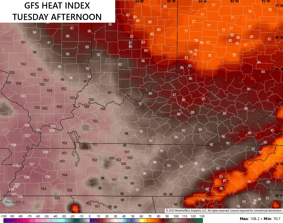
This boundary will still spit out a few showers and storms into Tuesday as it slowly becomes more diffuse. To the south and west of his boundary, it’s the swamp with a heat index today around 105 in the west. That looks to be with us again Tuesday with much better air in the central and east…
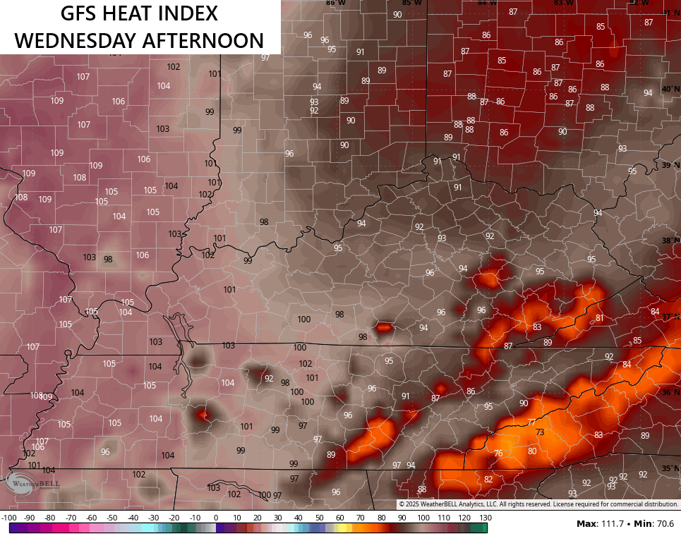
Wednesday keeps the west backing as the rest of the state comes up a bit…
Nothing changes out west for Thursday with areas of central and eastern Kentucky with a heat index in the mid and upper 90s…
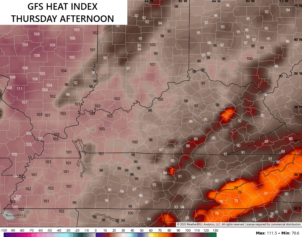
Notice the cooler spots in the east? That’s because isolated showers and storms go up during the afternoon and evening. By Friday, more in the way of scattered showers and storms join in on our steam bath and those look to go through the weekend into early next week.
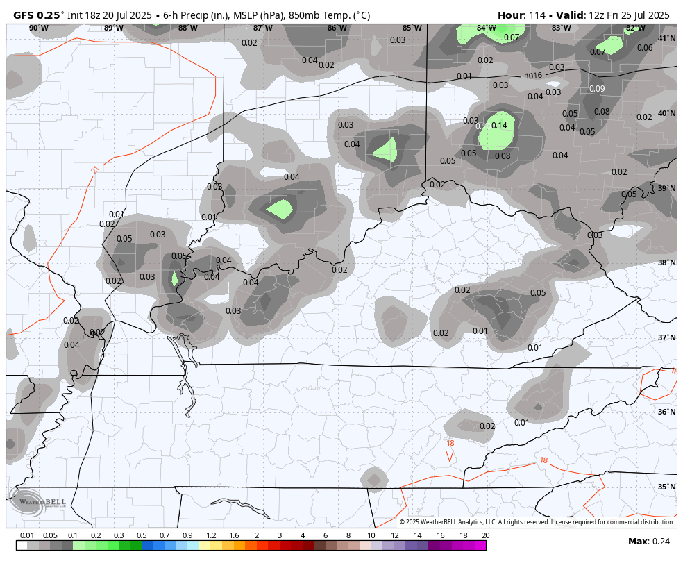
Here’s the GFS from Friday morning through Tuesday…
The EURO has a similar look…

I leave you with your full complement of Sunday storm tracking tools…


Current watches

Possible Watch Areas

Make it a magnificent Monday and take care.

Pouring rain now at my house but this is the first time since being in this weeklong stormy pattern that we’ve actually had rain.
None at my house. Looks like today a better chance ?
.47” yesterday afternoon (in an intense, brief downpour), so it looked like a repeat was going to happen overnight. Nope. Just grazed us. .06”
Richmond has stayed mostly dry and I’m not complaining a bit.
According to my PWS, the temperature high was 95.1°F, but an absolutely nuts dewpoint value of 83.7°F pushed the heat index to an equally nuts reading of 120.1°F! Our local forecast had posted an 88 percent chance for rain, but we received none.
At 8 am today, the temperature has already reached 82.2°F. The local forecast today is calling for a 99 percent chance of rain, so we’ll probably receive a trace.
Proof that models often fail.
Schroeder it looks like your county is getting hit. Update us when you can.
We had about a half inch, your right Jeff, we DON’T need anymore Rains. Time for Sunshine.