Good Wednesday to one and all. The summer steam is starting to flex a little bit and will do so through the upcoming weekend. As we steam it up, scattered showers and storms will also begin to show back up.
I’ll get into all this and I’ll look toward a comfy start to August.
The comfy air across central and eastern Kentucky this morning slowly grows more humid through the day. Highs hit the mid and upper 80s in these areas with 90-95 in the west. The Heat Index in the west will reach 105-110 at times. An Excessive Heat Warning is out for the far west…

Similar Heat Index numbers will be noted out west over the next several days. Farther east, the numbers will be way down but can still reach 100 at times in some areas, especially Friday into the weekend.
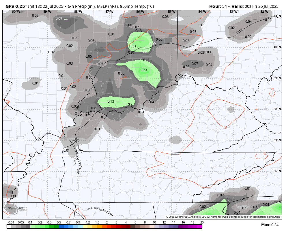
That’s also when a few showers and storms go up before this increases into the first half of next week. This animation goes from Thursday evening through next Wednesday morning…
All of this is ahead of what may be a very comfortable push of air to begin the month of August. The AI version of the EURO has been all over a pretty big dip in the jet stream in the eastern part of the country and it continues to see this well…
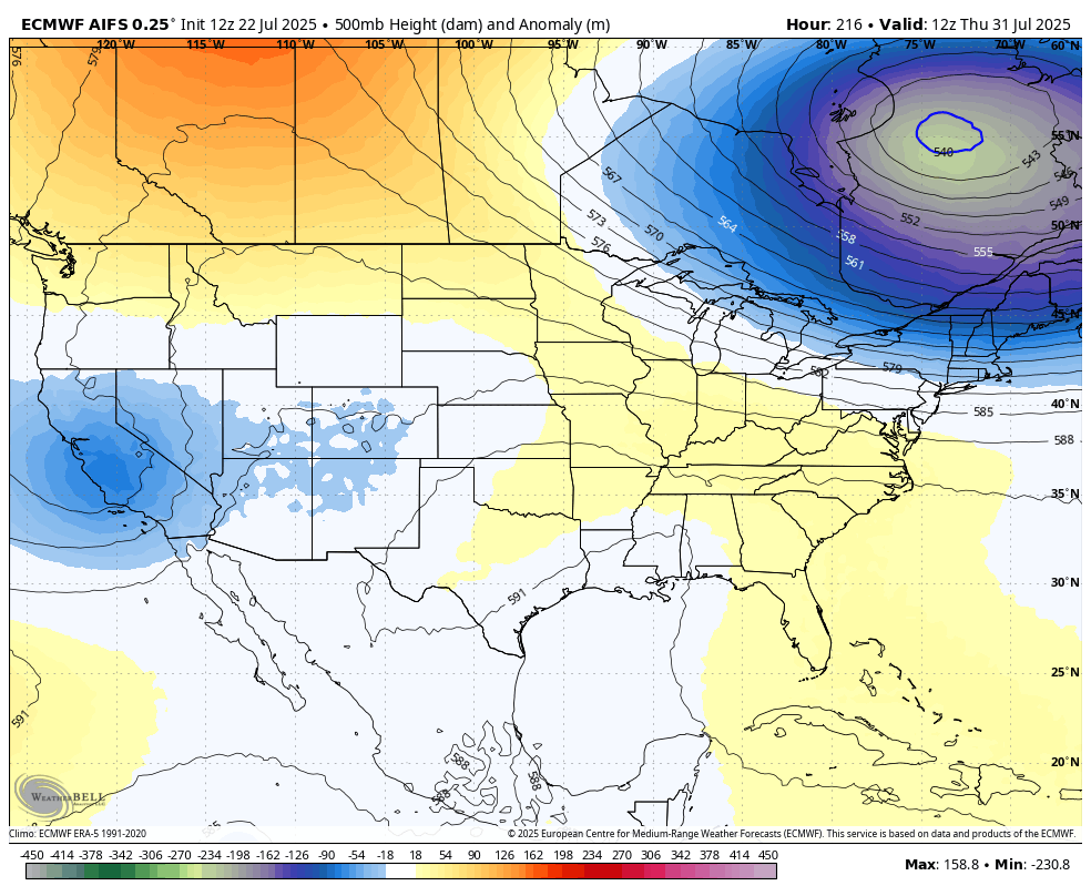
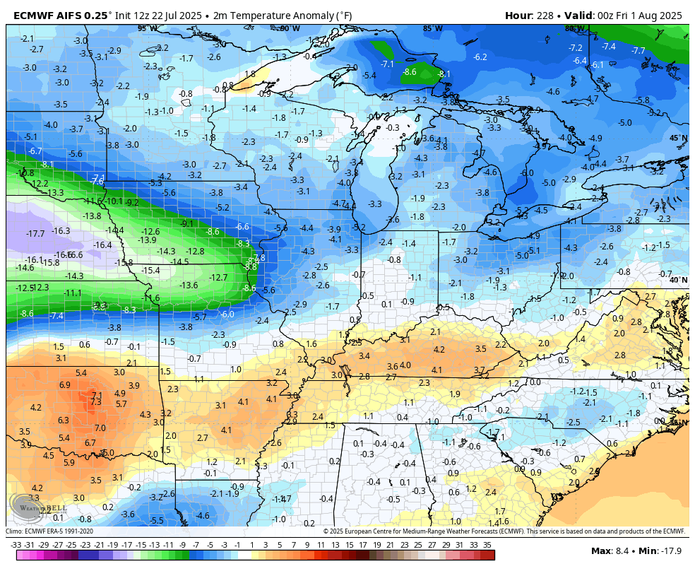
The EURO AI shows the below normal temps one would expect with a trough like that…
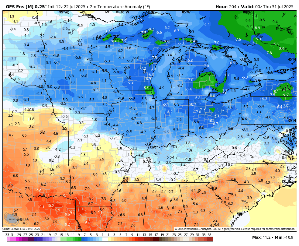
The EURO AI is now getting some friends. The GFS is seeing this…
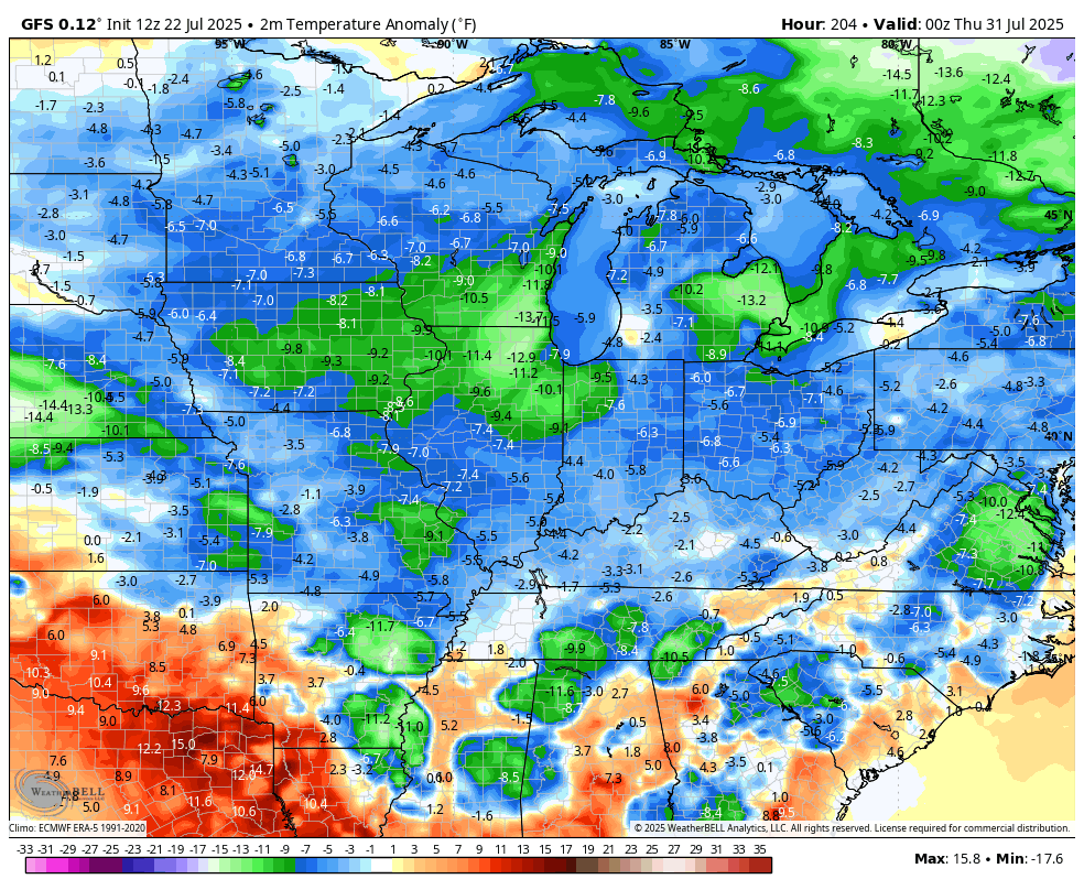
So are the GFS Ensembles…
Sign me up for that!!
Here are your regional radars to track any shower or storm lurking nearby…

Make it a wonderful Wednesday and take care.

Those models are liars and you know it.
With the integration of AI into the field of weather forecasting, modeling is steadily improving. The data is immense and complex.
https://e360.yale.edu/features/artificial-intelligence-weather-forecasting
Sorry Jeff we do need a break hope it comes to a frustration
LOL….
Omit the above.
Thanks Chris. I’m hoping the models pan out on the cooler days. All the models are in agreement for a change. If we have a cooler, drier August with lots of Sunny days, our Autumn will be colorful.