Good Saturday, everyone. Heat index numbers spike today across many areas as the summer steam steams right along. This will bring an increase in scattered storms out there today into the next few days.
As we look longer range toward the start of August, we continue to see a much more comfortable pattern taking shape. Until then… We sweat.
One or two of the storms this weekend may be strong or severe but this doesn’t look like anything more than that.
Here’s today’s Severe Weather Outlook from the Storm Prediction Center…

The Sunday Severe Weather Outlook looks like this…

Steamy temps hang tough until Wednesday when a stout cold front drops in from the northwest. This unleashes a much cooler setup with some storm chances.
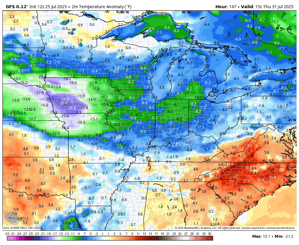
here’s the GFS from Wednesday through the first week of August…
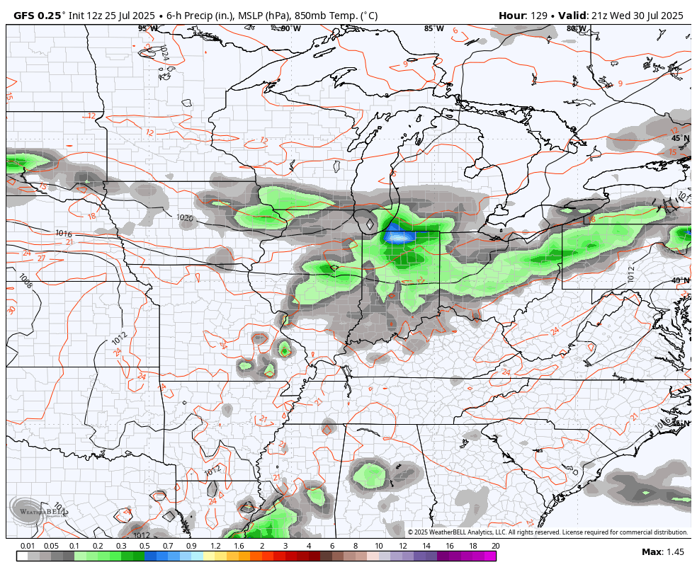
This brings in some absolutely awesome air with temps potentially going well below normal..
I leave you with your full complement of Sunday storm tracking tools…


Current watches

Possible Watch Areas

Make it a sensational Saturday and take care.

Temps will not go “well below” normal.
There’s always a 50 / 50 chance Jeff.
“Well below normal” for August means the A/C is still running. And “some storm chances” means we’re still watering.
Exactly right Jim. I think I’m going to go ahead and water my one Rhododendron, even though it shows no sign of stress from this awful heat. We have not had a drop of rain for ten days now.
Agree