Good Wednesday, everyone. Today has a chance to be the hottest day of the summer before the pattern completely changes as we close out July and enter August. That’s when much cooler temps settle into the region.
Temps today can hit 90-95 in many areas with humidity levels making it feel 100-105 across central and eastern Kentucky with 110+ in the west. That’s where the heat has been concentrated over the past week.
Isolated storms will go up with a little better shot in the southeast during the daytime hours. By this evening, we will watch for a few storms going up to our northwest. Those could come rolling in and some of these may be strong or severe.
The Storm Prediction Center has the low-end risk for parts of the area today…

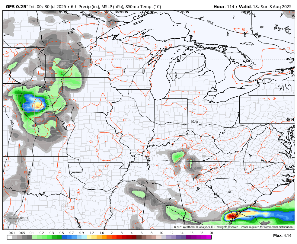
The cold front arriving Thursday will have rounds of showers and storms along and ahead of it. You can see all the showers and storms from tonight through Thursday night…

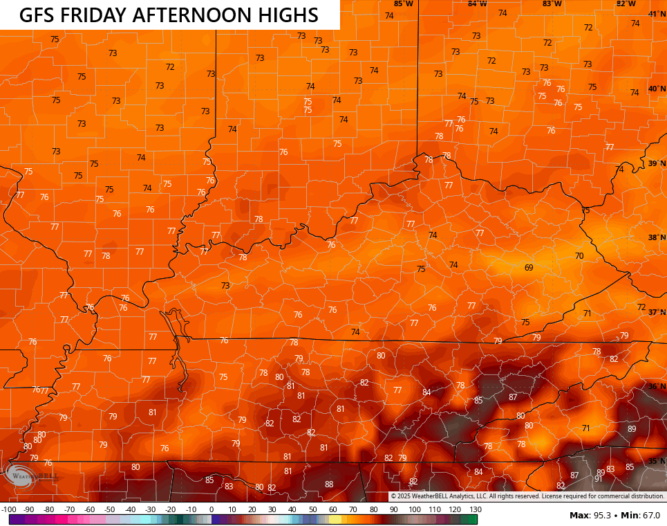
The air coming in behind this is flat out awesome and well below normal to start August. Normal highs are generally near 90 for this time of year, but many locations may not get out of the 70s for Friday…
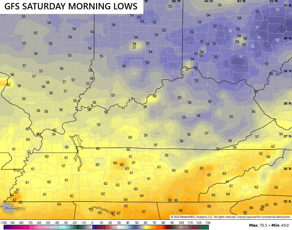
Lows by Saturday morning may be deep into the 50s…
Temps stay below normal this weekend and into much of next week as the potential for a few showers and storms creeps back in…
I leave you guys with all your mid-week tracking tools…


Current watches

Possible Watch Areas

Make it a wonderful Wednesday and take care.

Thanks Chris. Really looking forward to the lower dewpoints, but Summer weather is far from over. Maybe we will have weekly breaks from the heat until cooler / colder Autumn weather takes over.
This “cooldown” won’t last.
Of course not Jeff, but I hope there’s more cooler breaks to come.
As August rolls around summer isn’t over by no means, but we are on the back stretch of it. Headed my favorite time of year as fall is around the corner.
I hope winter has not much snow. I can tolerate cold well enough.
Nothing more depressive than a cold dry Winter with no Snow.
Morning and early afternoon clouds limited the daytime high temperature at my central Warren County location to 93.2°F yesterday, but the insane dewpoint levels continued, pushing the heat index to 115°F at 4:05 pm.
At 8:30 am this morning, the temperature is 84°F, which is 8° warmer than yesterday, so today’s highs are likely to be the hottest of the year. Even though the cooler air will only stick around for a few days, we welcome it in south central Kentucky. The week after week of extreme heat can stay in Texas!
Back when I was growing up 60;s and 70;s we didn’t have the term heat index it was all in plain English Hot and humid was the term. Now and days they make it sound like it never gets this hot. Hog wash
I concur
I grew up in the 50’s and 60’s, and it seemed like we had more days out of school due to Snow covered roads. I look up what phase ENSO was in during those period of years the most Snow fell. The most Snow fell when we had a ” weak El Nino. ” A defined Southern storm track called the ” El Nino jet stream ” brought the Snowstorms to our area.
Or Wind Chill Factor.
Yes sir Schroeder didn’t have that either.
Above is a reply for Winterlover.