Good Saturday, everyone. The first day of August was every bit as cool as advertised with well below normal temps across Kentucky. This cooler than normal setup remains this weekend into much of next week as some rain rolls back at us, this time from east to west.
Our day is starting with lows in the 50s for parts of the region, especially central and northern Kentucky. Temps today may not get out of the 70s again across many areas of the state. The Hi Res NAM is keeping the southeast near 70 and that’s about all they could muster on Friday. Take a look at the forecast highs from that model today…
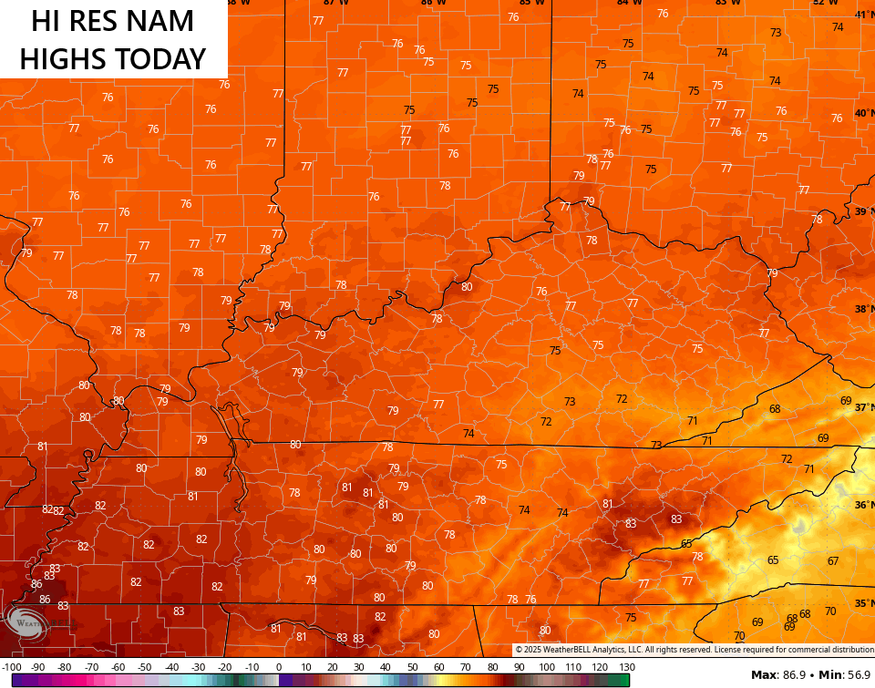
Where clouds are more prominent, temps will be held way down. Where showers and storms are will be even cooler.
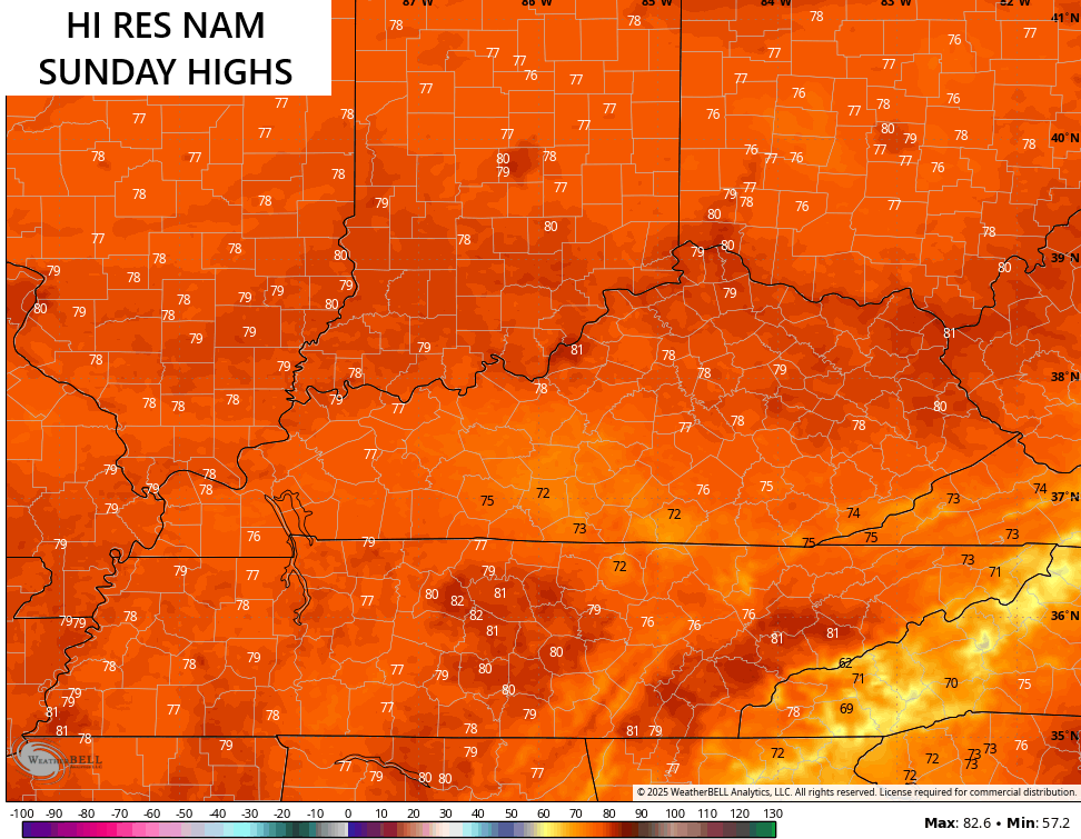
Sunday finds an increase in showers and storms spiraling in as a system moves from east to west. This may once again keep many from getting to the 80 degree mark…
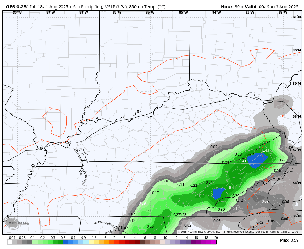
Some locally heavy rains are possible with this system rolling in against the grain…
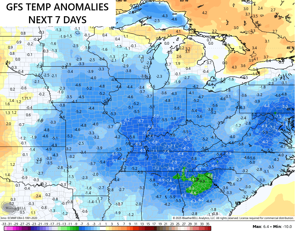
Temps next week generally hang out from the upper 70s to the middle 80s for highs, depending on where showers and storms are on any given day. This
As mentioned, thermometers for the next week come in solidly cooler than normal…
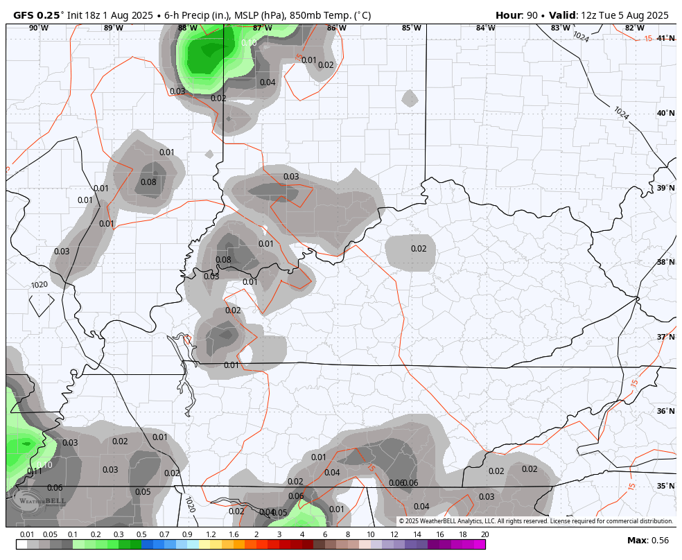
Here’s your daily dose of shower and storm tracking tools to watch the weather go in reverse…


Make it a sensational Saturday and take care.

Thanks Chris. A very pleasant start to the last month of Summer.
Yeah, right. Overblown cool spell.
Just face it Jeff, the cool air is here . We needed a break from the month and half heat we endure.
It wasn’t even that bad lol. Face it, summer isn’t over by a long shot.
Very true Jeff. Summer weather is not over, but I hope we have more of these nice comfortable breaks from the heat spells that may come. With the declining day lenght, the heat spells will hopefully be short.
That week ahead map does not indicate that summer is over. In fact, the past few summers in Kentucky were back-loaded, with warmer than normal temperatures during the first weeks of fall. And a lot has to do with what “cooler than normal” actually works out to. For instance one of the maps showing below normal temperatures shows Bowling Green trending 7 degrees cooler. Since the average temperature reading for early August in BG is 89°F, that cooler trend would translate to 82° during the period.
By no means is that “Pot o’ Chili Alert” weather!