Good Sunday to one and all. We continue with a very cool and very pleasant start to August. It’s the time of year that’s typically our hottest, but Mother Nature isn’t really in a heated mood. While the temps are awesome, we are seeing some showers and storms on the increase.
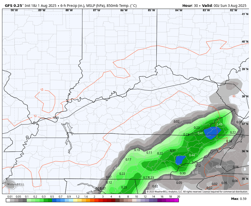
Temps today range from the middle 70s to low 80s across the state as a weak system rolls against the grain. This brings some spiraling bands of showers and storms with it as it moves from east to west.
Not everyone sees rain from this, but the areas getting the rains may see some pretty healthy amounts. Local flash flooding will be possible, and you can follow any warnings that go out…

Monday will be a similar day with the rain shield spreading even farther west. The pattern after this will feature a scattered shower or thunderstorm through Friday…
There are growing signs of Atlantic Hurricane Season waking up in the coming weeks. Of course, this is the time of the year when it should come to life, but things have a chance to go from zero to 60.
The National Hurricane Center is highlighting a couple of areas of interest…

The EURO Ensembles is seeing these two systems with the individual members picking up on the development…
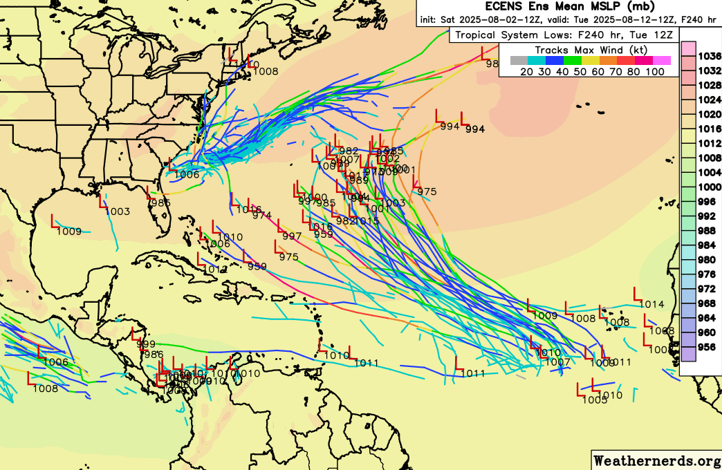
I think it’s the week leading up to Labor Day when things really start to crank, though.
Here are your tracking tools for the day…


Current watches

Possible Watch Areas

Make it a sensational Sunday and take care.

Tell us when the 90s come back.
Upper 80’s and lower 90’s are in my forecast starting at the end of week, so there is plenty of Summer ahead Jeff.
Thanks Chris. Enjoying the awesome temperatures these past few days, but we really need good soaking Rains, as it is getting way too dry here in Taylor, County. Only 1.72 ” accumulated Rains in July according to the mesonet.