Good Monday, everyone. The first full week of August is off and running as the brand new school year gets started for some districts across Kentucky. How are we already to this time of year? Ugh. Anyway, temps continue to average a bit below normal this week as showers and storms hang around.
Some of this action can drop a lot of rain in a short amount of time, leading to pockets of flash flooding.
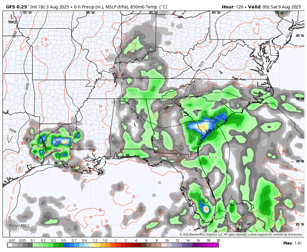
Scattered showers and storms are spiraling around an upper level system spinning through the region. This means the showers and storms are essentially going from southeast to northwest with the greatest coverage today across central and western Kentucky.
Just like what we saw Sunday, pockets of torrential rains may cause flash flooding. Here’s your map to track any warnings that may show up today…

Highs today range from the middle 70s for those dealing with showers and storms to the upper 70s and low 80s for areas getting in on sun and dry. Still, the average high today and this week is 85-90.
Temps come up a bit starting Tuesday as we get things closer to normal as the week wears on. That said, some showers and storms will still be around and that means to take the number in some areas.
You can see the action showing up on this animation that starts Tuesday and goes through Friday…

From here, I suspect much of what happens with the overall pattern will be impacted by how things go in the tropical Atlantic. It’s a more active look on the Tropical Weather Outlook from the National Hurricane Center…

Tropical Storm Dexter formed last night but it’s moving away from the US…

Back here in the Bluegrass state, two systems make a run at us this weekend with the first backing in from the south. That brings additional spiraling bands of showers and storms before the next system drops in from the northwest…
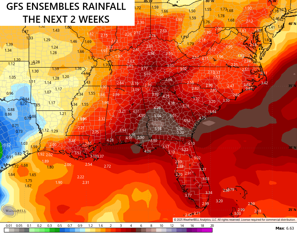
With the tropics coming to life, the models are really hinting at a lot of rain across the southeastern US over the next few weeks…
Here are your tracking tools for the day…


Current watches

Possible Watch Areas

Make it a magnificent Monday and take care.

The models have really been hit and miss with rain lately.
Sure have. Only .01 ” at my location.
Thanks Chris. Hoping for a real soaking Rain sometime this week.
The latest Pacific Decadal Oscillation ( PDO ) for July, 2025 is in. A reading of a negative 4.00. This is the longest stretch of negativity ever recorded in the ( PDO. ) This all saids that La Nina is dominating through this coming Fall and Winter, but could move towards the positive later in the Winter 2026.
Here’s the link to ( PDO ) readings :
https://www.ncei.noaa.gov/access/monitoring/pdo/