Good Saturday, everyone. We have a different wind blowing out there today as a southwest flow kicks in along and ahead of our much-anticipated fall cold front. This boundary slides through Sunday, bringing some of the coolest air you will ever find to close the month of August.
This big blast of fall encompasses much of the eastern half of the country, bringing well below normal temps each day next week…
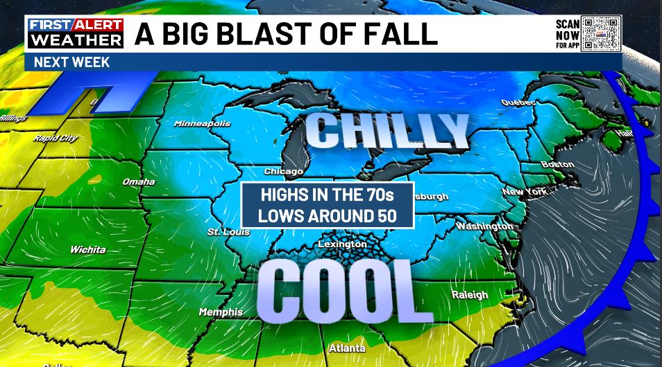
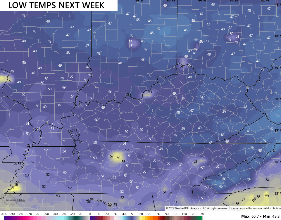
Highs are in the 70s from Monday through Thursday with overnight lows around 50. Some mornings may very well drop into the upper 40s as the airmass turns absolutely bone dry. I’ve never seen August dewpoints as low as what the models are indicating next week. Upper 30s and low 40s for dewpoints is absurd…
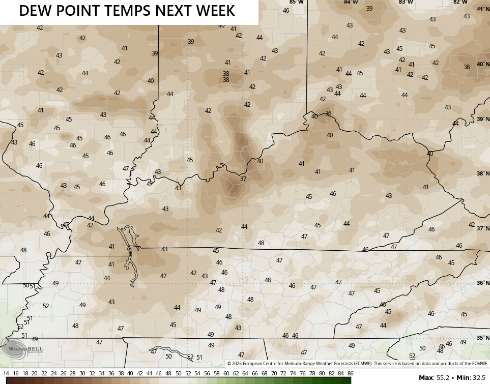
Upper 40s would be near record territory…
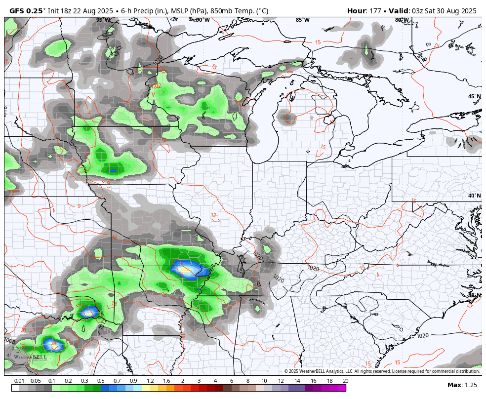
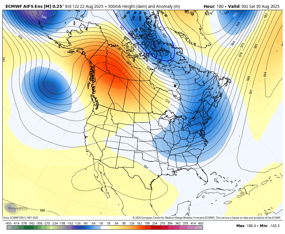
The potential is there for a slow-moving system to move our way over the Labor Day holiday weekend. The EURO AI has been showing this for several days and continues to hit this system pretty hard. This animation starts next Sunday and goes through the following Wednesday…
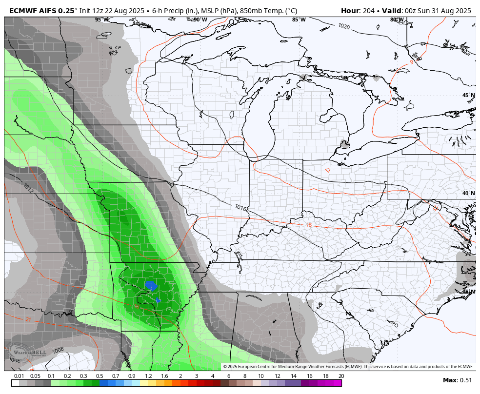
The GFS is picking up on this system, but it’s quicker in moving it through our region. This animation starts Friday night and goes through the following Tuesday morning…
This may be ahead of another fairly deep trough developing for the first week of September. The EURO AI Ensembles is leading the way with this potential…
Erin is no more, but the National Hurricane Center is showing a few more benign systems…

I leave you with your storm tracking toys for the day…


Make it a great Saturday and take care.

Common August cool spell. Nothing to see here.
If you want to believe that Jeff. It’s fine. I don’t remember Dewpoints in the 30’s ever this early. That’s Frost territory.
Frost isn’t happening.
I see you finally accept the reality Jeff
Uh, ok? Like I said, it’s a common August thing so no need to hype it up. And you know full well that the heat is far from done.
Thanks Chris. Must have been a change in the MJO, and maybe the PDO is moving towards the Positive ? It can’t get anymore Negative than a Negative four. A better chance of Rain later next week. Until then, ENJOY the early Autumn Weather.
Peak Tropical Storm Activity is around the 10th of September, but each year it’s always different. We shall see.
rolo returns for first time since June 23 and I bring the fall weather with. thanks Bailey for getting me unblocked. great see the regulars still around. first snow last 15 days of October.