Good Sunday, everyone. An honest to goodness strong fall cold front is pushing across the state today and it’s bringing some of the coolest air you will ever find around here in August. Record low temps will be possible in the week ahead with a few spots dropping into the upper 40s.
The best chance we have for some areas to set record lows will be Tuesday through Thursday…
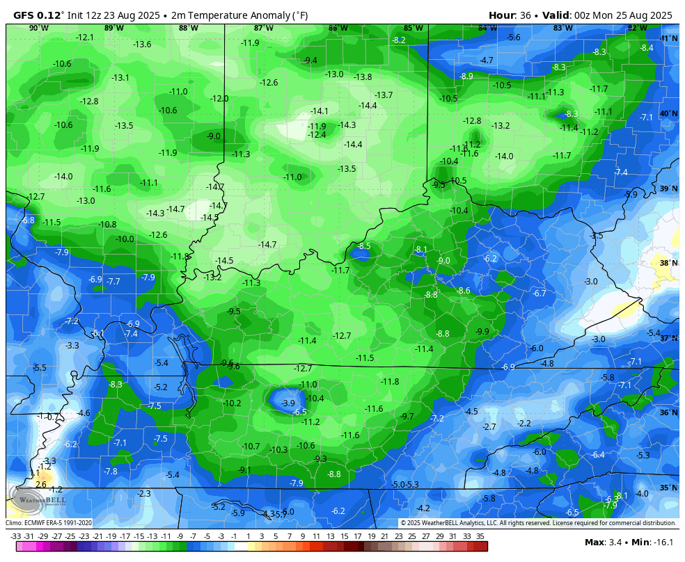
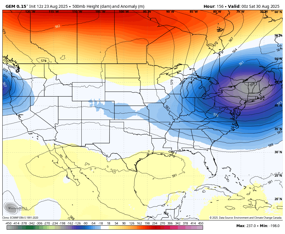
Temps go MUCH BELOW normal starting this evening and roll through the start of Labor Day Weekend. This animation shows the temp departures from normal from 8pm this evening through 8am next Saturday…
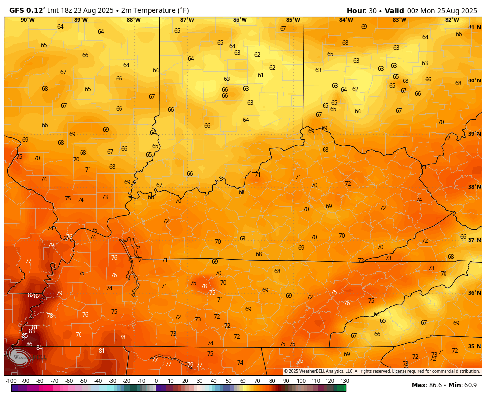
Temps today spike into the upper 70s to low 80s ahead of the front, then drop quickly once it passes by. This animation shows the temps from 8 this evening through 7am Monday…
Highs are in the 70s Monday through Thursday and possibly into Friday. Overnight lows can really tank. Upper 40s and low 50s show up Tuesday morning…
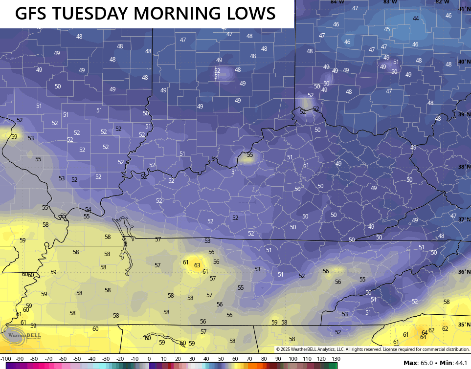
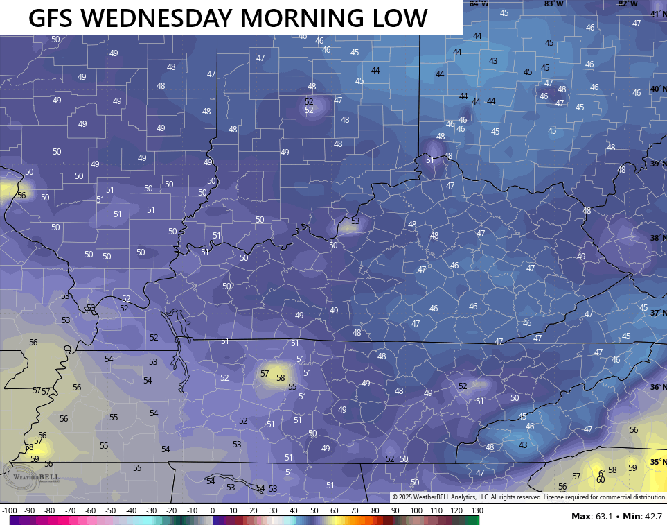
Then again Wednesday morning…
and on Thursday morning…
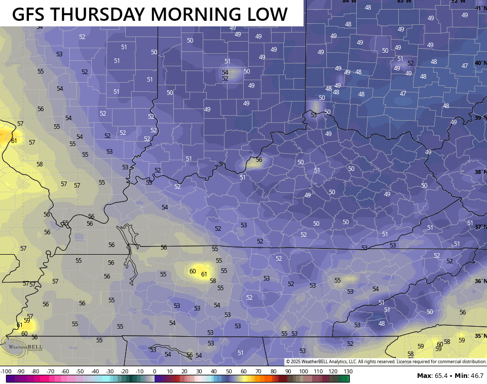
We may even see that carry into Friday morning if skies are clear. Record lows during this time are mainly in the upper 40s to around 50 for most locations.
This might be the driest August air mass I’ve witnessed in my lengthy time studying Kentucky Weather. Dew point temps settling into the 30s and 40s are being forecast by the models…
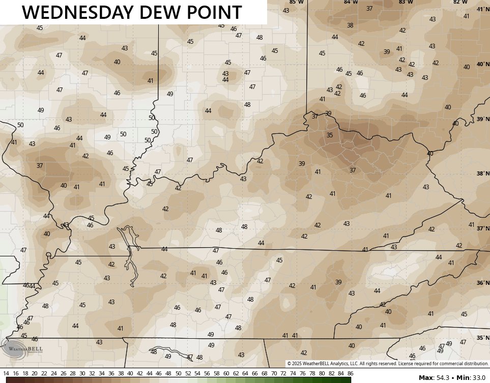
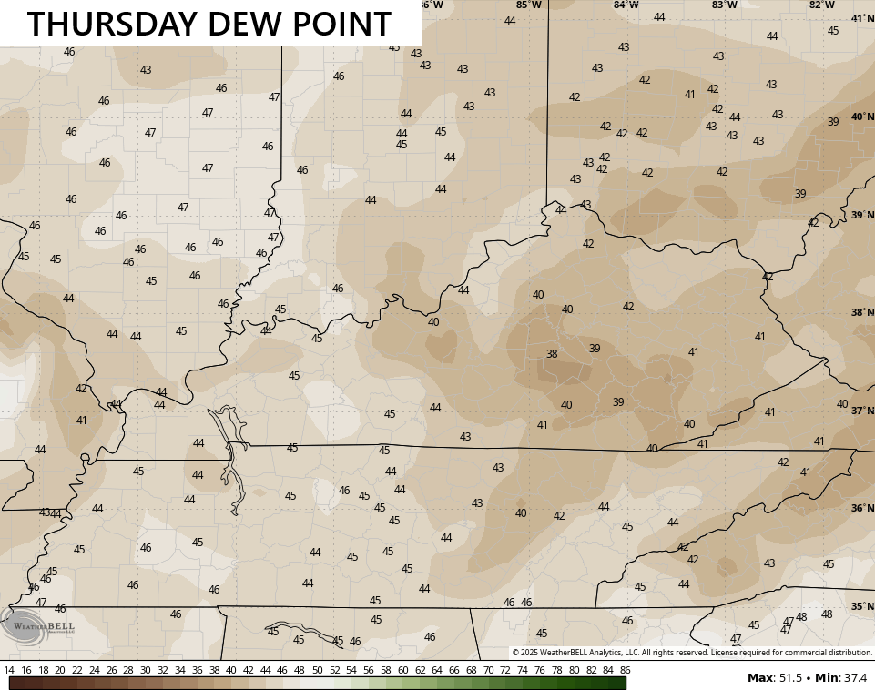
From a meteorological perspective, that’s pretty amazing.
I’m torn on how much of a system moves in over Labor Day Weekend. The trend had been for a cutoff system developing and bringing some rain in here. The current trend is for a deeper trough dropping in to keep the cooler than normal air rolling into early September…
In the tropics, Tropical Storm Fernand developed way out there in the Atlantic, but will remain a fish storm…

The system coming in behind that may get into the Caribbean in the coming days…

I leave you with your storm tracking toys for the day…


Make it a great Saturday and take care.

Thanks Chris. Very refreshing. Hoping for some good Rains, maybe after Labor Day ? A down side to this delightful weather is the Fire Danger in Forested areas of the State. Watching the Gulf for any Tropical development.
Over the past 36 days my PWS near Bowling Green has recorded only 0.25 inches of rain, and the local 10-day forecast is predicting more of the same. All vegetation is showing stress. With the exception of those homes with irrigation systems, lawns in the BG area are brown, and trees have been dropping leaves. Record low dewpoints are last thing we need to see in our area!
The hurricane center is showing a disturbance with a 40-60% chance of development in the Caribbean, but forecast plots show this system becoming another fish storm.
Was there ever any doubt? This happens EVERY single year this time of year. The weather turns totally boring for weeks on end because of the tropics. This is why this is my least favorite weather month.
Boring isn’t all bad.
This overblown cool spell won’t last.
We may have warm days, but I think the 90s is done for the year as we may experience an early fall. Hopefully the rain fall that Chris is saying around labor day comes to a fruitation . Is anyone is saying the D word yet.
I don’t think 90 is done yet, but I agree that drought is knocking on the door.
Jeff I hope 90s are done but I would say you are right we may see another couple I hope not. I remember Halloween of last year high 80 in my neck of the woods. I just sit out in the yard and gave out candy.
Yup and September 2019 had late-month highs near 100. Anything can happen.