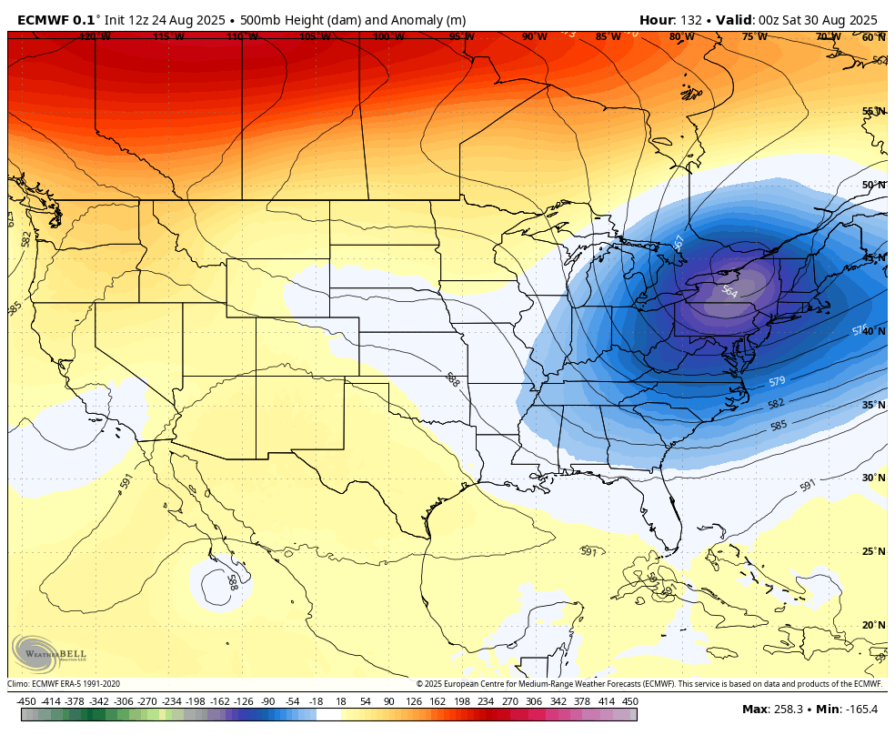
Good Monday, everyone. It’s a true taste of fall weather taking hold of the Commonwealth this week. This pattern delivers well below normal temperatures and may even bring some record lows to much of our region.
This is a setup that’s been well advertised for a while now. The pattern is actually putting the coldest temperatures in relation from normal across the entire Northern Hemisphere right on top of Kentucky and surrounding areas…
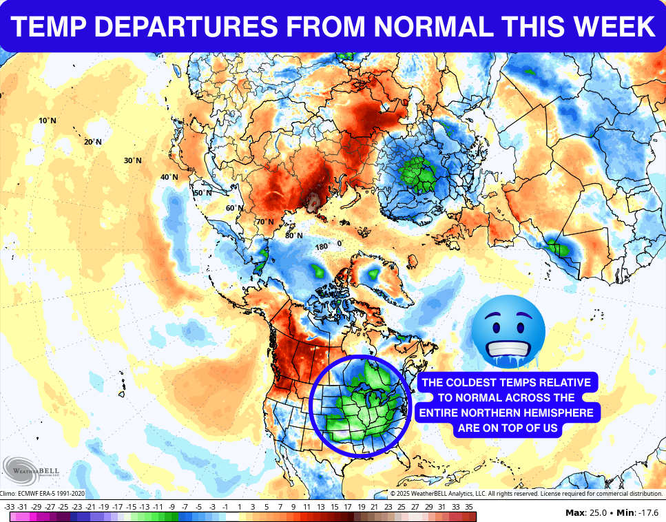
That’s pretty wild to see in the month of August.
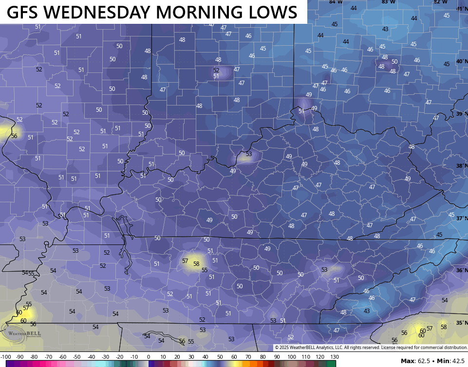
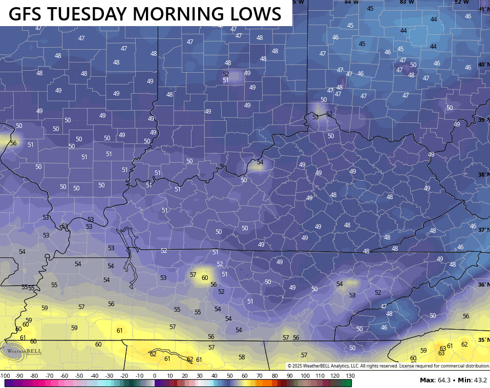
Overnight lows this week are generally in the upper 40s to low 50s and that’s exactly where record lows are for many locations. For Lexington, the best chance to tie or break a record low comes Tuesday, Wednesday and Thursday. Here’s a look at the numbers we have to hit:
August 26th: 48 1945
August 27th: 49 1968
August 28th: 50 1986
Fun Fact: July and August are the only two months that have never recorded temps in the 30s in Kentucky.
In terms of the model forecasts, they drop into the upper 40s which makes me wonder if we can get a few of the colder valleys to drop into the middle 40s…
Highs this week are in the 70s with super low humidity levels and dry skies.
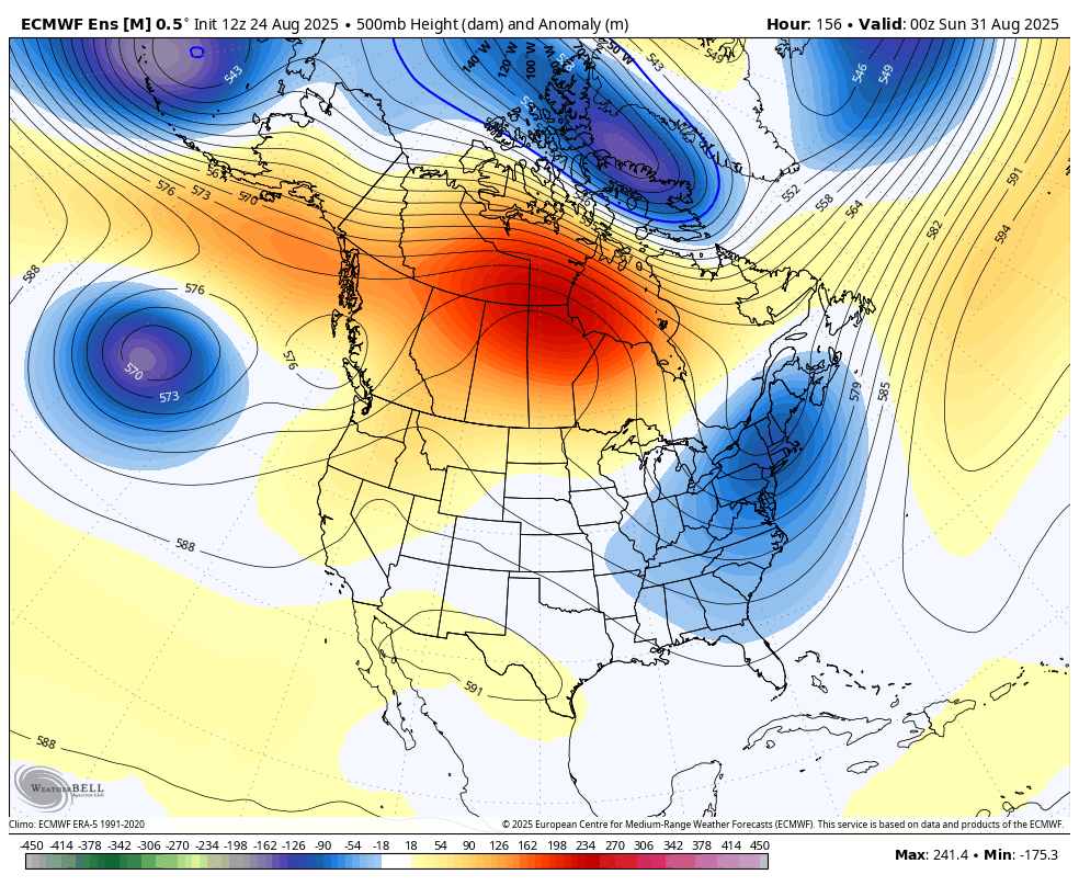
The potential is there for a slow-moving system to bring some rain in here at some point late in the upcoming Labor Day Weekend. The GFS is the most enthusiastic with this…
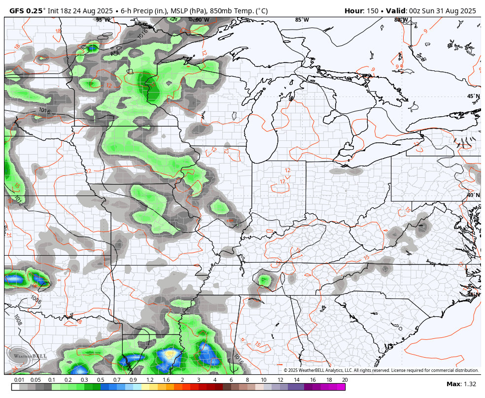
That would come with below normal temps and that may keep rolling through the first week of September as another trough settles into the eastern half of the country…
EURO
EURO ENSEMBLES
In terms of the tropics, we continue to watch Fernand as a fish storm with the system coming in underneath that trying to sneak into the Caribbean…

Have a magnificent Monday and take care.

It’s still no big deal.
IT IS A BIG DEAL. Could Decide our Fall and Winter Weather 2025 – 26.
No it’s not.
Thanks Chris. Unbelievable Low Dewpoints, that I don’t Remember Experiencing. More Likely to Occur in the Western Areas of the CONUS. The Dewpoints will Eventually Rise to our Normal Levels, and Hopefully the Chances for a Long Wet Period will Come About.
As the drought intensifies in south central Kentucky, I’m thankful to see that Warren County has instituted a burn ban. The month-lomg lack of rain combined with a short term forecast for rain hanging in the single digits, means that the brush fire danger is very real, and it wouldn’t surprise me to see neighboring counties take similar action.
Joe, I CAN’T hardy believe this, TAYLOR COUNTY has NO BURN BAN at the Present. I’m Sure that will be issued either Today or Tomorrow. I Hope.
I got the air conditioner on right now at 927.