Good Tuesday, everybody. Fall has arrived a wee bit early this year as temps flirt with or set record lows over the next few mornings. This is part of an overall change in the pattern that looks to feature troughs digging into the eastern part of the country over the next few weeks.
Meteorological Fall doesn’t start until September 1st, but Mother Nature doesn’t care as it fully…
Temps this morning and Wednesday morning drop into the mid and upper 40s for some areas, potentially setting records…
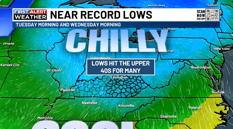
Some of the traditional cold valleys have a chance to hit the low 40s, especially Wednesday morning. How rare is this? Kentucky has never officially recorded a temperature of 40 or below in July or August. So, getting temps to get into the low and mid 40s is pretty crazy.
Highs the next few days continue to run in the 70s with a mix of sun and clouds. The atmosphere stays incredibly dry as well.
There’s another weak cold front sliding in here Thursday night into Friday, but this looks moisture starved…
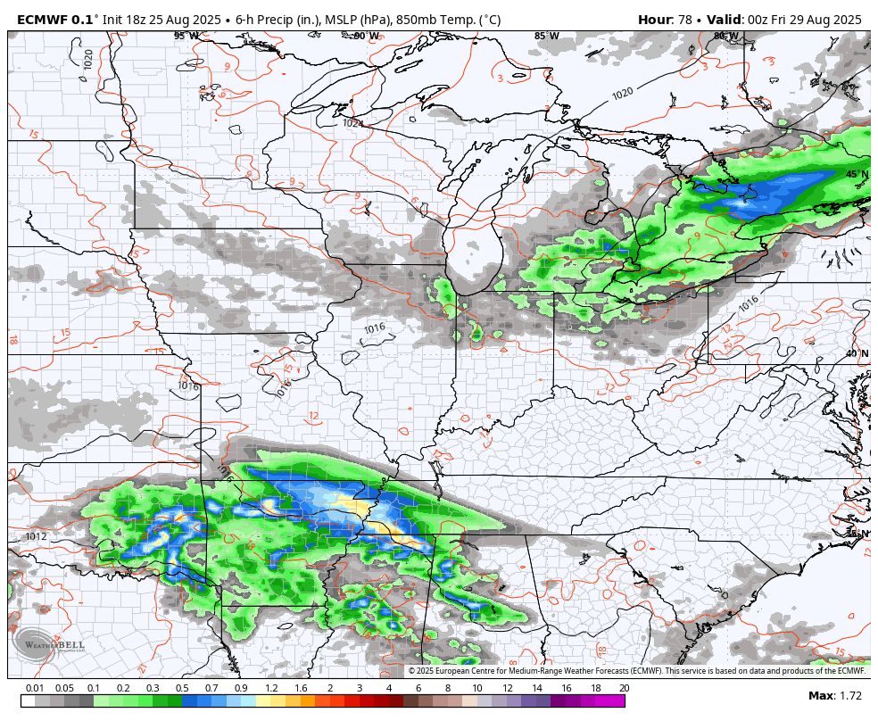
You can also see that system to our southwest, grazing southwestern Kentucky with a few showers. That front keeps the pleasant weather going into the Labor Day Weekend with upper 70s and low 80s for highs with lows in the 50s.
There’s still the chance for a shower or storm around later Sunday into Labor Day, but the coverage looks rather sparse… For now.
The next trough digging in for early September continues to show up well, especially with the EURO AI…
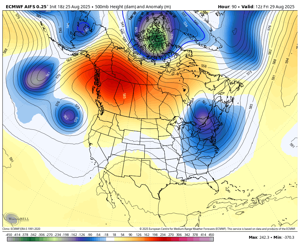
The EURO AI Ensembles…
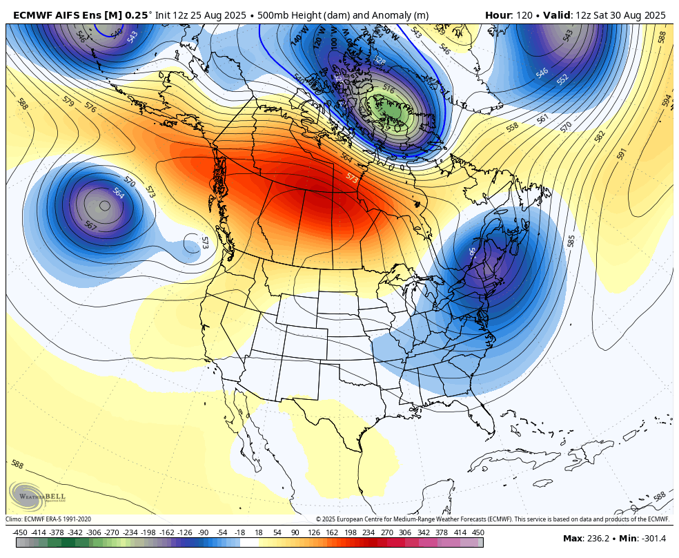
Below normal temps are a good bet during that time.
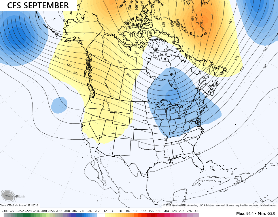
The latest CFS seasonal model for September likes the idea of a trough in the east…
That continues into October…
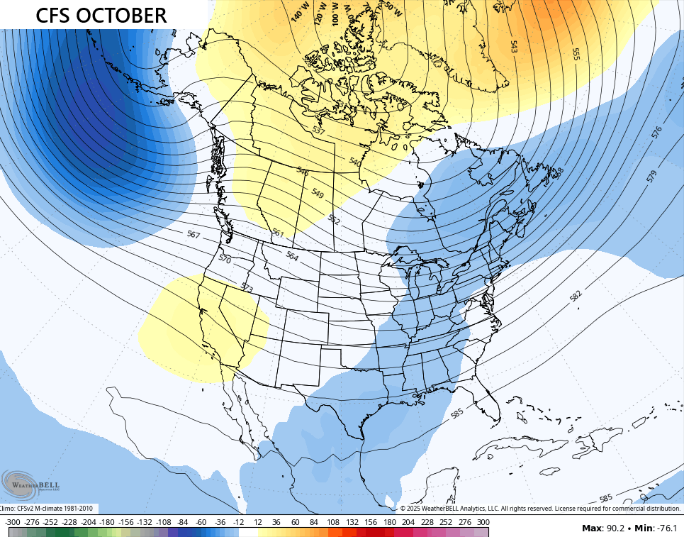
When I see those lower pressures extending into the Gulf, I wonder if that’s a hint at some Gulf tropical systems in October.
Speaking of, the tropics are quiet outside of Fernand…

Have a terrific Tuesday and take care.

False fall. Sorry, not sorry. 🙂
NO IT’s NOT, Jeff
Yes it is. I’ve lived in Kentucky since August 2001 and I know how it works.
I’ve Live here in Taylor County since July 2008, and the Autumn’s ( until this year, ) were all very Warm. It’s been a long time since I’ve seen a Weather Pattern like we have now. You may be Right Jeff, being in this part of the Country, we could Flip back to a Summer Pattern, which would be Depressing to me.
Thanks Chris. Really Enjoying the Early Fall like Weather. Hopefully, We Will have a Wet Period before the Driest Month ( October ) arrives.
I found out that the Tropics are Currently Inactive because Hurricane Erin has Significantly Cooled the Sea Surface Temperatures in the Tropical Atlantic, but the Gulf and the Caribbean Sea remain Very Warm. We shall see what happens there in the coming weeks.
Schroeder, Erin did cool the sea surface temperatures along the east coast, but temperatures in the Atlantic tropical convergence zone remain high. Activity is low right now because there’s been another injection of Saharan dust impeding convection and strengthing shear along the coast. Also, there were very few storms blowing up in west equatorial Africa, which are the “seeds” that create tropical waves. The cooler waters are quite visible in the latest SSTA chart:
https://www.ospo.noaa.gov/products/ocean/sst/anomaly/
Also Joe, stronger than normal tradewinds across the Gulf are acting to prevent further Tropical Cyclone development.