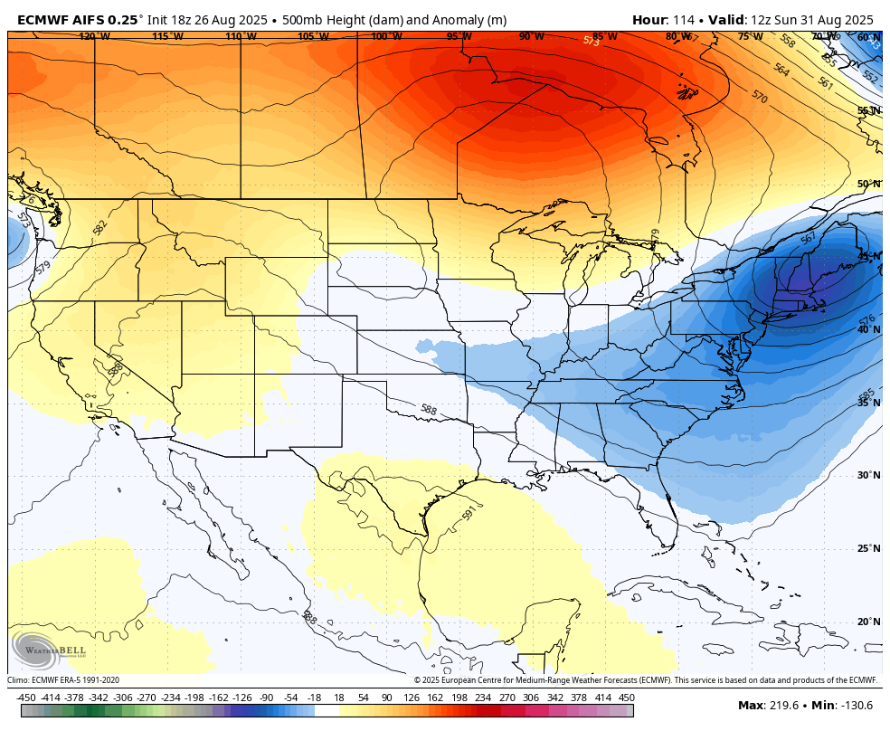
Good Wednesday to one and all. It’s another record setting temperature day across Kentucky as this early blast of fall continues to flex on us. The pattern bringing us this blast of fall is one that keeps troughs digging into the eastern half of the country into early September, at least.
Temps this morning will likely be amongst the coldest August temps ever recorded in the Bluegrass State with low and mid 40s. This comes on the heels of temps that hit the middle 40s yesterday morning…
Lows this morning hit the mid 40s on many of the Kentucky Mesonet sites. Here’s a look at the Top 10 coolest locations. #kywx pic.twitter.com/27MvCwDaQZ
— Chris Bailey (@Kentuckyweather) August 26, 2025
Highs this afternoon are back into the 70s with a mix of sun and clouds.
Clouds will be a determining factor on whether or not we see record lows again Thursday morning. Temps hit the upper 40s with clear skies but stay 50-55 with clouds.
Lows in the low and mid 50s will then continue through the upcoming Labor Day Weekend. Highs range from the upper 70s to low 80s, depending on where you are. The numbers may actually have to be adjusted down a little more behind a weak Friday cold front.
Overall, the Labor Day Weekend of weather still looks awesome.
There’s still the chance for a shower or storm to go up Labor Day into the middle of next week, but that really depends on what happens with a big upper level low.
The overall pattern isn’t shy about troughs sweeping into the eastern part of the country through the first week of the new month…
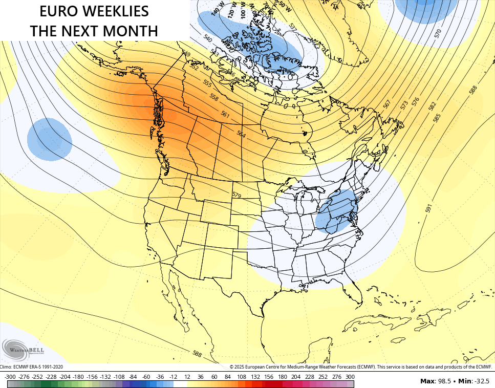
The latest from the EURO Weeklies continues to trend toward the eastern trough fairly deep into September. This is the 30 day average starting today…
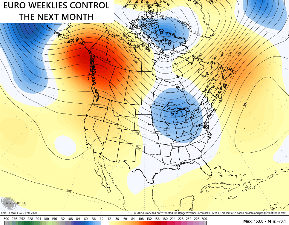
The Control Run of the Weeklies have a deeper look…
Some rain to go with that would be nice.
I suspect we have to watch for something tropical out of the Gulf to help us out later in September or October. Right now, there is nothing threatening the US…

Have a wonderful Wednesday and take care.

If it stays dry, the final throes of warmth will be amplified.
Jeff, the on going Drought plus the Shorter Day Length will prevent Real Deal Summer Weather’s return.
September 2019 says anything can happen.
” In September 2019, Kentucky, experienced significantly warmer and drier weather than usual due to a major, region – wide climate anomaly. ”
Could the above happen this September 2025. It very well could, but not likely.
Thanks Chris. All I can say is Enjoy the Quiet and Pleasant Weather Everyone. One more Thing, a Burn Ban has been Issued for Taylor County. We may get by with No recored Rainfall for the Month of August. First time in my life I’ve seen such.