Good Thursday, everyone. It’s another day with record or near record lows as this week goes down as one of the coldest ever recorded in Kentucky during the month of August. As we look ahead to the Labor Day Weekend and into early September, we find a few more cold fronts dropping in.
As expected, Wednesday morning was one for the record books…
Another Record Cold morning in Lexington as our temp hit 46 degrees. This shatters the old record of 49 from 1968.
This is the 3rd coldest temperature ever recorded in the month of August. #kywx
— Chris Bailey (@Kentuckyweather) August 27, 2025
This was one of the coldest August mornings in recorded history for Kentucky. In addition to Lexington posting our 3rd coldest August temperature ever, many of the Kentucky Mesonet sites dropped into the low 40s.
FUN FACT: August and July are the only months in Kentucky history… pic.twitter.com/s1JPsZveyw
— Chris Bailey (@Kentuckyweather) August 27, 2025
Temps this morning will be back into record territory with mid and upper 40s for those with clear skies. Areas with clouds will stay in the low 50s. Highs this afternoon are in the mid and upper 70s with a mix of sun and clouds. There is the smallest chance for a sprinkle or shower this afternoon.
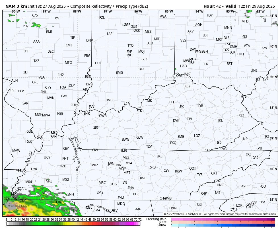
There’s also the chance for a stray shower along a Friday cold front dropping in from the north. The future radar from the Hi Res NAM shows this possibility…
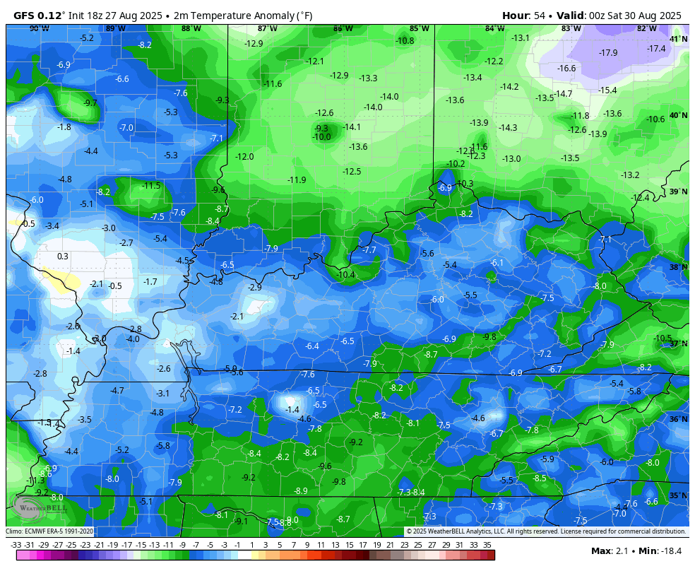
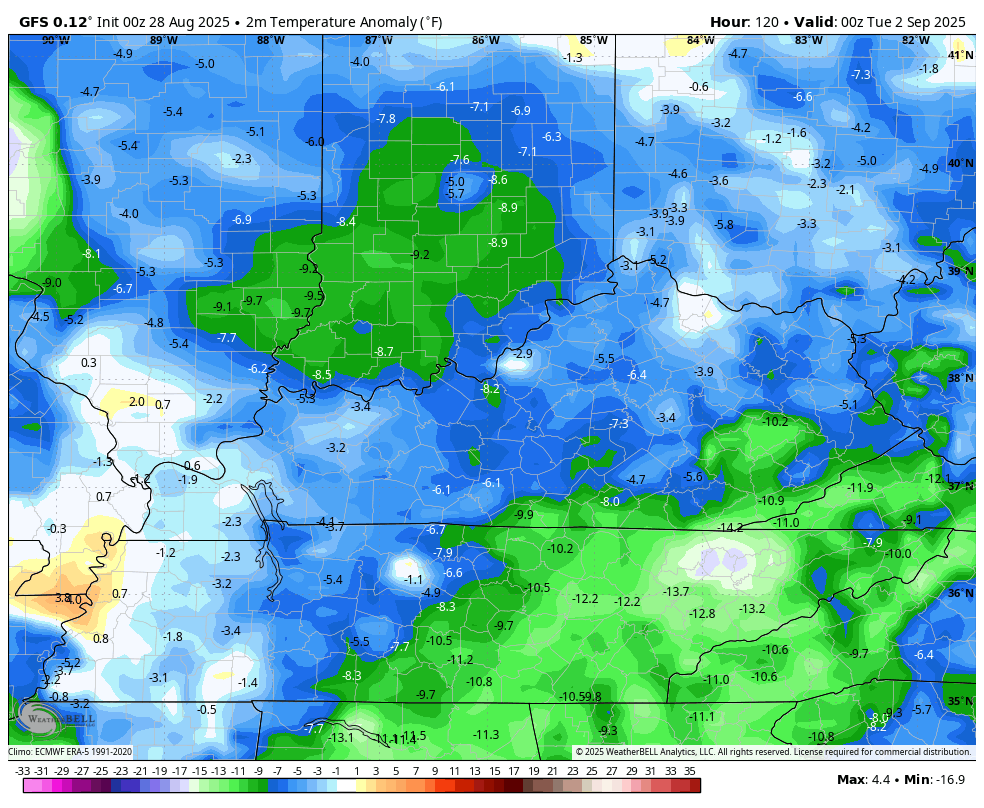
The air behind this boundary keeps things awesome into the Labor Day Weekend. with temps still being below normal. This animation shows the temperature departures from normal starting Friday evening and rolling through Labor Day…
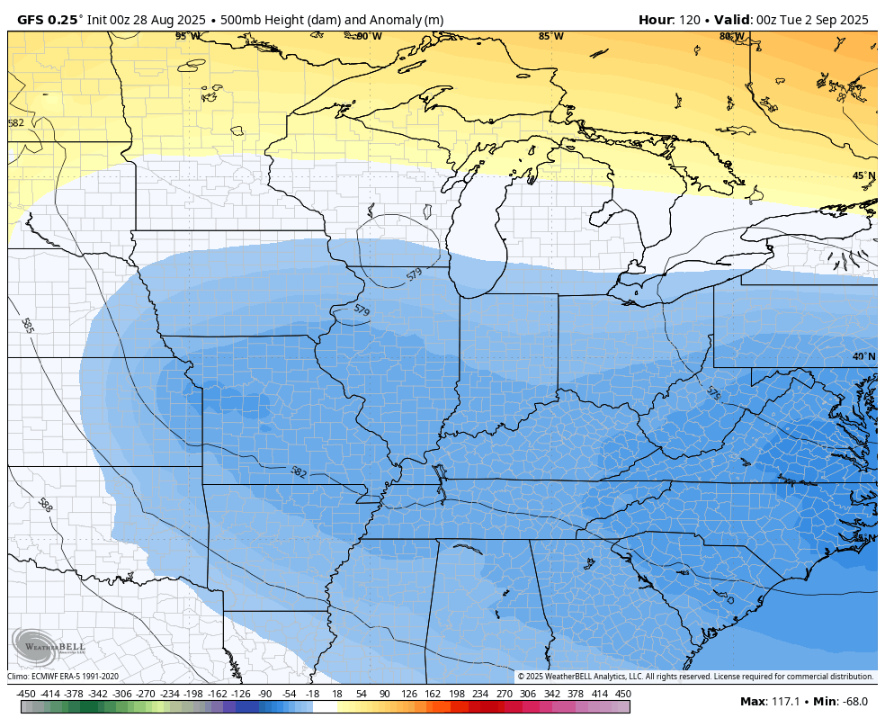
The setup next week continues to be that can feature a few wet weather systems spinning into our region. The models show a slow-moving upper level system impacting us from Tuesday through late next week. This could be a monster upper level system…
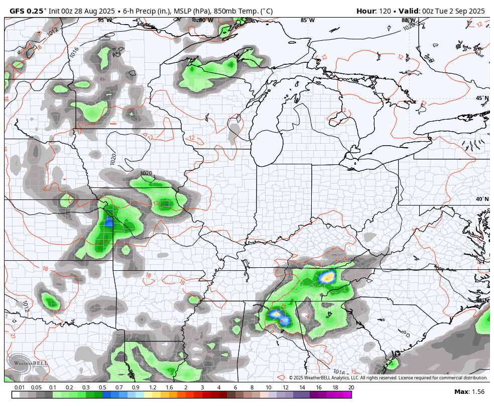
Here’s what that system looks like at the surface…
All of this brings another round of well below normal temperatures into our region. Once again, we are seeing the Barney colors in this animation that starts Labor Day evening and goes through the first weekend in September…
IF this upper low does spin overtop of us with some needed rains it could give us a day or two with highs only in the 60s.
The tropics remain a snoozefest as we get closer to the peak of the Atlantic Hurricane Season…

Have a great Thursday and take care.

The three summer months (JUNE, JULY, AUGUST) I’ve always thought of August as the least hot of the 3. I guess because JUNE/JULY have more sunlight (longer days) These temps are amazing. I can’t see how anyone could complain because it’s not uncomfortably hot or bitterly cold. My only complaint is the boringness of the weather. If it stays the same for too long, no matter what type of weather, I get bored with it.
As a warmth enjoyer, I won’t deny that it feels great outside.
Thanks Chris. Hoping for some Good Rains early Next Week. Enjoy this Rare Pleasant Weather we been having.
Definitely hoping for some rains soon. My house has only seen 0.42″ of rain the entire month of August. The temps are definitely nice, but my lawn went from the thickest and greenest I have ever seen it to completely dead. Everything is so dry now and there are burn bans popping up all around here.
According to my PWS, I’ve recorded 0.15″ of rain over the past 42 days, so in my corner of the Bowling Green area, I have no qualms about saying that we are in a moderate drought state. Except for homes with sprinkler systems, the lawns in my neighborhood are brown, trees are losing leaves, and many bushes are pale green shading to brown in spots. I fear that we will be well into September before we get any meaningful precipitation. Certainly no help from the Tropics!
I AM Thinking about Getting Rid of my Rain Gauge. LOL… My Total Rain Accumulation for the Month of August is 0.00. ” This Drought is Worse than the One back in 1988. Oh well it will Change for the Wetter one of these Days. Always has.
The drought in 1988 lasted almost 2 years if I remember correctly
Here’s some information on why the Tropics are so inactive in 2025. I hope it keeps up ?
https://climateimpactcompany.com/u-s-midday-update-research-comments-cool-12z-gfs-2/
Correct, I Almost Lost my Nursery during that Awful Drought !