Good Friday, everyone. We have another cold front dropping into the region today and it’s just reenforcing the awesome air just in time for the Labor Day Weekend. Beyond this, a much bigger blast of fall is lurking for the middle and end of next week and this one may bring some rain with it.
Temps today reach the upper 70s to low 80s for many with 80-85 in the west and southwest. Our cold front drops in this evening with limited moisture so things are mainly dry.
Temps come way down again behind the boundary with some 40s showing up by Saturday morning. The WRF has been money with the record cold this week…
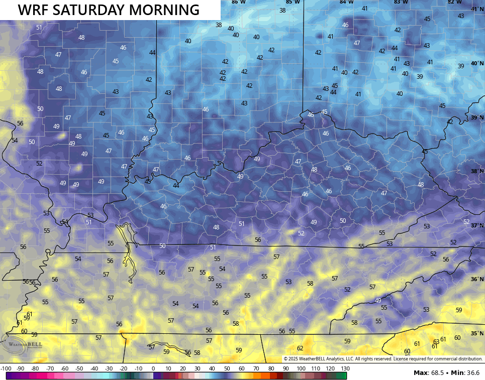
Record lows are in the upper 40s, so there’s a chance for another record in a few spots.
Saturday looks awesome with temps mainly mid and upper 70s…
You can see how the west and southwest will be a little warmer. It’s a breezy day and absolutely gorgeous!
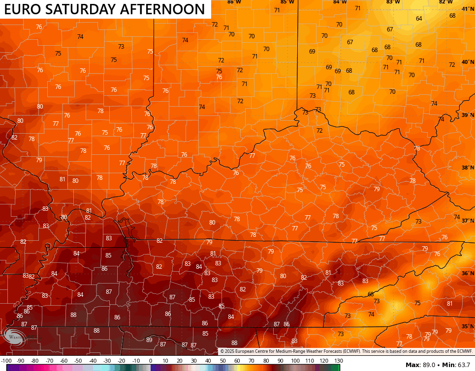
Sunday is equally as nice with highs from the upper 70s to the low 80s across the state.
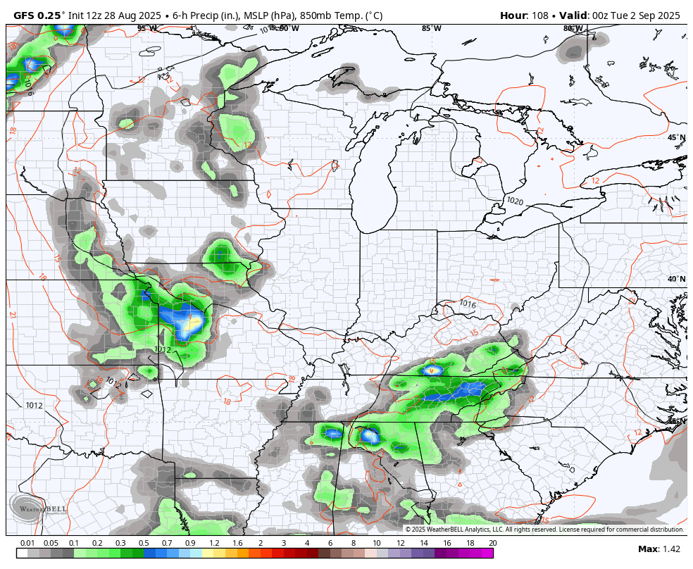
Labor Day finds some moisture building into the southeastern corner of the state and that leads to some showers and storms going up. From there’ the focus is on a big upper level system pushing in here with the chance for some much needed rains. The best chance for this comes late Tuesday through early Thursday with another front a few days later. This animation starts Monday night and goes through next weekend…
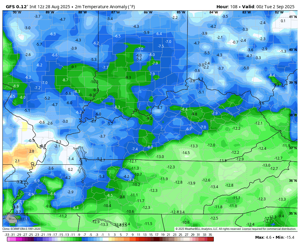
This type of a setup may very well bring even chillier air than what we just had, especially for daytime highs. A few days later next week may struggle to get out of the 60s and that’s just a few days into September.
The Barney colors are even bolder when we look at the temperature anomalies from Monday night through next weekend…
A Pot of Chil Watch is possible in the next day or two. This would be the earliest we’ve ever issued one if in fact I decide to go that route.
I leave you with your radars to track any sprinkle or isolated shower that tries to pop along and ahead of our front…

Make it fantastic Friday and take care.

Thanks Chris. Really been Enjoying the Weather Pattern ( Temperatures ) here lately, but the Lack of any Measurable Precipitation has me Concerned. This has been the Second Driest Month of August ever Recorded in Taylor County. The Good News is that the Chances for Precipitation Late Next Week are Increasing, as You have Stated in this Morning’s Blog.
Adding to the Above : Enjoy the Final Days of Summer Everyone ! Really looking Forward to Fall and Winter 2025 -26.
But isn’t this our “dry” season?
October is Typically our Driest Month.
Pot of chili watch? Chili and soup are good any time of year. I’ll grill if it’s 20° outside too. 🙂
Maybe Good for you, but Not for this Old Body LOL…
Speaking of chili, I just made some couple days ago. I also don’t let mother nature keep me from grilling if it’s too hot or too cold.
If it’s not precipitating or very windy, I can grill.
I’m Getting Worried about Wildfires in my Area, because Some don’t Pay any Attention to the BURN BAN that’s in Effect in My County.
Trying to not get to excited about the possibility of ENSO neutral this winter. New data out next week.