Good Sunday, everyone. Our pleasant Labor Day Weekend continues as we eye some nice changes for early September. The setup ahead will bring us some much needed rains and will take our temps toward readings more typical of early October.
Saturday made it 6 straight days with, at least, several areas of Kentucky seeing temps in the 40s for lows…
This was the 6th straight morning with temps hitting the 40s in many areas of Kentucky. The Kentucky Mesonet sites had low and mid 40s this morning. #kywx pic.twitter.com/SNgvldHqGo
— Chris Bailey (@Kentuckyweather) August 30, 2025
Temps may start in the upper 40s again today for a few areas as afternoon high temps climb back into the upper 70s to low 80s. There’s the chance for a stray shower or storm to go up in the southeast.
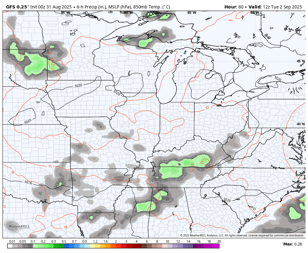
Scattered showers and storms will be noted on Labor Day, mainly in the south. This is ahead of much-needed rains spiraling across the state as an upper level low spins in Tuesday and Wednesday.
Showers and thunderstorms will accompany this system with the potential for 1″+ rains to show up in several areas. Temps will be held down because of the beneficial rains.
A powerful fall cold front then sweeps in behind this late Wednesday and Thursday and ushers in very chilly air. That will be followed by another system later Friday or Saturday…
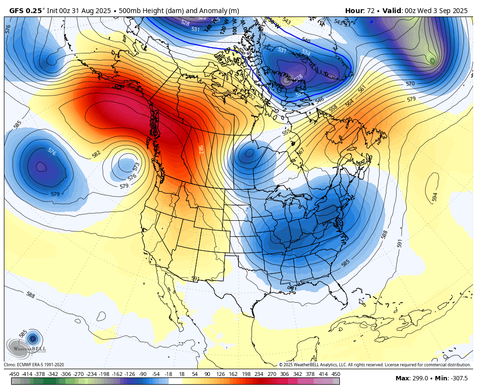
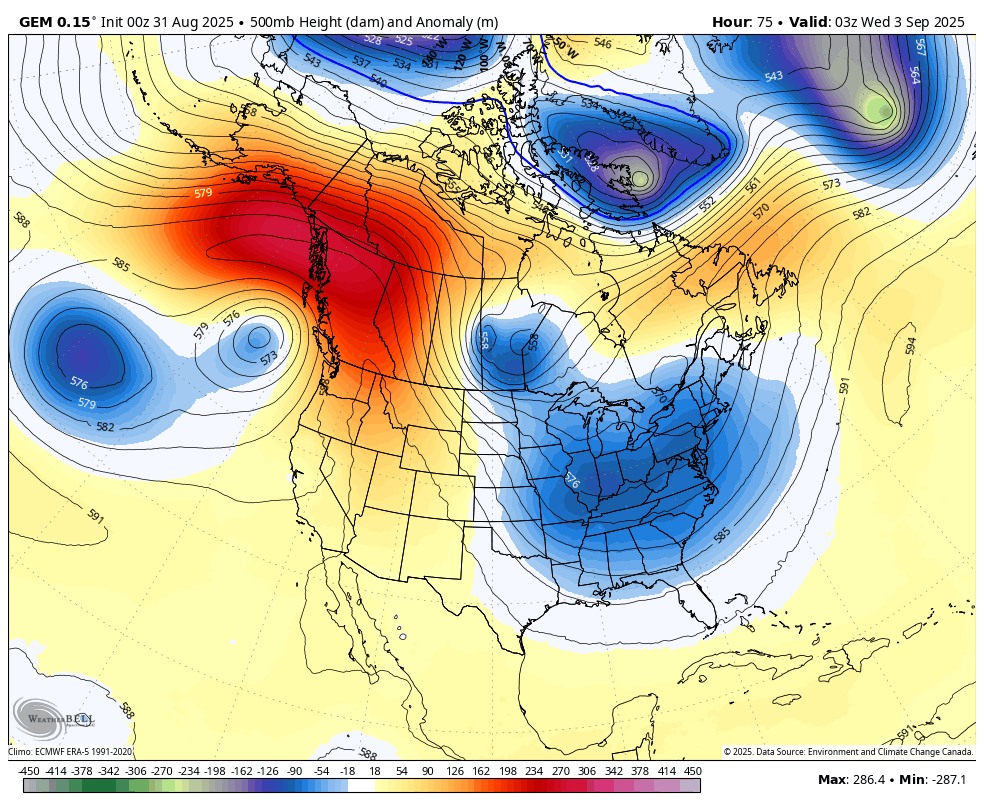
All of this is coming from a MONSTER upper level low pinwheeling across the eastern half of the country this week into next weekend…
GFS
CANADIAN
What about that looks like early September? Nothing. Literally nothing about that animation looks remotely like
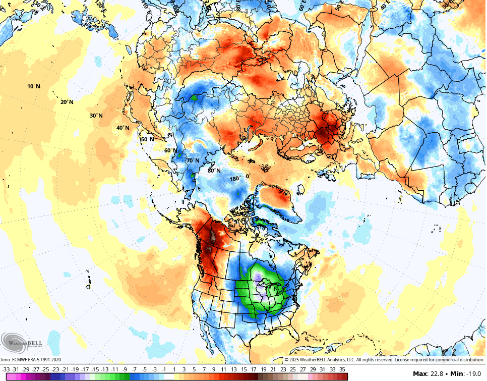
Temps underneath this are well below normal with a few days potentially staying in the 60s for highs. Lows have a chance to approach record levels once again. Look at these departures from normal on the GFS. This animation starts this Tuesday and goes through the following Tuesday…
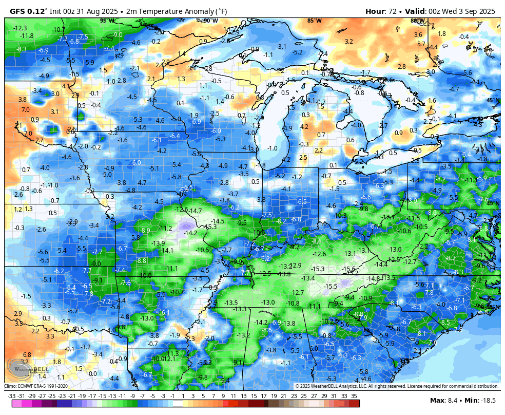
The air we’ve had over the past week has been the coldest air relative to normal in the entire Northern Hemisphere and we are about do it all over again in the first week of September…
That’s just so wild to see for a second straight week!
I leave you with your Kentucky Weather Radars to track any shower or storm that tries to go up across the southeast today…

Make it great Sunday and take care.

I woke up cold tempted to turn heat on but no I didn’t. I think it’s time to get warmer clothes out in the near future. I am enjoying the cooler weather but as Jeff says I am sure we haven’t seen the last of the warm weather. I don’t know Jeff about any more of the 90’s. What do you all think???
Temperatures will have to Balance Out Sometime in the next Few Months. I Hope it’s Stays cool and Turns Wet, As we Enter our Fall Season.
Yes we need rain but please no more flooding. You know use to I only had to worry about the river in the month of April but this past February changed that. I hope we never see that again but that was an exception. I was watching it in the evening it started rising 3 feet an hour in my area. I never saw that before.
NO we Do Not need anymore Excessive Rains. Just Rainy Periods to Gradually make up the Rainfall Deficit.
Thanks Chris. Hoping for Wetter Days before the Next Trough arrives later this Week.