Good Thursday, everyone. We have the first of two fall cold fronts blasting across the Commonwealth today. This is bringing a healthy band of showers and a few strong storms along for the ride. The next front looks to do the same late Friday into Saturday as very chilly air crashes in.
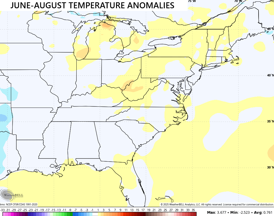
Before we get to the look ahead, here’s a look back at the average summer temps for the eastern half of the country. Kentucky came in around normal to slightly above normal from June through August…
Today’s weather is highlighted by our cold front bringing a few rounds of showers and storms with it. The action clears out from northwest to southwest this afternoon and evening, but not before leaving behind some beneficial rains. A half to 2″ of rain will fall in a few swaths of central and eastern Kentucky.
Some of the storms in the east and southeast may be locally severe with damaging winds. The Storm Prediction Center continues to highlight this low-end risk today…

Temps ahead of this front spike to near 80 in the far southeast early today before dropping through the 70s and into the 60s. Areas dealing with rain early on may not make it to 70 at all today.
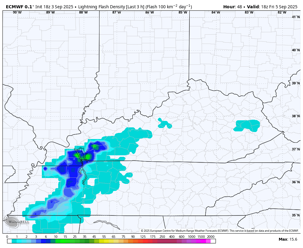
Friday is a busy day as a southwest wind cranks ahead of the next front. That boosts temps into the 80s before showers and storms go up during the evening hours. Some of these may cause lightning delays for high school football action. Check out the lightning forecast from the EURO late Friday afternoon through early Saturday afternoon…
Can some of the storms being strong or locally severe Friday evening? I can’t say no. Here’s the Friday Severe Weather Outlook from the Storm Prediction Center…

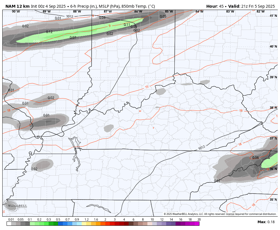
The showers and storms drop through early Saturday with lingering showers into, at least, early Saturday afternoon. The NAM is lingering this stuff pretty late into the day…
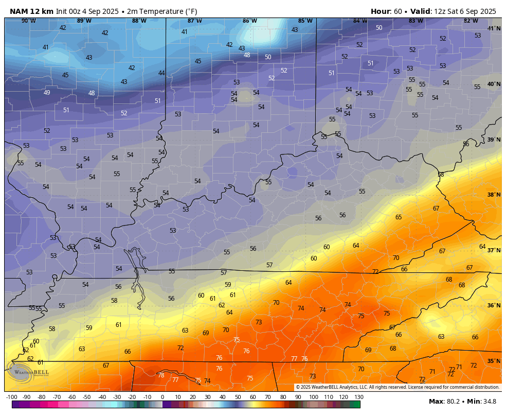
If clouds and rain linger through the entire afternoon, temps in the upper 50s and low 60s will be noted. If the skies clear out, highs reach 65-70 for many. The NAM is on board with the Pot of Chili potential…
Sunday and Monday are rather brisk fall days with highs in the upper 60s and low 70s with lows deep into the low and middle 40s.
We continue to watch one system in the tropics, but it is way out there in the Atlantic…

If that can develop, it’s something that COULD threaten the US in about 10 days or so. IF.
I leave you with your storm tracking toys for the day…


Current watches

Possible Watch Areas

Make it a great Thursday and take care.

I’ll consider it a “blast” of Fall when it gets below 40.
I’ll Consider it When we Have our First Frost of the Autumn Season.
Thanks Chris. Thunderstorms, which were more Widespread Early this Morning dropped a lot of the Much Needed Rains. Maybe over an Inch ? I will Have to Check my Rain Gauge After while to See What the Total Is.
In the past 48 hours 1.75 “
Precip totals yesterday evening and early this morning combined to drop 0.25inches of rain on my PWS, just south of Bowling Green. When I stepped outside this morning I swear I heard our neighborhood lawns slurping.
Regarding the tropics, that storm in the equatorial Atlantic has a reasonably good chance for development, as there is very little shear aloft and ocean water temps in its path are near 90°F. If it maintains its course, it could see rapid development and may take a run at the Gulf of Mexico, where water temperatures are also near 90°F.
And Joe, there’s No High Pressure Protecting the Caribbean or the Gulf from Tropical Cyclone development. We shall See by Sunday, At the Earliest ?