Good Saturday, everyone. We have another awesome blast of air coming into the region today and this sets up shop into the first half of the upcoming week. This awesome air will also take us back into another prolonged dry period of weather.
Our cold front is working through the region early today with morning showers and storms ahead of the boundary and a few lingering showers right behind it. Temps will be in the 50s in the rain right behind the front before clearing takes over from west to east today.
This all means a big temp swing across the state with many areas of central and eastern Kentucky 65-70 with the west 70-75.
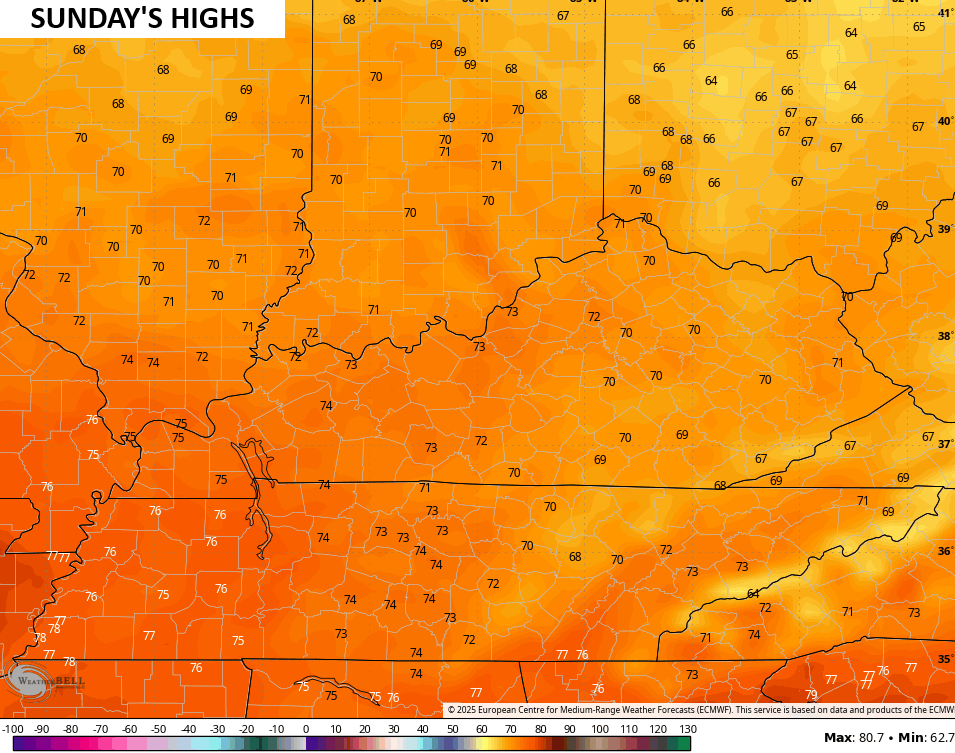
Highs Sunday generally hang out in the upper 60s to low 70s for central and eastern Kentucky and 70-75 in the west…
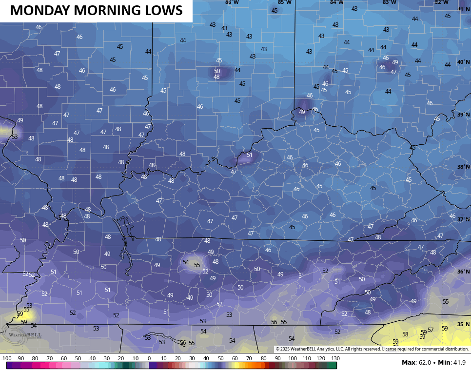
Record lows are possible Monday morning with some areas seeing temps drop into the low and middle 40s…
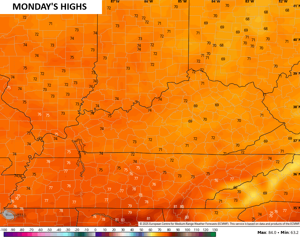
Highs Monday afternoon are similar to what we have out there Sunday…
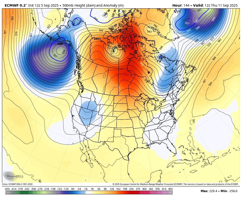
The pattern looks dry for much of next week as the overall setup across North America looks rather blocky. The latest from the EURO at 500mb shows this well and shows how we may see another deep trough digging into the country by the middle of the month…
A quick check on the tropics shows our system out in the Atlantic struggling to really develop…

The pattern seems to be pretty hostile to storm development still and no one will really complain about that.
I leave you with your storm tracking toys for the day…


Make it a sensational Saturday and take care.

“Blast” lol
Thanks Chris. We had a very quiet night, and early morning, here in Maple. No rain in my rain guage this morning. Oh well, that’s the way it is in this part country.
Chris, I wrote a detailed post this morning and it didn’t get posted. This is the first time this happened, so I wrote another short simple post, telling everyone that the rain and storms miss our area of the state. Now I like talking about the Weather, and I’m very interested in Meteorology, and I wish I would have made it my Major, but I choose Agriculture instead. At age 74 it is a little late in the game. I’ll understand if you would rather I not post anymore, because I’am a little long winded. I will still read your Kentucky weather Blog every morning though.
Honestly, I doubt he even reads these messages. I don’t think it was Chris censoring your post. It’s automatic with this service he uses for the blog. You’ve never had that happen? Wow. It’s happened to me TONS. Specifically if you use a word that alerts the auto censor. Believe it or not, the word g-r-a-s-s sets it off and it will not post. If that word sets it off, imagine what else will? Try it. It doesn’t even have to be a CURSE word. If the word has any characters remotely pertaining to a curse word.. forgetaboutit.. Post lost and ends up in the black hole of the interwebs. Type a post and use that aforementioned word and see what happens.
Mark, No it went straight to ” you must be log in to post ” Question: How could I write a post if I wasn’t log in ?
Thanks for caring Mark.
Very little rain here. It’s time to dry out again.