Good Sunday to one and all. Our big fall cold front has pushed to the east with another blast of well below normal air setting up shop behind it. This early October feel means we have a shot at record lows today and Monday.
I honestly meant to put out the Pot of Chili Watch several days ago but the severe storms distracted me. So, given where temps were on Saturday and the potential for record cold the next few mornings… Let’s go straight to the…
In retrospect, I probably should have gone with the POCA with the record cold at the end of August, but the Pumpkin Spice Alert was just too fun to pass up.
Our Sunday starts with temps in the mid and upper 40s for areas with clear skies and in the low 50s for areas where some clouds and fog show up. Records this morning are generally in the upper 40s, so it may be close in a few cities. Lexington’s record is 47 from 2017.
Highs this afternoon reach the upper 60s and low 70s with a partly sunny sky. Today is just flat out awesome.
Clear skies, light winds and low humidity combine tonight to bring the potential for record or near record lows. The models are all deep into the 40s to start the week…
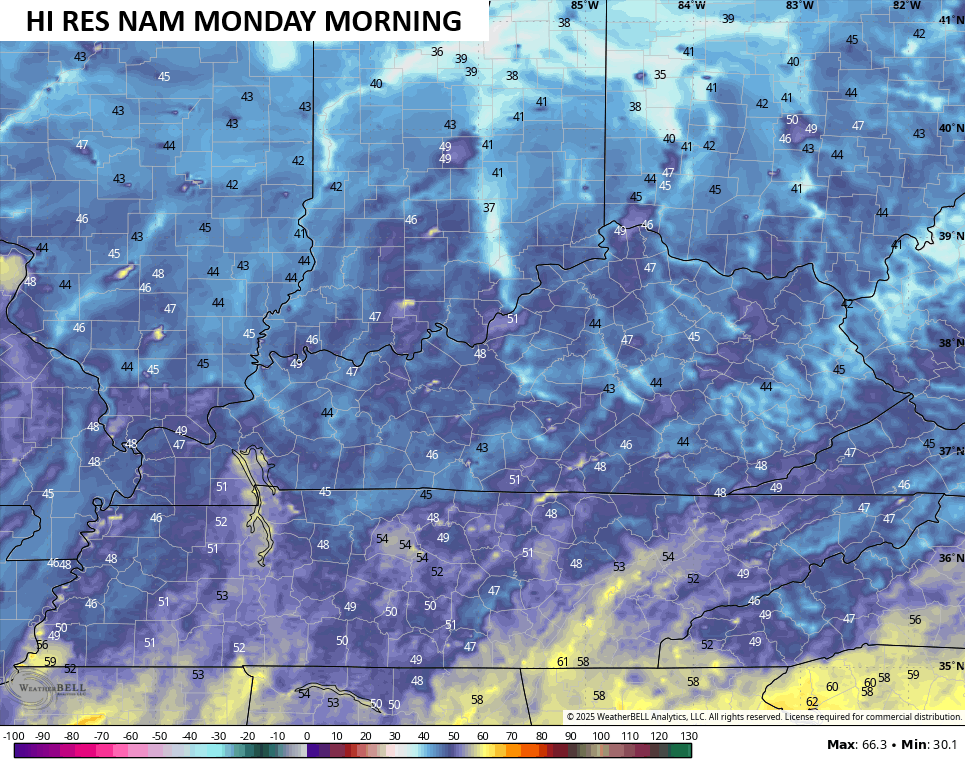
The WRF nailed the record lows back in late August and it’s the coldest of the bunch for Monday morning with low 40s and pockets of upper 30s…
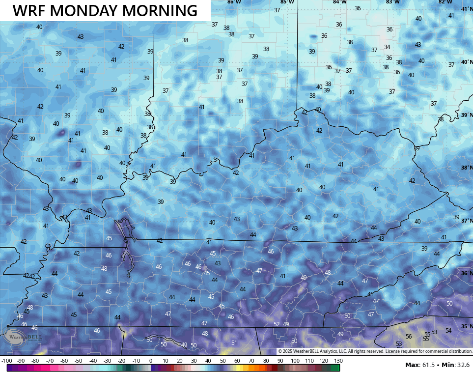
That’s probably a few degrees too cold, but it gives you an idea of the air mass we’re dealing with. For Lexington, our record low for Monday is 45 from back in 1956. It should be noted we had a similar shot of record cold last year at this same time with the record low coming just a day later.
If you’re wondering… 2024 is one of my top analogs for the winter ahead. That doesn’t mean we get an exact repeat of last winter, but something similar is possible.
Temps start to rise for the middle and end of the week as highs reach the 80s, but it’s comfy with bone dry humidity levels. Lows hang in the 50s.
Looking farther down the road, the GFS Extended likes the general idea of temps averaging cooler than normal through early October…

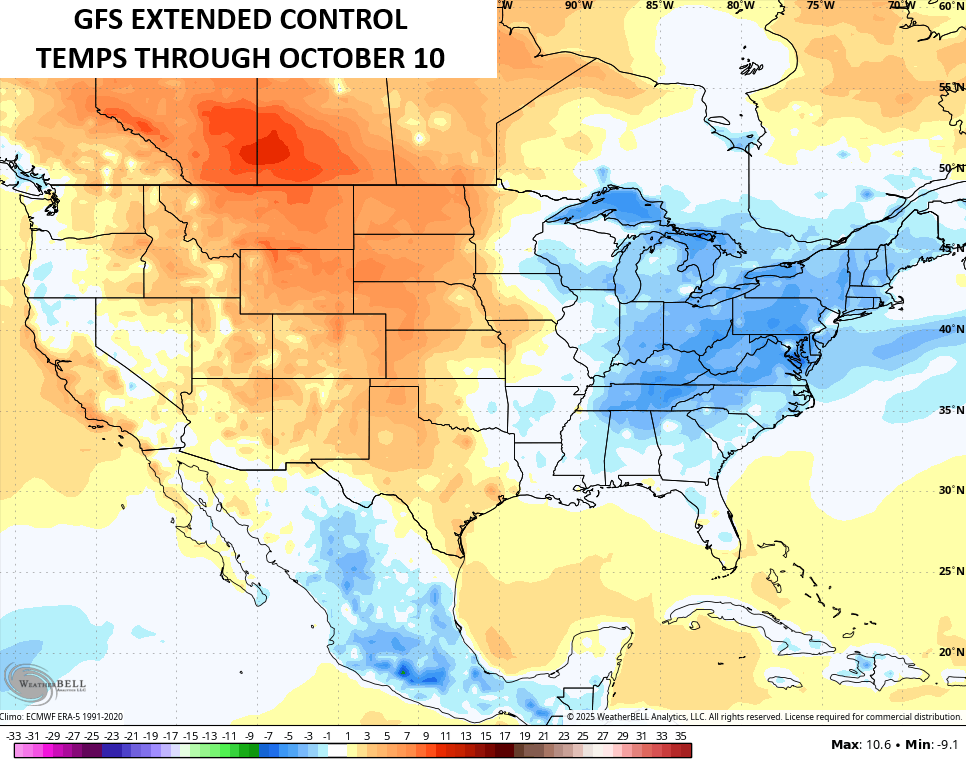
The drier than normal pattern looks to continue as well…
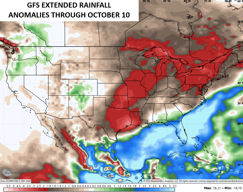
It’s a dry fall ahead of us and that may spell an exceptionally active fall forest fire season around here.
In the tropics, there’s the one lonely system of interest in the Atlantic and the chances for development with it continue to decrease…

In the East Pacific, Hurricane Kiko passes very close to Hawaii…

Have a great Sunday and take care.

Why is chili only good during cold weather? Weak.
Jeff, it just a traditional thing and yes chili is good anytime of the year
Also, apple cider is much better than pumpkin spice lattes.
We can’t blame the tropics the dryness were in that some claim. It’s been a lame season as far the tropics has gone hope it stays hat way. Were stuck in a pattern hopefully it will change.