Good Monday, everyone. Another round of record lows are with us to start the the day and the week as our exceptionally cool pattern continues. If you’re a fan of late Summer, we have some of that coming back later in the week as temps get to normal-ish.
Temps this morning are in the 40s for much of Kentucky and that’s likely to break a few more records. This comes a day after another record for Lexington…
Lexington set another Record Low this morning when the thermometer bottomed out at 45 degrees. This breaks the old record of 47 from 2017.
This is Lexington’s 4th record low in the past 13 days. Tomorrow’s record is 45 from 1956 and we may very well break that, too. #kywx
— Chris Bailey (@Kentuckyweather) September 7, 2025
Highs this afternoon reach 70-75 central and east and a few degrees better in the west. Skies look really nice.
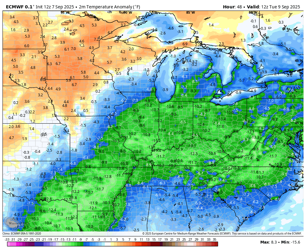
Temps gradually come up through the rest of the week but still average cooler than normal on the whole. Watch the temperature departures from normal Tuesday through Saturday…
Skies are dry during this time.
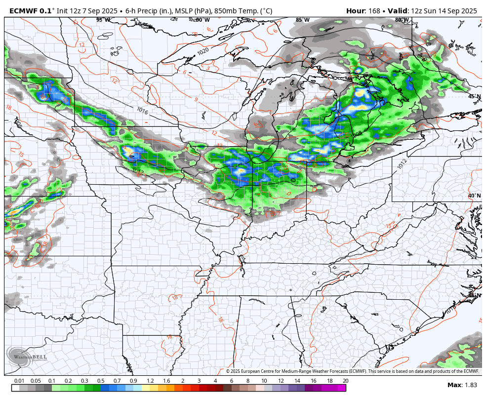
The next threat for a few showers and storms may not appear on the scene until late this weekend into next week. The Euro sees another cold front dropping in during this time…
The pattern across North America continues to have a very blocky look to it with big high pressure blocks showing up across Canada. This often means the potential for cutoff systems to develop under all that across the good old USA. The EURO AI is seeing this and continues to go toward a deeper trough down in the medium range..
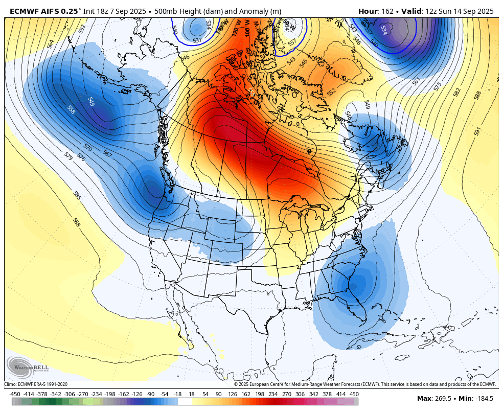
Something like that matches the kind of blocks we are seeing setting up across Canada. Let’s hope it brings some rain with it above all else.

Temps will have one final salvo and overachieve.
Typical September weather for this part of the country. Just hope we have some good rains at week’s end.
If it wasn’t for globull warming we all would be frozen, lol.