Good Wednesday to one and all. Our crisp mornings continue as afternoon temps slowly start to climb. With this climb comes the slight chance for a shower or storm tonight and Thursday with a better chance showing up late this weekend into early next week.
Temps today reach the mid and upper 70s across the east and 80-85 in the west. A weak system is moving in from the northwest and it may have just enough juice to touch off a shower or storm later tonight and Thursday.
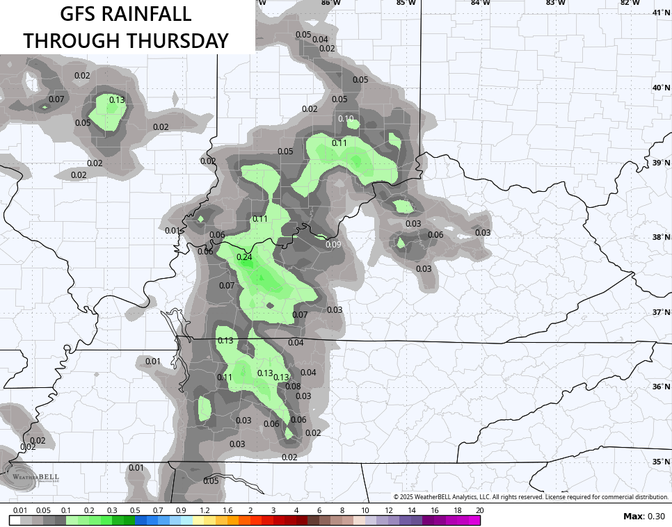
The models are just now seeing this but differ on where to put the action. The GFS is central and western Kentucky…
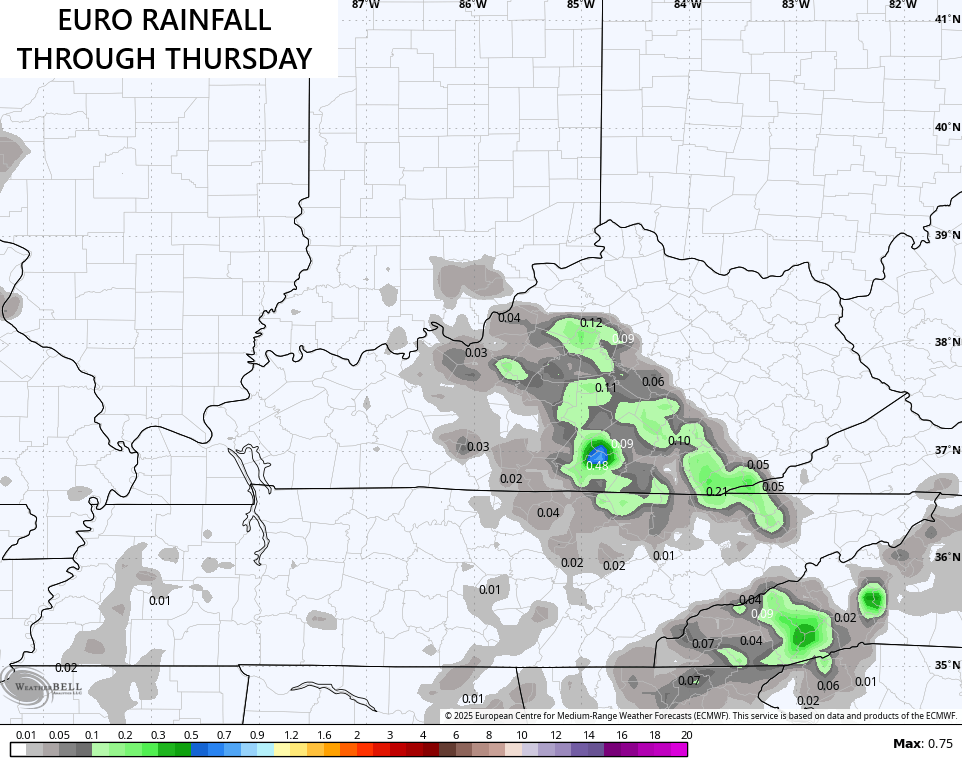
The EURO is more into central and southern Kentucky…
Temps Friday into the weekend are into the 80s with a mix of sun and clouds as a touch of normal late summer temps return.
The setup after this will feature the chance for a few showers and storms firing up later Sunday into early next week. To what extent is the question. Still, the models are trying to find us something…
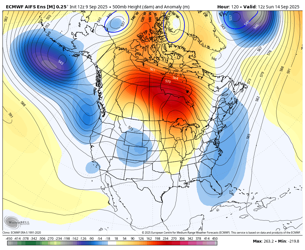
Looking farther down the road, the EURO AI Ensembles continue with our blocky look that SHOULD lead to another dip in the jet stream across the eastern half of the country around or just after the middle of the month…
Looking even farther down the road at the next month of weather via the EURO Weeklies, we find that blocking across Canada showing up well. The average of the 500mb height anomalies show a trough near the Aleutian Islands with the block across Canada. That usually leads to downstream troughing showing up in the eastern half of the country.
The smoothed out 30 day average is beginning to show this…
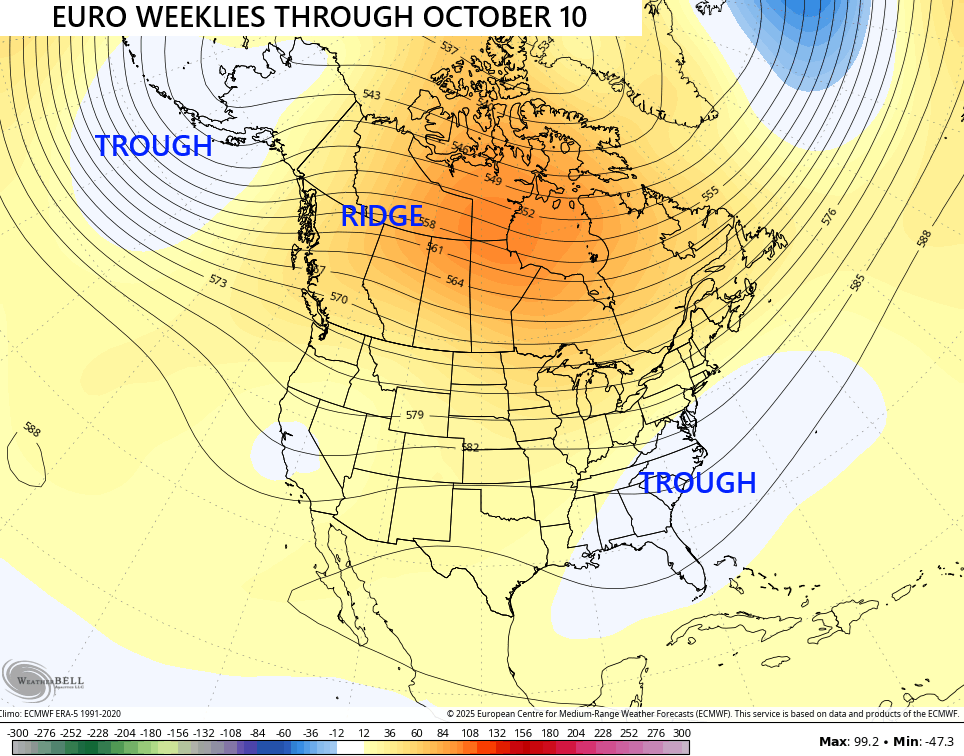
The single run of the EURO Weeklies gives us a better view of how this may play out…
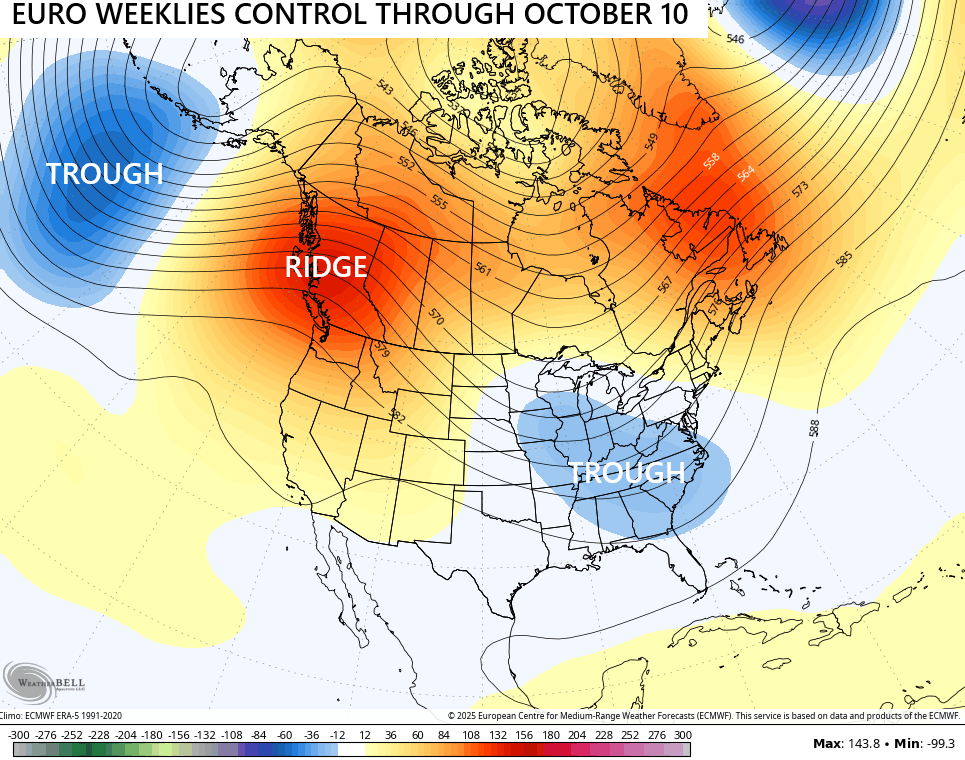
Regardless of temps, this pattern is skewed much drier than normal unless the tropics can change things.
Have a wonderful Wednesday.

It’s a given, the weather being dry this time of the year is not unusual, but NOT this dry, and the record dry is expected to continue according NWS out of Louisville. The temperatures, dew points and humidity have been very comfortable since the end of August, but a return to normal late Summer temperatures, will only amplify the record dryness issues ( wildfires, )
A very strong Bermuda High Pressure System and sheer across the Gulf ( may be the reason for the record dryness in the states of Ohio and Kentucky, ) and the lack of Tropical Cyclone development. Will be glad when more interesting weather returns, and it will.
The drought in central Warren County continues to intensify, and is really impacting lawn service companies in the BG area. It’s ironic that leaf removal, from trees that are prematurely losing their leaves due to heat stress, is what’s keeping some of these forms afloat. According to the NWS, temperatures in the area are forecasted to spike into the 90’s beginning on Friday, calling for a high of 95°F on Monday! The strong Bermuda high continues to cut off moisture flow from the Gulf of Mexico, where average sea surface temperatures set a new all-time high in August of 88°F. That flow will eventually
…resume, but it has also raised the odds of an uptick in Fall severe storm activity.
Yeah, like the tornado we had in December a few years back.