Good Thursday, everyone. Summer isn’t going quietly into the night as our temperature pattern continues to bounce from one extreme to the other. Temps in the coming days will be straight outta summer coming just days after a nearly 3 week stretch of record cold.
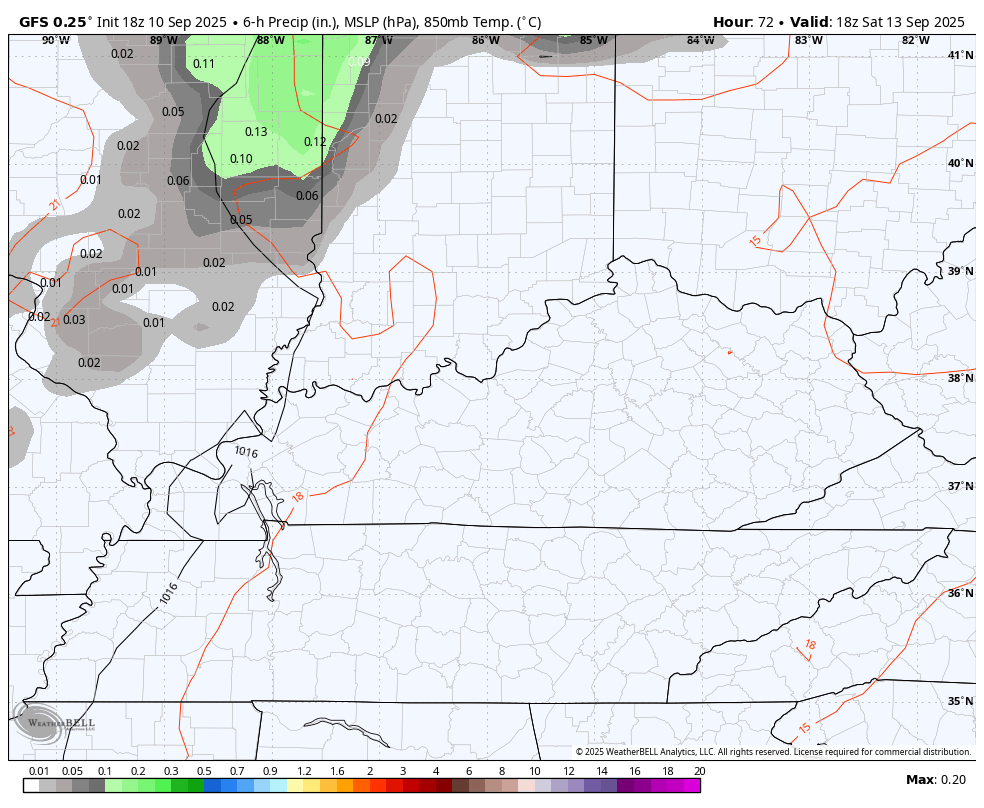
Temps today make a run at 90 in the west with upper 70s and low 80s across the east. Isolated showers and storms will be noted across areas of central and western Kentucky, but isolated is the name of the game.
Temps come up a little more compared to today and that trend continues into the weekend. It’s a weekend where a shower or storm may go up, especially Sunday…
The system I was expecting to come in Monday and Tuesday now looks like it won’t arrive unto the second half of the week. That means temps can take off into the first part of next week. The west is going to be flat out hot with a more tamed amount of heat in the east.
The models for Monday are showing some notable differences for temps, based on any possible clouds or isolated showers and storms. The EURO has the tamest stuff for central and eastern Kentucky with 90s west…
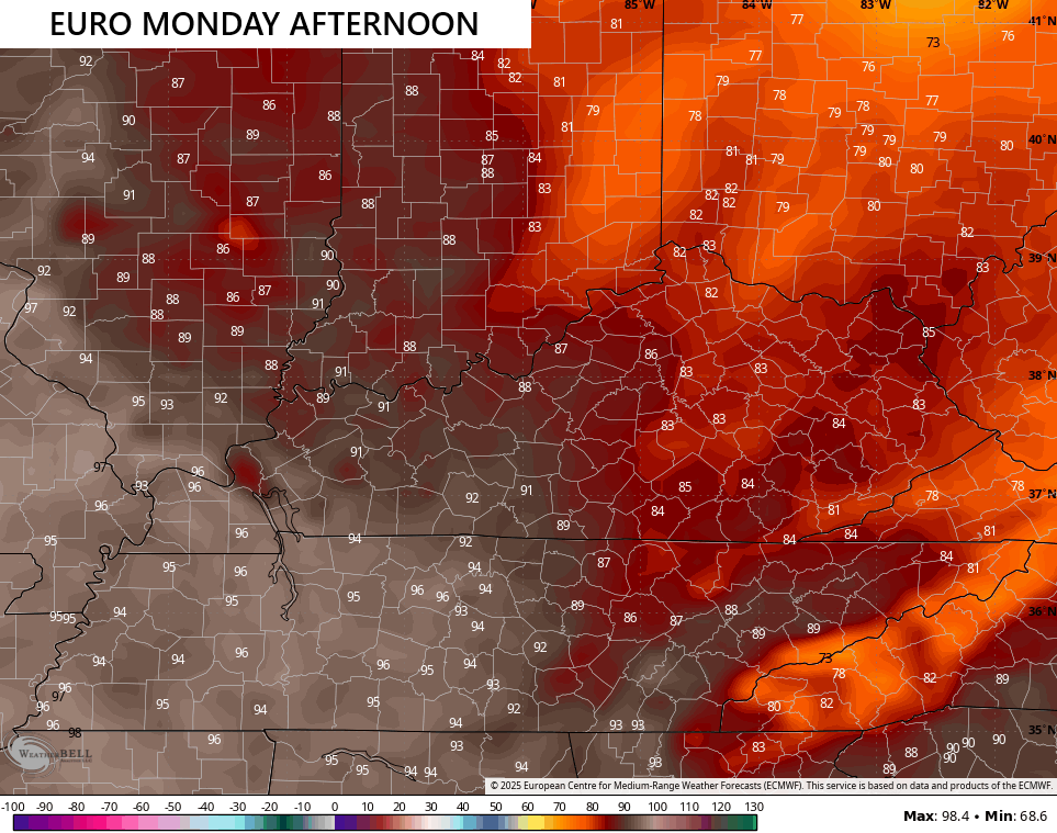
That’s obviously seeing some clouds and isolated action going up.
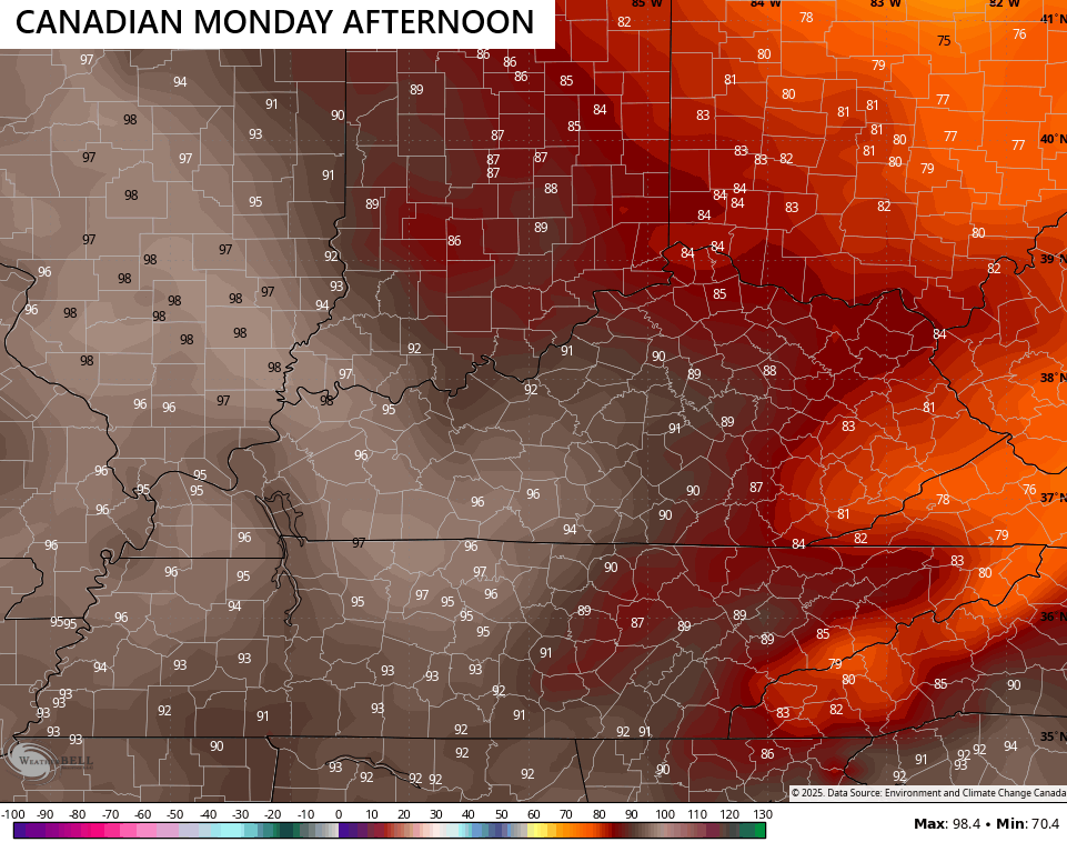
The Canadian has a similar look, but it’s more generous with the 90s into parts of central Kentucky…
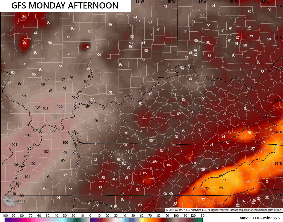
I’m actually liking what the GFS is doing, but there’s a catch. The spatial map showing cooler in the southeast and east with hotter weather in the west and north looks good as this has been the trend of many of these hot pushes this summer and over the past few years. That said, I’m not on board with the 100 in the west right now…
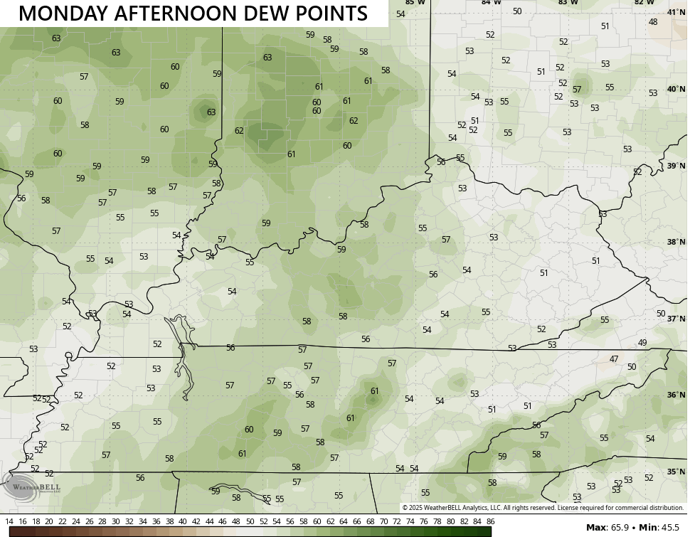
The one positive about this is we won’t be dealing with much in the way of humidity levels as dew points only reach the 50s for many…

Temps get pushed down Tuesday and Wednesday as more of a northeastern flow kicks in. This still means well above normal temps show up until a system moves in later next week or weekend…
The timing of that system is in question, but September is famous for being a fickle month with hard to time medium range systems.
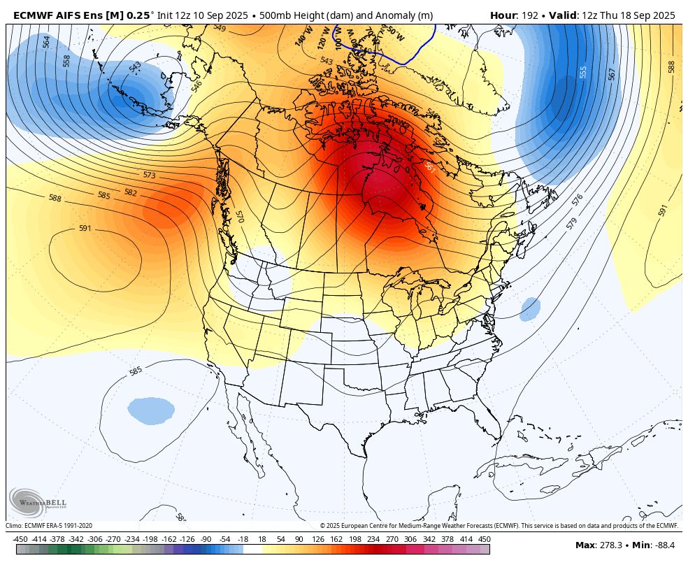
The overall pattern continues to evolve toward a deepening trough in the east as we get into week three of the month…
We are at the peak time of the year for the Atlantic Hurricane season, but we have yet to have a named storm in September. This is highly unusual, and the National Hurricane Center isn’t seeing much in the way of development in the next week…

I leave you with your isolated storm tracking toys for the day…


Have a great Thursday and take care.

The lower dewpoints don’t surprise me because a flow of moisture from the Gulf of Mexico is nonexistent, and foliage, which normally contributes a significant amount of moisture to the air, is brown and dried up.
First of all, We must Remember what Horrible Event that took Place in our Great Country 24 years ago on this Date 9 / 11. God Bless America.
Mother Nature is beginning to preform a balancing act on our temperatures, but the flash drought continues. Light winds may help keep wildfires from spreading too quickly, but we need a system that supplies heavy wide spread rains. None is seen in the forceable future.
” Short- lived La Nina ahead. Vigorus marine heatwave reaches West Coast of North America, If persistent could initiate El Nino in 2026.” Here’s the link to the rest of the very interesting article :
https://climateimpactcompany.com/september-2025-enso-outlook-short-lived-la-nina-ahead-vigorous-marine-heatwave-could-initiate-el-nino-in-2026-2-2/
I think temperatures will overachieve myself.
Enjoy the late Summer, dry heat wave, Jeff. I am glad that the balance in temperatures are taking place now, instead of in our Winter months, when most of us want Snow.
Me too because it’s bone dry