Good Sunday, everyone. Some areas are picking up on some needed rains today, but that’s nothing terribly widespread. The overall setup continues to be skewed much above normal for temps into the coming week, but some changes are lurking later next week.
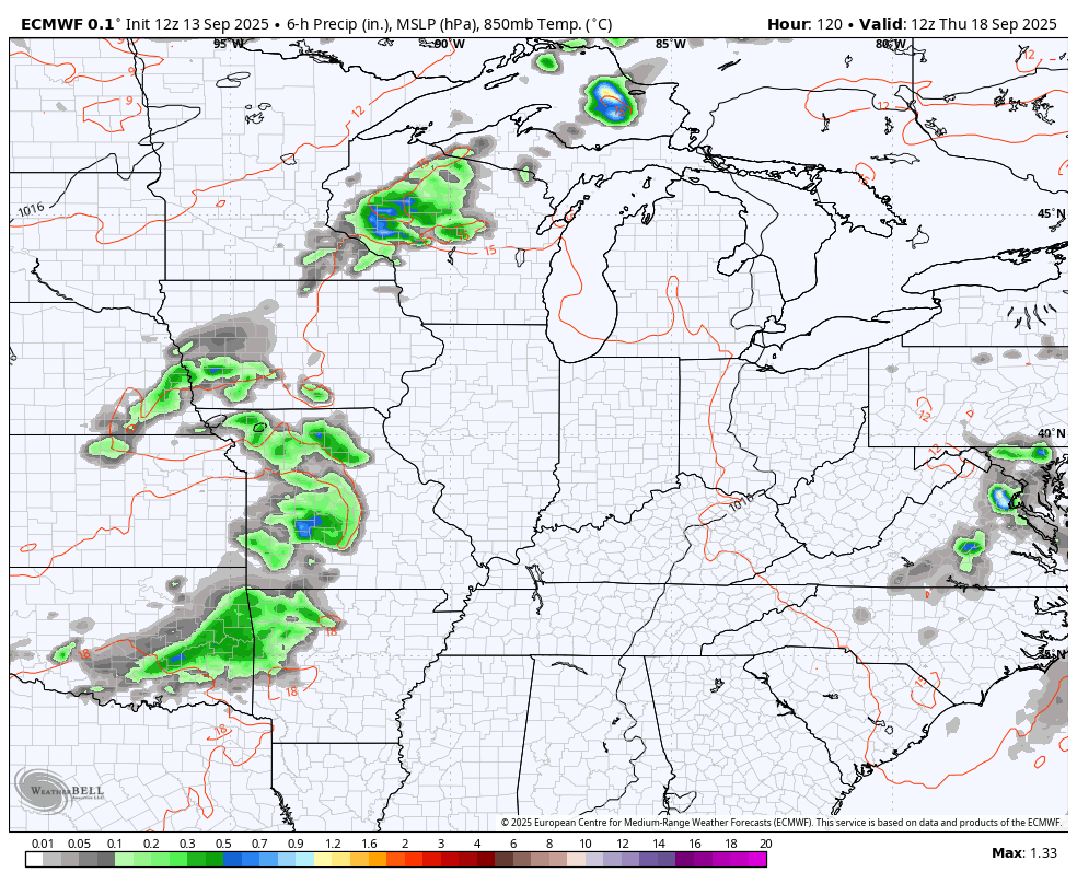
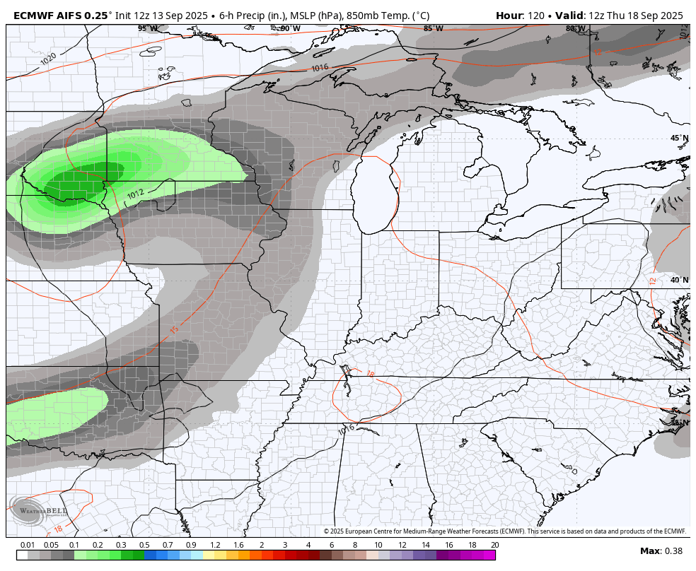
Today’s scattered showers and storms are primarily impacting the western half of the state. I’ll have your radars in a bit.
Temps are toasty in the coming days with just a slight chance for a shower or storm to go up. The best chance comes Wednesday in the east as a slow-moving system spins up the east coast. That will be followed by a couple of upper level systems spinning in from the northwest starting late next week and going into the following week.
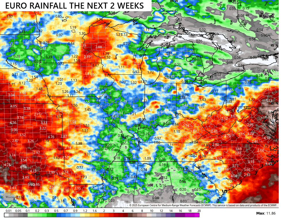
How these systems play out remains a work in progress with the EURO family the most aggressive with much-needed rains. Here’s the operational Euro…
The rainfall forecast from that run looks like this…
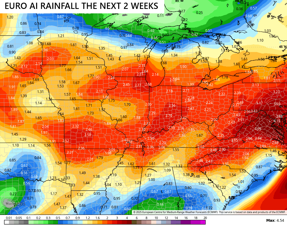
The EURO AI is even more robust with these systems…
I think most of us would settle for these kinds of rains over the next 2 weeks…
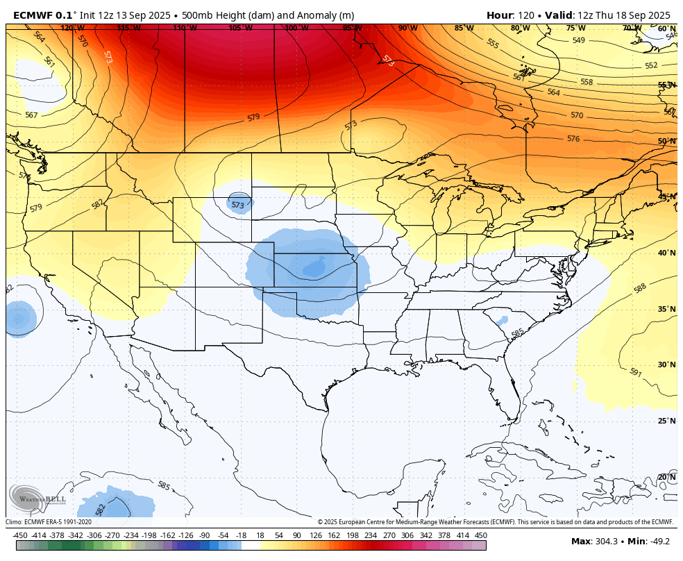
These systems are spinning under a huge block going up across Canada. This has been a common look to the pattern over the past couple of years…
The Atlantic continues to be quiet without a named storm so far in September. That looks to change in the coming days as the National Hurricane Center is pretty confident on development with that system WAAAAY out there…

I leave you with your isolated storm tracking toys for the day…


Have a great Sunday and take care.

As much as the rain is needed, I’m not convinced it happens to a significant degree.
Thanks Chris, for this morning’s update. Hoping that the models are closer to predicting an end to this almost two month old drought. I hope the balance in precipitation occurs this Fall and Winter, and not two or more years from now ? No one knows for sure when it will end. It probably ( my guess ) won’t end entirely until we have a change to a positive PDO in the Pacific, with ENSO / El Nino phasing in.