Good Monday, everyone. Toasty temps continue across the Commonwealth as some late season Summer keeps rolling. This warmer than normal air will be noted through the end of the week with before several systems begin to impact our weather.
Temps today are 85-90 for most of central and eastern Kentucky with 90-95 in the west common. There’s still the chance for a shower or storm going up across the southern half of the state, especially.
Low pressure spinning across the Carolinas will flex a bit and give us more of a northeasterly flow in the coming days. That knocks the temps down a few degrees from today and may still spit out a stray shower or storm.
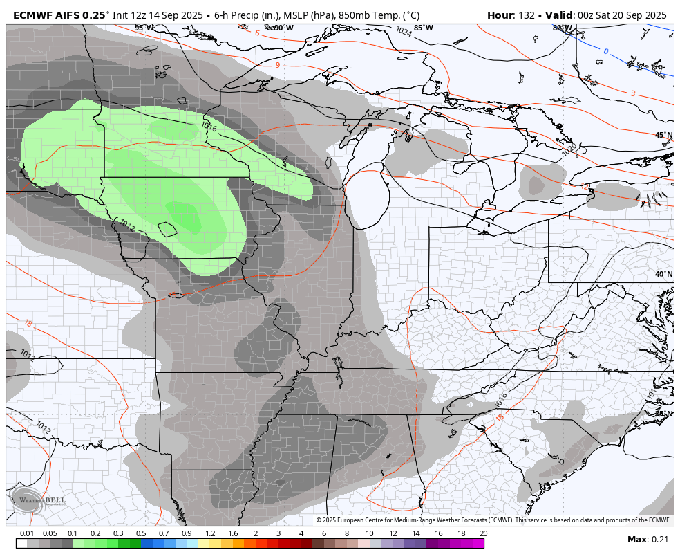
The pattern FINALLY becomes more active by the end of the week into the weekend as the first in a series of upper-level systems rolls in from the west and northwest.
The EURO AI has a good look at these in this animation that starts Friday and goes through September 28th…
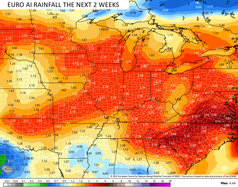
The EURO AI rainfall during this time would be glorious…
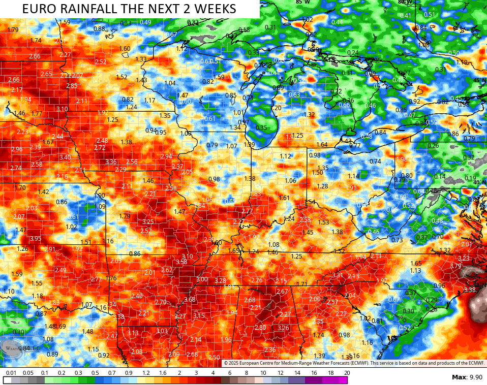
The Operational EURO would be as well…
Other models aren’t as excited about the rainfall potential, so let’s really pull for the Euro family. The GFS has essentially no rain because it’s too busy spinning up a half dozen tropical systems that will never happen during this time span.
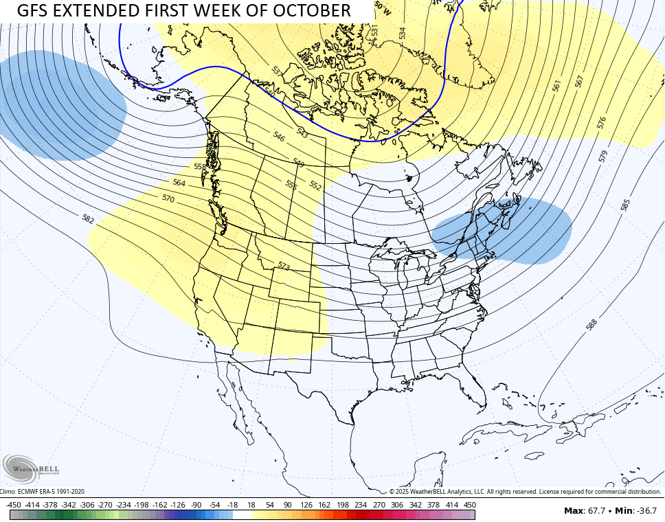
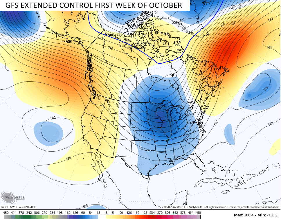
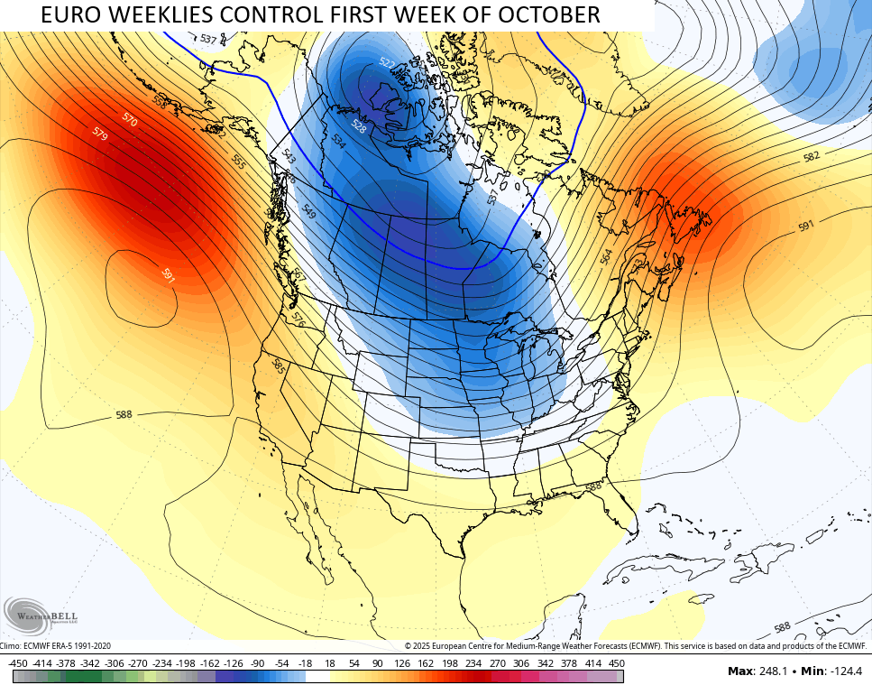
Looking farther down the road to the start of October, we find really good agreement from the EURO Weeklies and the GFS Extended on a trough in the eastern half of the country…
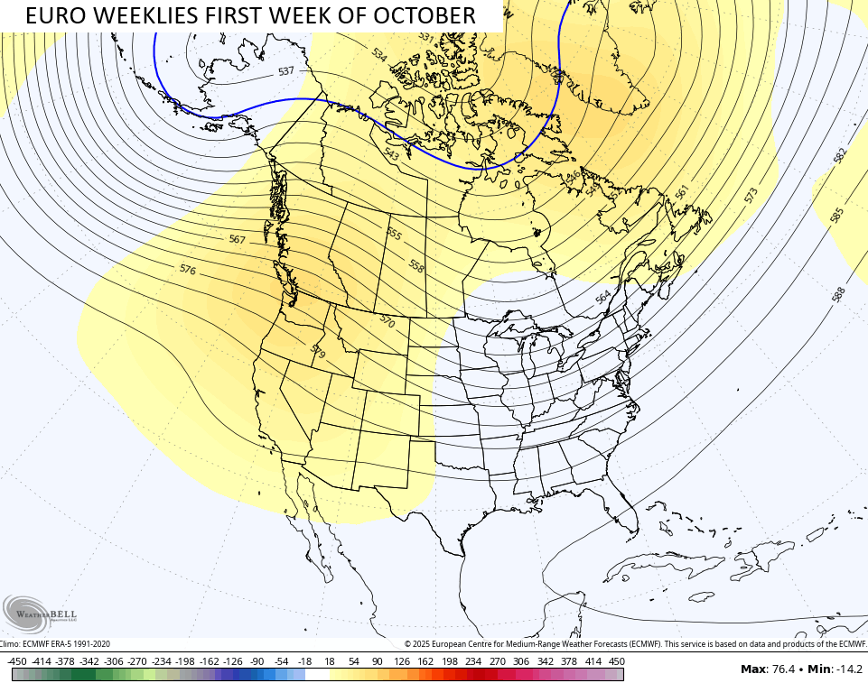
It’s interesting to note that the control runs of those also look similar, but with a much deeper trough diving into the country…
The system well out in the Atlantic is likely to become the first named storm of September in the coming days…

The last time we were this deep in September without a named storm in the month was back in 1992.
I leave you with your isolated storm tracking toys for the day…


Have a magnificent Monday and take care.

Using Lexington as a reference: As I type this, the airport has had a year to date precipitation amount of 44.11 inches (which is over 7 inches ABOVE normal for the year.) Last year at the same time, Lexington’s airport year to date was 35.69 (BELOW normal for the year by two or three inches). Yet last year, we weren’t NEARLY this dry with much LESS precip . So it goes to show, it does NOT matter how much precip you get within a year as much as it matters how spread out through the year that precip is. I’m sure most of you know this but honestly I never thought about it before.
Bingo
I really doubt the EURO runs work out.
Thanks Chris, What I said (typed) yesterday ( 9 / 14 / 25 ) still applies.