Good Tuesday, everyone. It’s another seasonably toasty day across Kentucky, but some clouds and isolated storms try to help us out a bit. Looking farther down the road, we find a few systems working our way this weekend with a better chance for some scattered stuff.
I’ll also have a look toward the first sign of some winter stuff showing up.
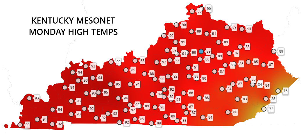
Temps on Monday ranged from the mid to upper 80s for much of central and eastern Kentucky to 90-95 in the west. The Kentucky Mesonet from Monday looked like this…
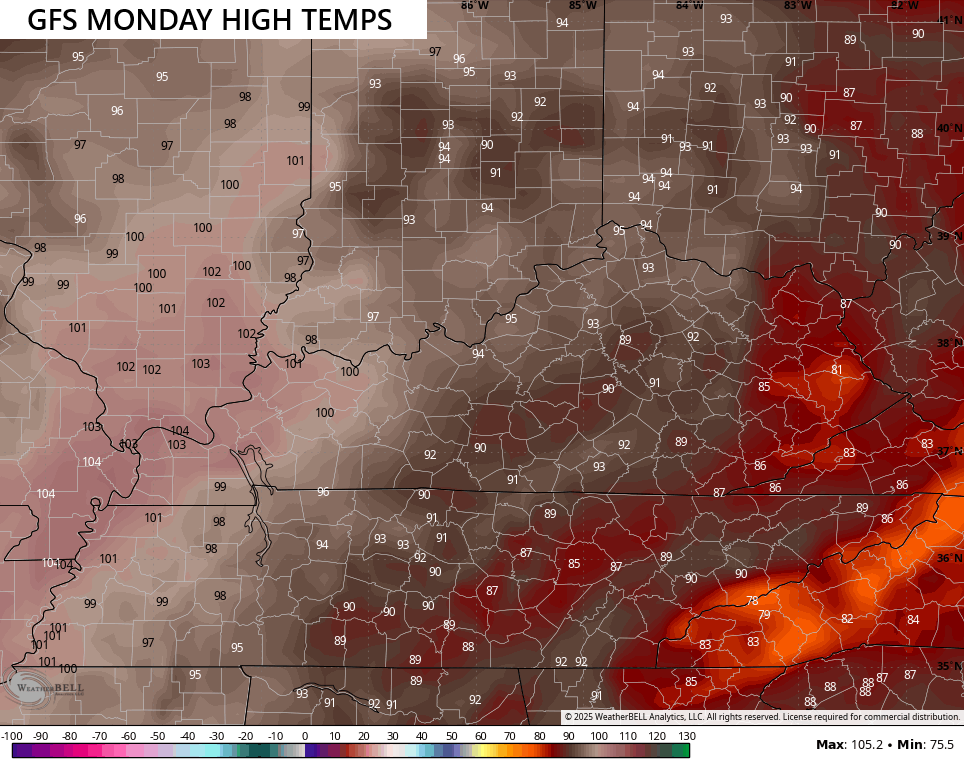
So how did the models do with that from last week? The GFS was horrendous as it routinely showed Monday’s temps reaching 100 to 105 in the west and low to mid 90s into the east…
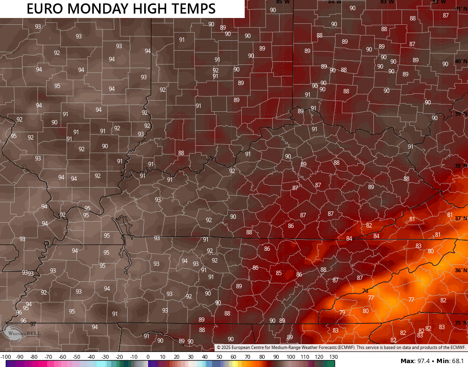
On the other hand, the EURO from last week was pretty darn good…
Temps in the coming days will be down compared to what we had yesterday. There’s the chance for a scattered shower or storm in the south and east Today and Wednesday.
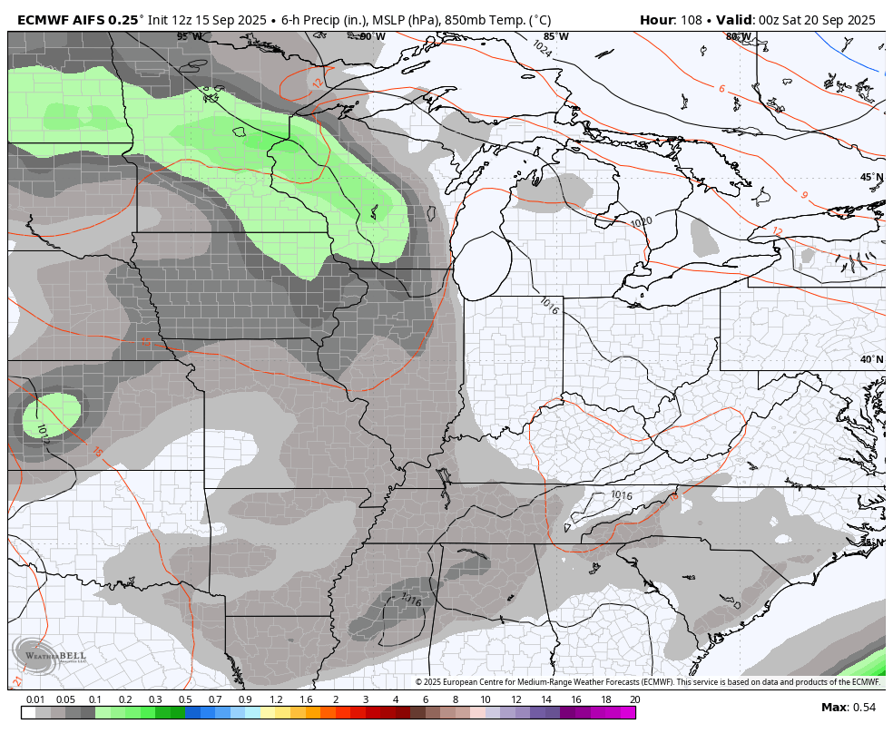
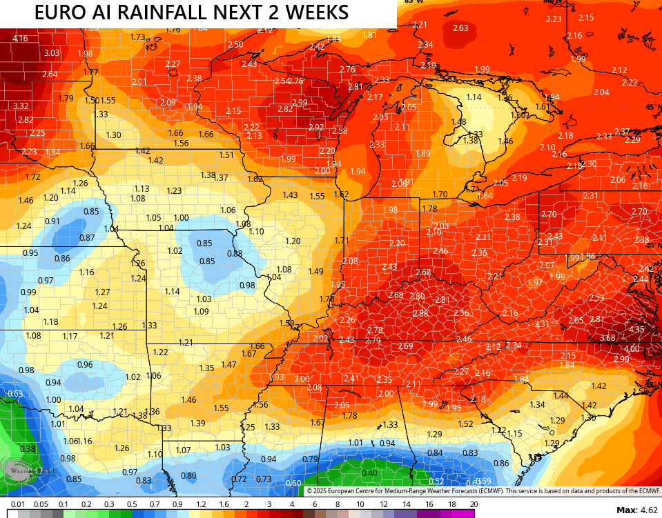
In terms of rainfall, the EURO AI continues to be THE most optimistic model out there. This model brings several slow-movers through here on this animation starting this weekend and rolling through the closing days of the month…
The rainfall from the EURO AI…
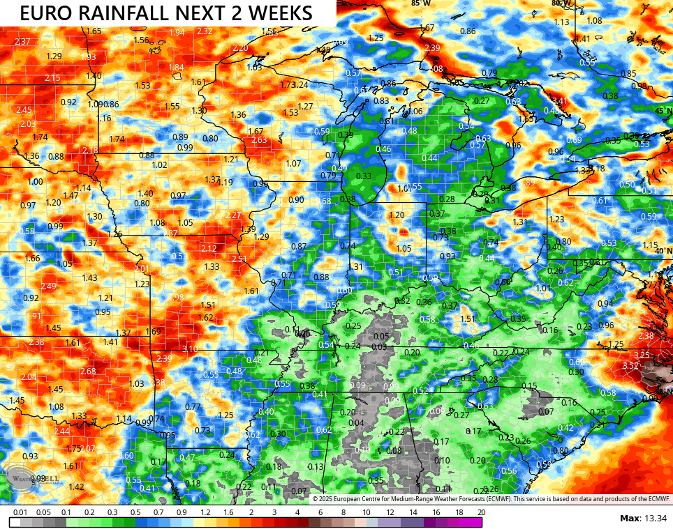
The operational EURO decided it doesn’t want to play nice with the rains…
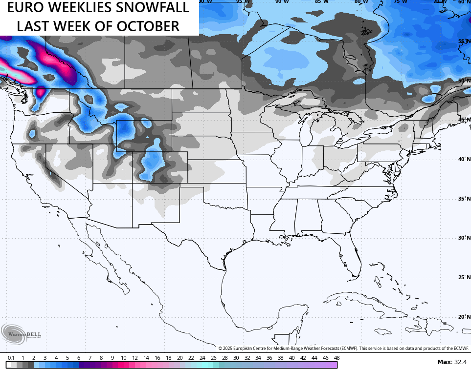
You want proof we are getting close to winter? For this first time this season, the EURO Weeklies go deep enough to show some flakes. They are picking up on some flake chances around here for the final week of October…

There’s a better chance for a tropical system to form today or Wednesday and the National Hurricane Center is showing this out in the Atlantic…

As usual, I leave you with your isolated storm tracking tools for the day…


Have a terrific Tuesday and take care.

Thanks Chris. During the past 30 days the AI models out preformed the operational models. Here’s the evidence link :
https://climateimpactcompany.com/
This weather pattern we have now is becoming destructive to the Wildlife population. We found two decease Deer near our property. My Brother, who is a Wildlife biologist called the State of Kentucky Wildlife biologist, and reported this last evening, so they could tell what happened to these animals. My Brother thinks it’s ( EHD. )
I would not be giving false hope for Snow at the end of October, until this current weather pattern completely breaks down, and it doesn’t look like anytime soon.
In a few days maybe a Tropical storm to track ?
Schroeder, we reported our first deer lost to EHD three weeks ago and surprisingly haven’t seen any more, yet. That alone makes me wish for an early hard freeze and of course RAIN.
A soaking rain followed by a hard freeze would really eliminate the EHD problem. We just hope we don’t fine anymore decease Deer in the county.
Interesting article on the Tropical Atlantic season so far :
https://climateimpactcompany.com/north-atlantic-basin-10-day-tropical-monitor-92l-likely-to-develop-but-stays-out-to-sea-2/
That is interested Schroeder, will see how this winter plans out.
The EURO AI is lying to us.
The Euro AI is the most accurate.
Nah