Good Wednesday, everyone. We’ve made it to the middle of the week with more of the same in terms of the weather. Much warmer than normal temps keep on keeping on with rain chances seemingly always several days away.
Since the weather is so boring with summer lingering, let’s talk about how summer is fading into fall with the amount of daylight we are seeing. Take a look how much daylight we are losing in the next month…
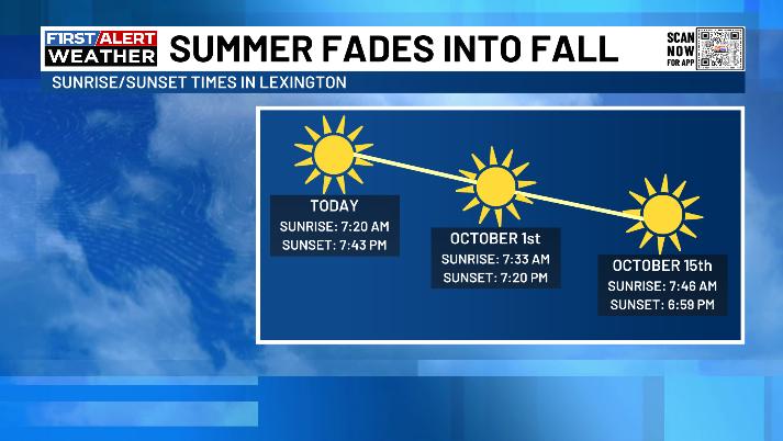
Eventually, the weather will catch up to the season, but that’s not happening in the short term and probably won’t until the first half of October.
Highs stay well above normal through Saturday with the west doing it a little hotter than the rest of the state. There’s also the slightest chance for a shower or storm in the south and southeast today. Your friendly Kentucky Weather Radars will show up at the end of this post.
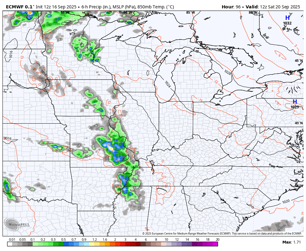
The models continue to advertise a more active setup later this weekend into next week, but the extent of which varies greatly.
The operational EURO is now the most optimistic with a series of systems bringing beneficial rains…
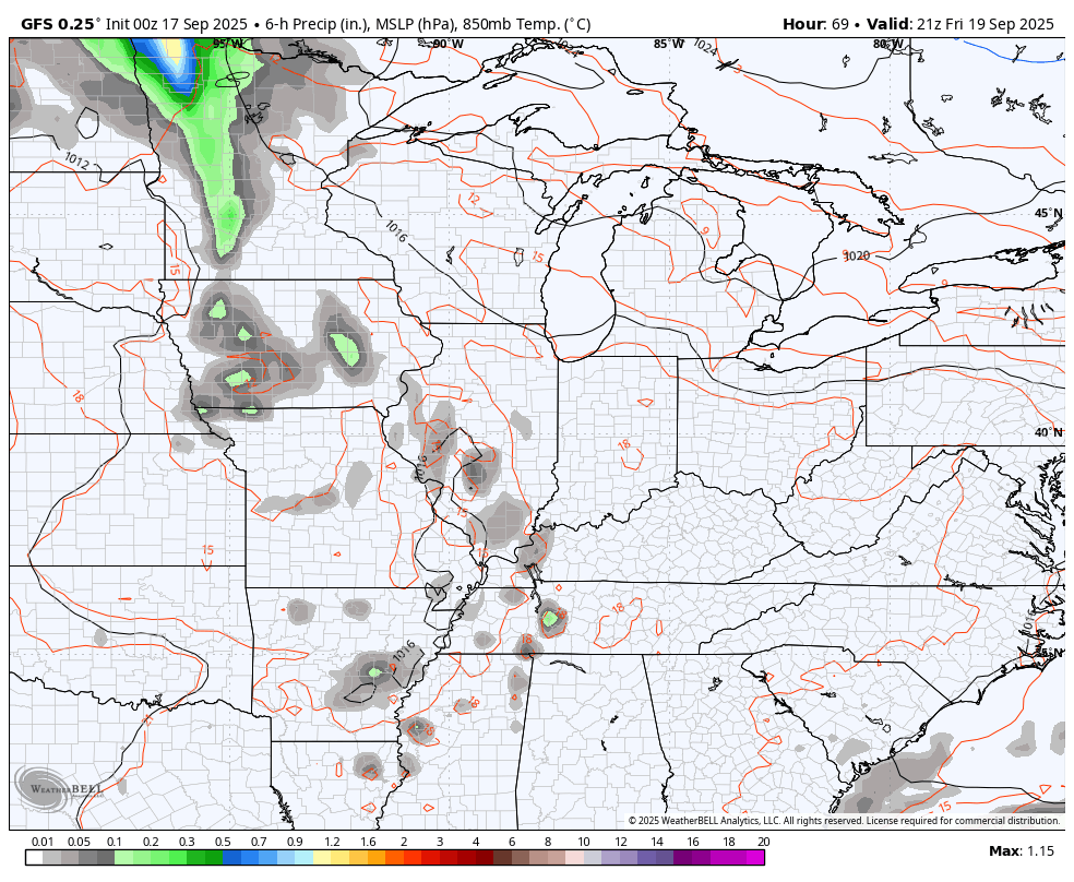
The GFS is trending that way and is even a little quicker bringing some showers and storms into the west on Friday. That’s when this animation starts and goes through the following week…
Much of what happens over the next few weeks may very well be impacted by what happens in the tropics. We are likely to see the first system of September in the coming days with additional possible development behind that…

As usual, I leave you with your isolated storm tracking tools for the day…


Have a wonderful Wednesday and take care.

Thanks Chris. I agree, it’s what happening in the Tropical Atantic, that’s causing this long persistent, late Summer like weather here in Kentucky. This is the reaction to a very wet Spring, and a very cool and dry end of August and early September. When will it balance out in both temperature and precipitation is the question. Way too early to predict what the weather pattern we may have this coming Fall and Winter. My guess would be an up and down on both temperatures and precipitation. When it’s cold, it will be dry, and when it’s warm, it will be wet. NOAA is strong on predicting a short – lived ENSO / La Nina this Fall and the early beginnings of Winter. What happens after that is another question. Hopefully, ENSO / El Nino will phase in along with a positive PDO for the 2026 – 27 Fall and Winter. We shall see.
Another reason why our Summer weather has returned :
https://climateimpactcompany.com/europe-west-russia-week-2-4-outlook-wet-pattern-continues-into-early-october-2-2/
I have a feeling this winter will make up for the boring weather were having now. I’ve read several sites that we will experience more polar vertex outbreak this winter.
Polar Vortex outbreaks happen frequently during La Nina Winters, because it’s often in the weak phase, which causes Arctic outbreaks to enter the CONUS, but often it’s frigid and dry. High heating bills result. I certainly don’t want that happening this coming Fall and Winter.
I vote for wet over snow in winter.
I like to see about three major Snowstorms, but I live in South Central Kentucky, where huge Snowstorms are rare. Most likely the Northeast and Southeast Kentucky areas receives the most Snowy Winters over a decade period.
Tropical Cyclone Gabrielle forms :
https://www.weatherstreet.com/hurricane/2025/Gabrielle.htm
Finally, a storm to track.
After Gabrielle pa*s*ses out to sea. This may change our weather pattern. I certainly hope so. Here’s the link:
https://climateimpactcompany.com/north-atlantic-basin-10-day-tropical-monitor-tropical-depression-7-forms-likely-to-become-a-hurricane-2-2/