Good Thursday, everyone. It’s another much warmer than normal day with dry skies across Kentucky. The dry weather has been the theme of the past few months, but a much-needed pattern change is about to take place with beneficial rains likely in the next week and change.
We know this weather year has been crazy, but this stat may steal the show…
Wanna hear an insane weather stat? August was the driest August on record for Kentucky, yet 2025 is STILL the 6th wettest year (January-August) on record. We were more than 10″ above normal on rainfall entering September. #kywx pic.twitter.com/juU15jcWZI
— Chris Bailey (@Kentuckyweather) September 18, 2025
There is zero in between with our weather as we go from one extreme to the other.
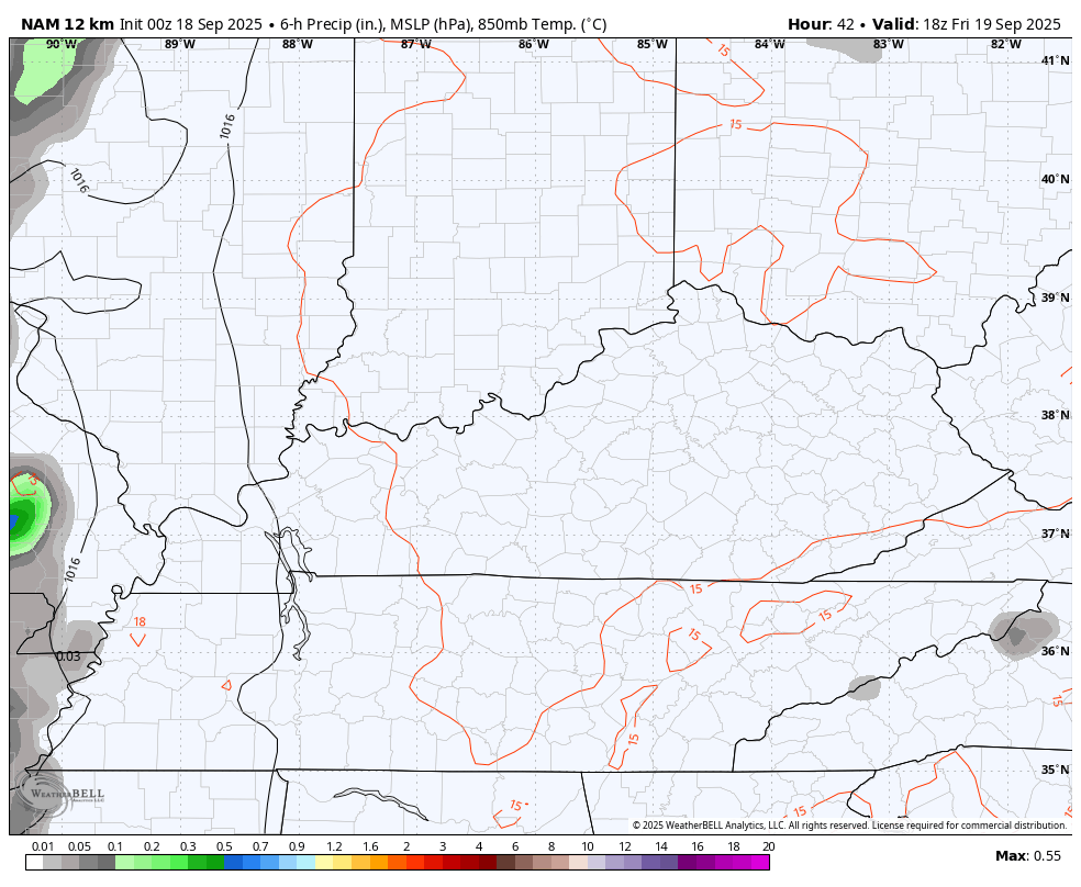
Scattered showers and storms fire up in the west on Friday with the chance slowly increasing across the rest of the state over the weekend. The NAM animation starts Friday afternoon and goes through Saturday morning and shows this well…
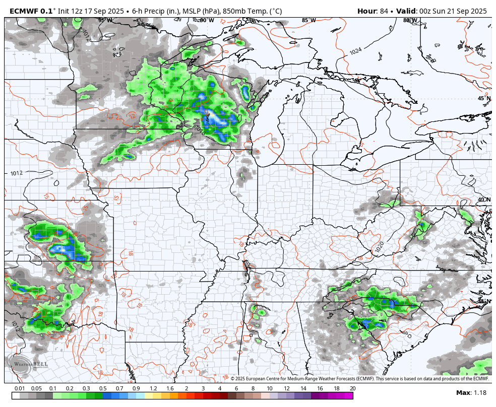
The setup after this will likely feature a big upper level system dropping in from the west and northwest, setting up shop very close to us for much of next week. The EURO is showing this well. Our animation starts Saturday night and goes through the following Saturday…
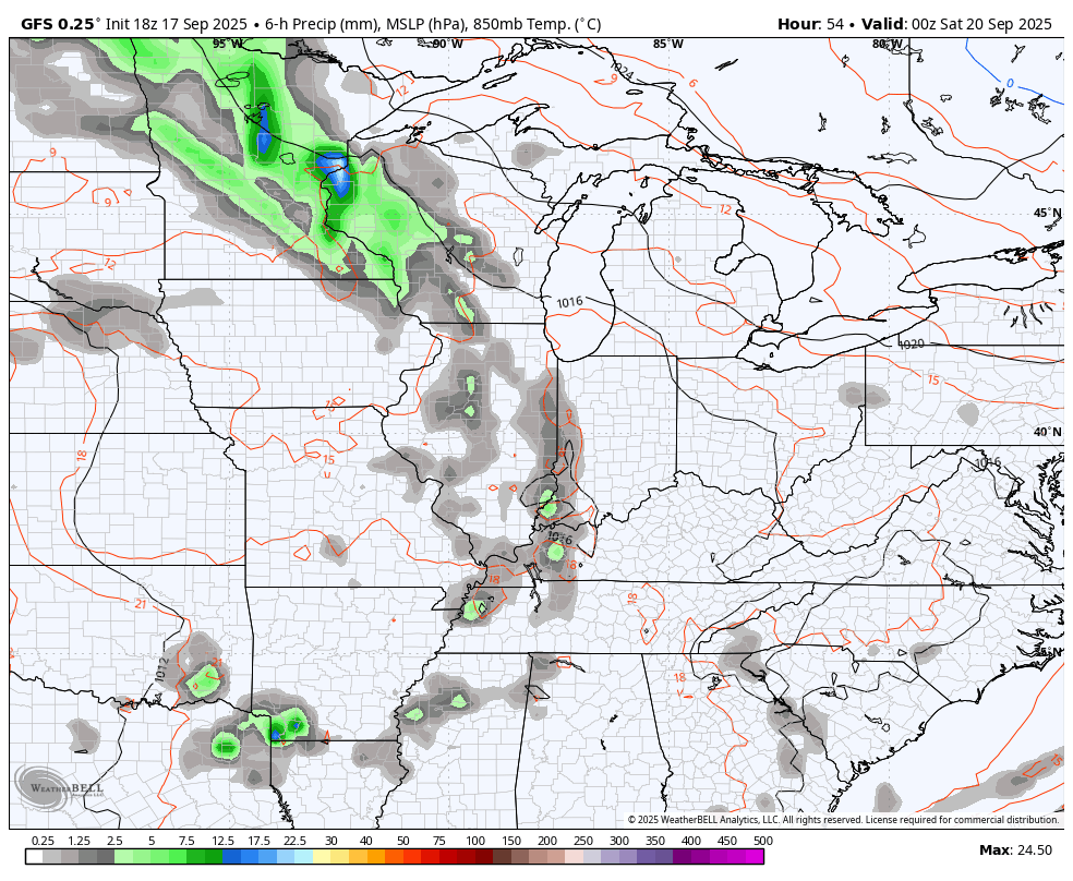
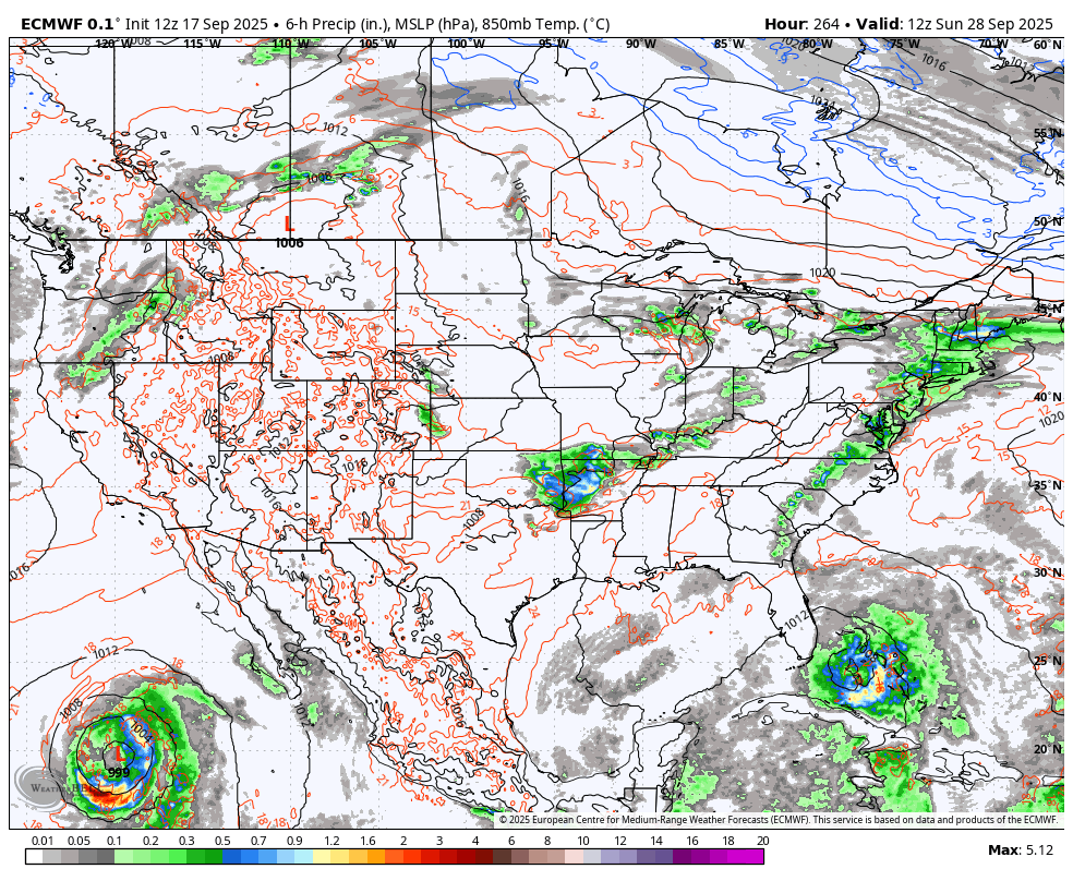
The GFS is also showing this system well…
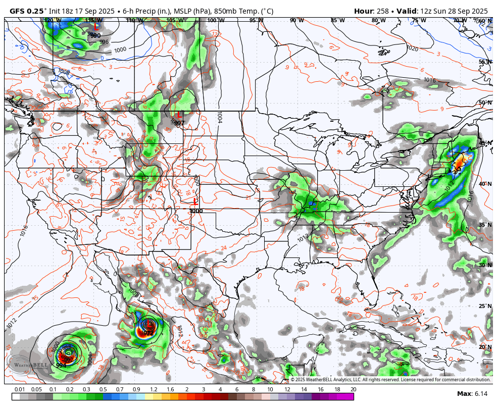
The GFS then goes on to show another system with a deepening trough with the tropics coming to life to end September and begin October…
The EURO has a similar overall theme but comes with the usual differences…
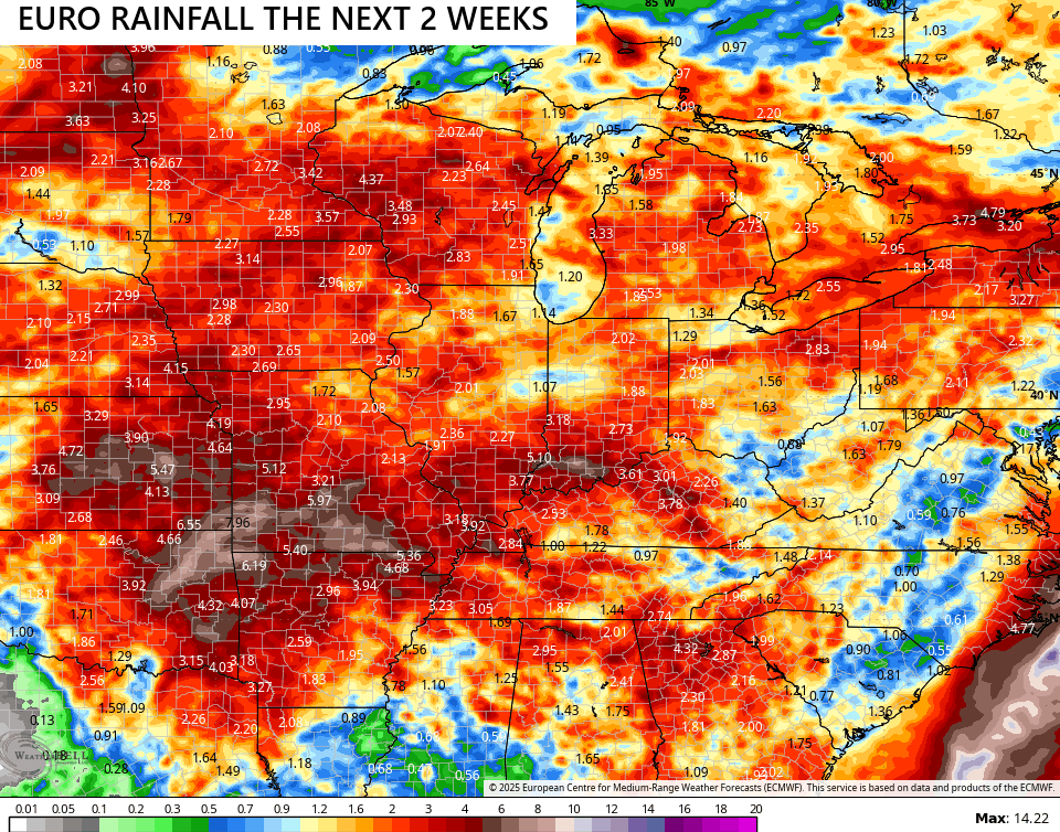
The models continue to go back and forth a bit on just how much rain can fall around here over the next few weeks. Some of the latest runs from the models are showing some hefty totals.
Here’s the EURO…
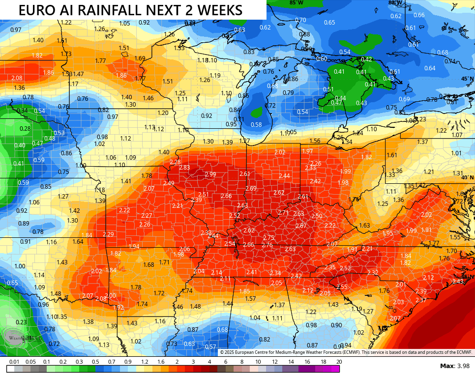
The EURO AI has been steady as she goes with beneficial rains…
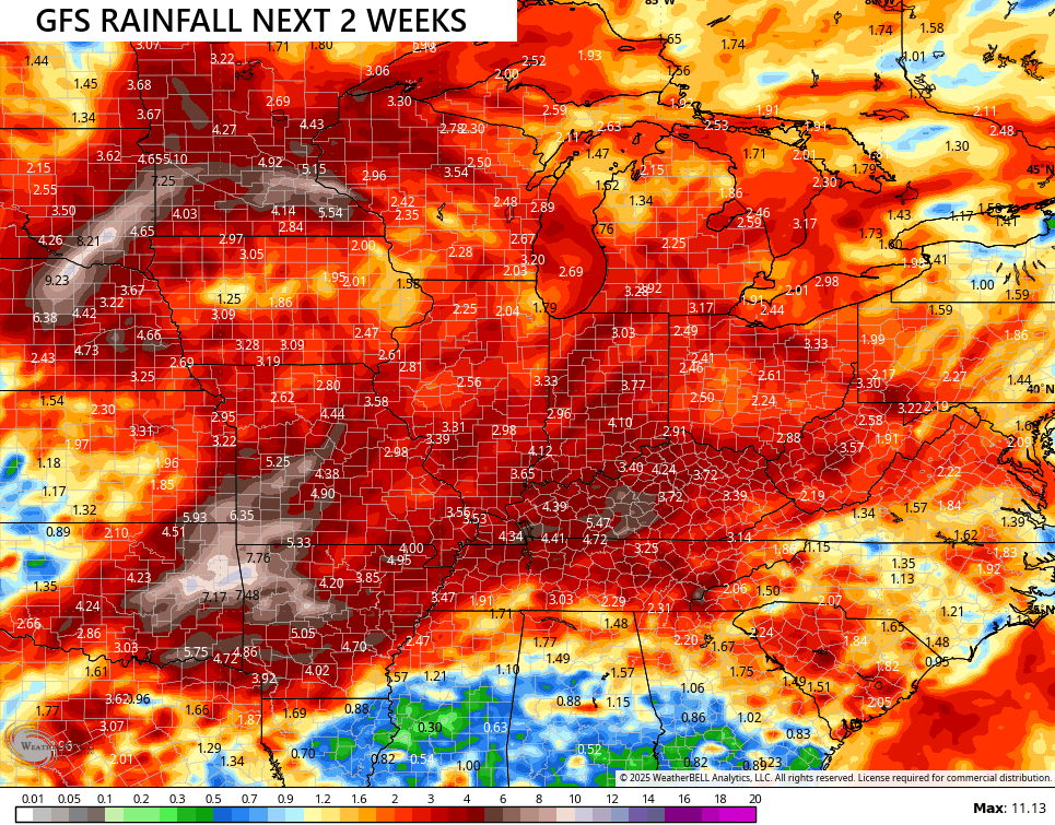
The GFS goes from showing very little rain to showing something like this…
Given the wild precipitation swings this year, I wouldn’t discount this pattern flipping back to very wet for, at least, a spell.
In the tropics, Tropical Storm Gabrielle has developed in the Atlantic and may threaten Bermuda by Monday…

Two additional systems are being monitored behind Gabrielle…

Have a great Thursday and take care.

For real crazy stats! It’s like a desert out there and still above normal for the year. I should have known when I bought a dehumidifier this would happen!
Thanks Chris. We shall see what happens in the next week or so ?
Most of Kentucky is in ” Drought Persist.” Never seen Kentucky in this category. Doesn’t mean it’s not going to rain, but we may be abnormally dry going into Fall, and I think now Winter. Here’s the link for drought outlook :
https://www.weatherstreet.com/drought-outlook-us.htm
The heating season forecast for the coming Fall and Winter. November will start out colder than normal, December and January warmer than normal, February back to colder than normal. Sounds like a typical Fall and Winter. Here’s the link :
https://climateimpactcompany.com/u-s-gas-power-notes-official-nov-25-to-mar-26-hdd-forecast-released-2/
I don’t think it gets extreme, but we certainly will get beneficial rain.