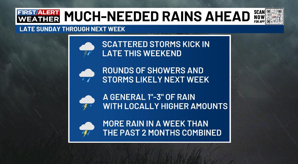
Good Saturday, everyone. The pattern is changing quickly and it’s one that’s leading us into an honest to goodness wet setup. Much-needed rains are on the way in the coming days and there’s even the potential for too much rain for some.
Isolated showers and storms will go up today with the greatest concentration coming this afternoon and evening. Locally heavy downpours will be possible, but many of us will miss out on the action. Temps are toasty outside the storms.
From there, things take a turn toward wet and stormy. Here’s a breakdown of what I expect…
Watch how all the showers and storms spin around a slow-moving storm system that settles in and slows down in the week ahead. This animation starts Sunday morning and goes through next Saturday…
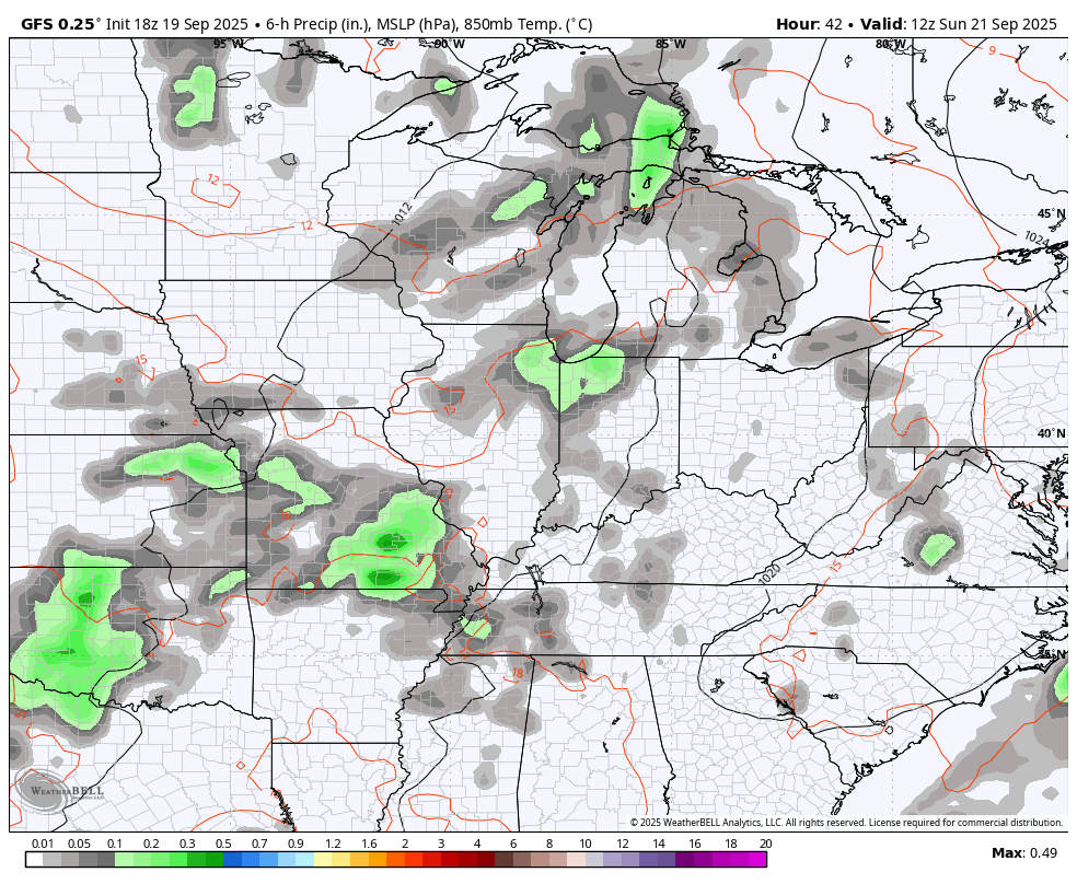
Here’s what this looks like with the surface low and the upper level low spinning pretty much in tandem during all this…
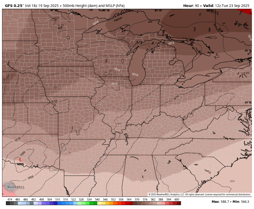
That’s the big slow-moving system I’ve been yapping about for days now…
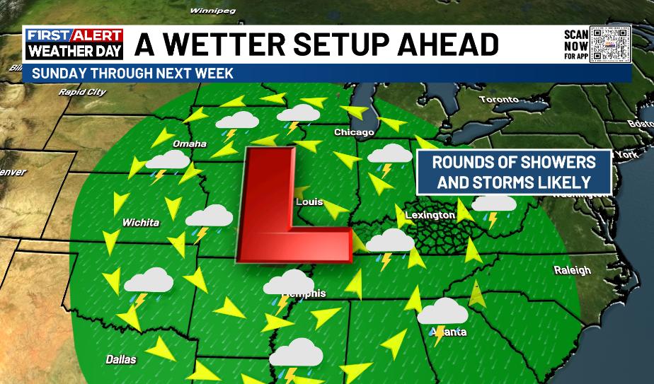
This setup can put down enough rains to cause some local high water issues from time to time in the week ahead. I can’t rule out some pockets of strong or locally severe thunderstorms.
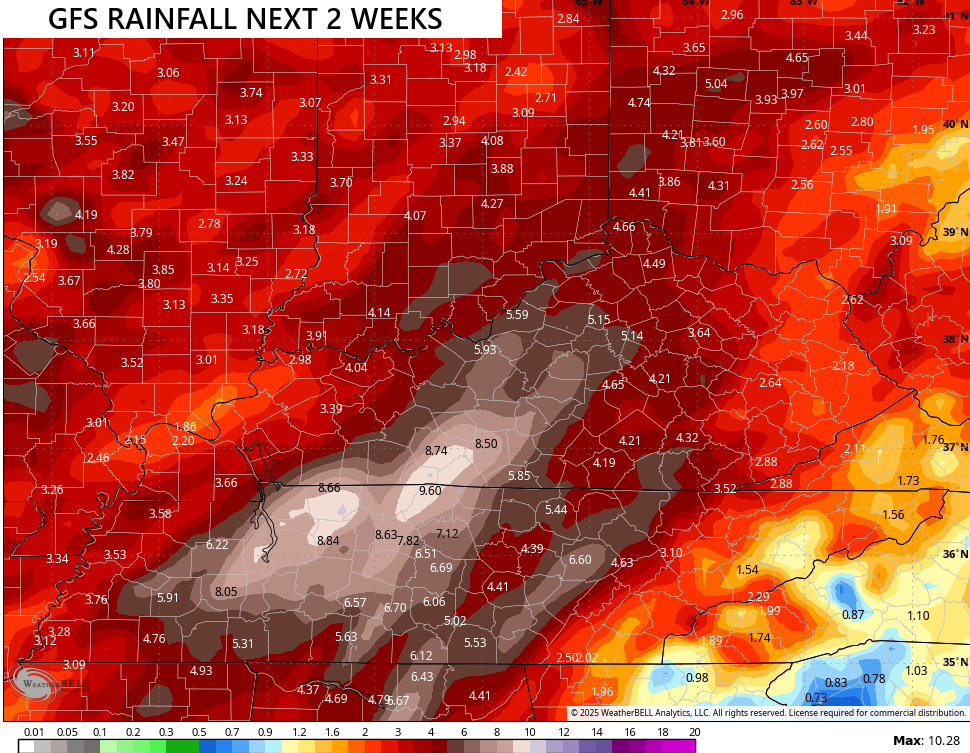
Once this system moves away, the pattern should feature another wet weather maker a few days later into the first few days of October. The forecast models are seeing more and more of this with the GFS now echoing recent runs of the EURO with some big totals in the next 2 weeks…
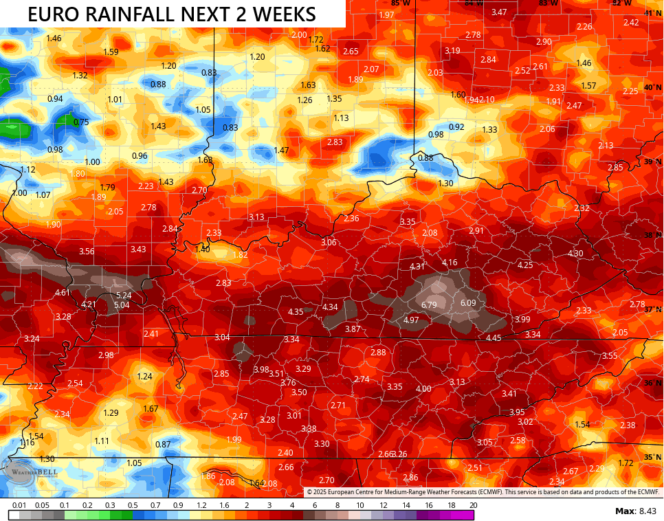
Here’s the EURO during this same time…
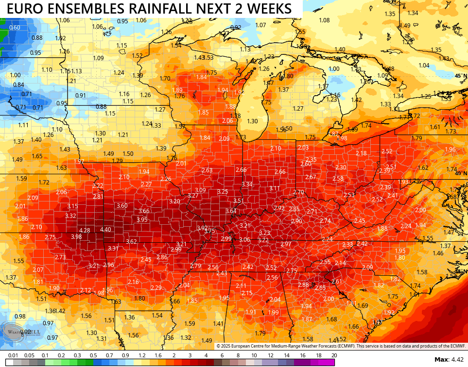
The average rainfall from the 51 member EURO Ensembles is pretty beefed up…
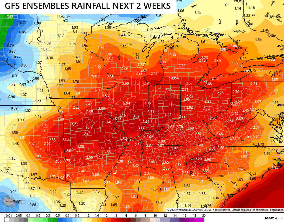
The average of the GFS Ensembles…
There are no chances with what’s going on in the tropics as Gabrielle continues to be a fish storm…

The system behind Gab isn’t in a hurry to develop anytime soon…

I may drop by for another update later today. Until then, I leave you guys with your friendly tracking toys…


Have a sensational Saturday and take care.

I’ll believe it when I see it.
Yesterday around 6pm we experince lot of strict lighting and thunder with some rain. It cause some football games to be delayed up two hours. That’s how long the lighting show was hanging around.