Good Sunday to one and all. A few strong to severe storms show up across Kentucky today as we get set for a very stormy and wet pattern ahead. Beneficial rains are likely over the next week, with the chance for some areas to pick up too much of a good thing.
Let’s begin with today’s low-end severe weather risk. The Storm Prediction Center has this risk for much of the Ohio Valley, including the Bluegrass State. Here’s a look at today’s Severe Weather Outlook…

This isn’t a setup for widespread severe weather by any means, but some pockets of damaging winds may show up with a few of the storms going up. This low-end damaging wind threat shows up on the Severe Wind Outlook from the Storm Prediction Center…

The risk for tornadoes or even large hail is so low the Storm Prediction Center probably won’t have anything on the respective outlooks…


Not everyone sees storms today, but those who do will also be dealing with torrential downpours.
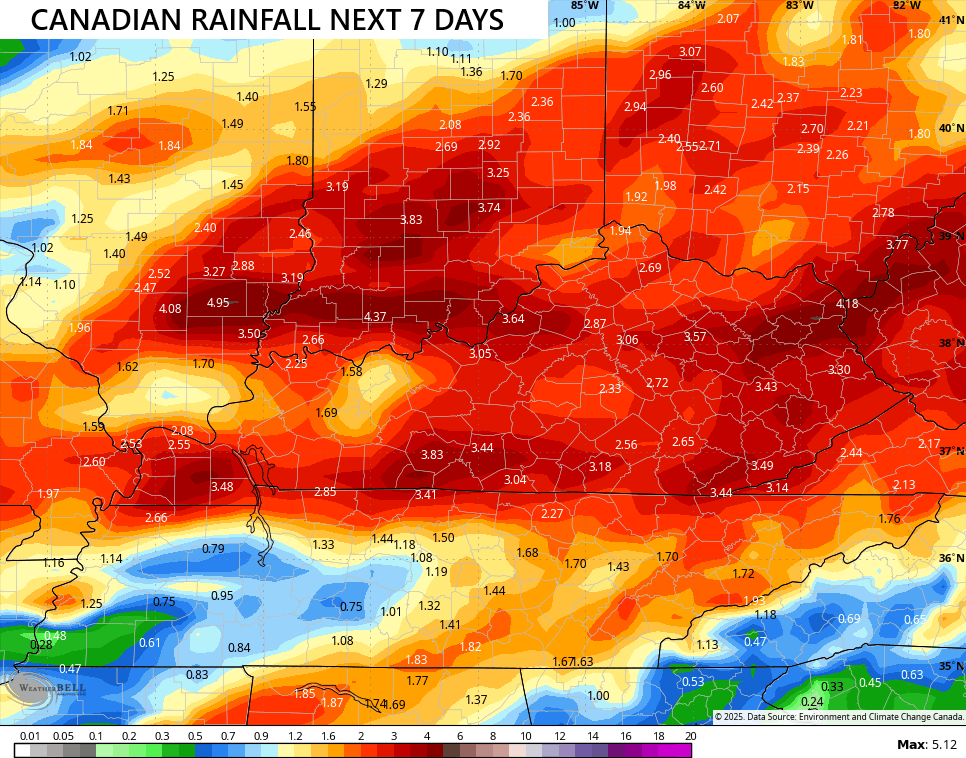
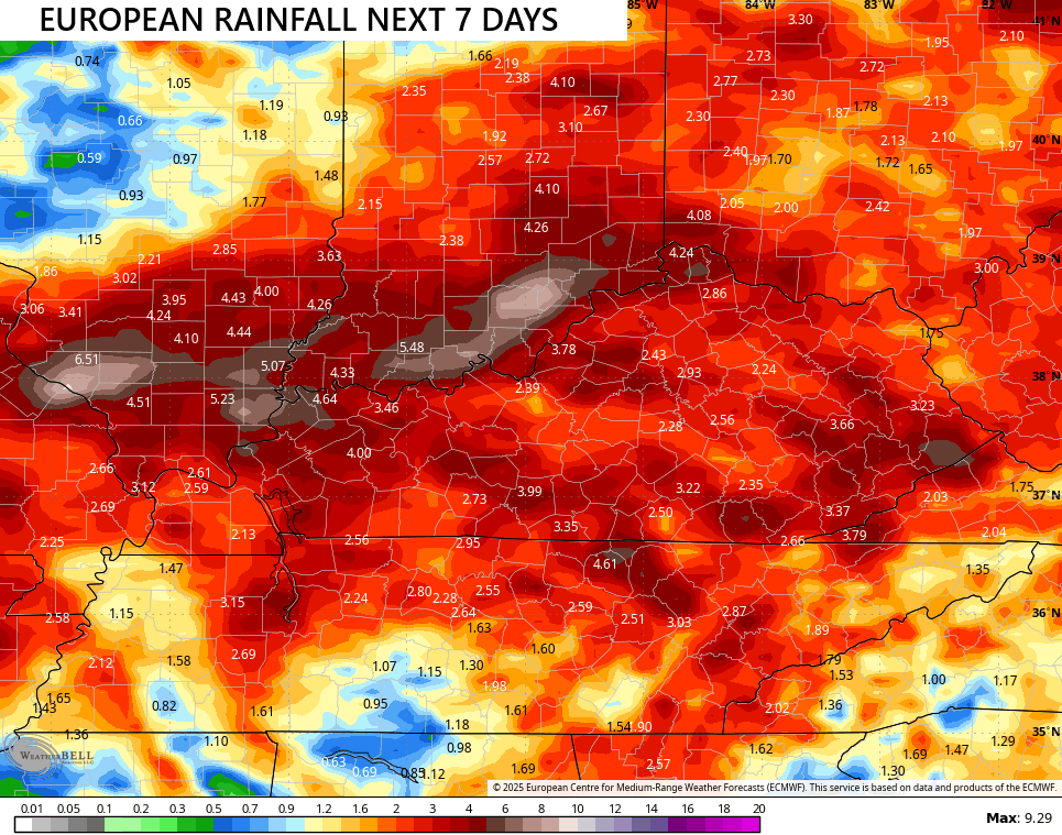
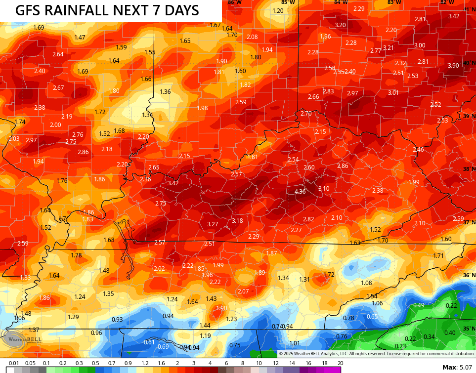
The threat for quite a bit of rain continues in our region through the upcoming week as low pressure spins in and slows down. The end result will be waves of heavy rain producing showers and storms spinning through the region, with breaks between each of these rounds. With ample moisture available, we are seeing the models spitting out quite a bit of rain…
![]()
![]()
Again, I think this is a general 1″-3″ of rain that falls across Kentucky through Friday with some areas going above and beyond. Areas that do that will have to be on guard for local high water issues.
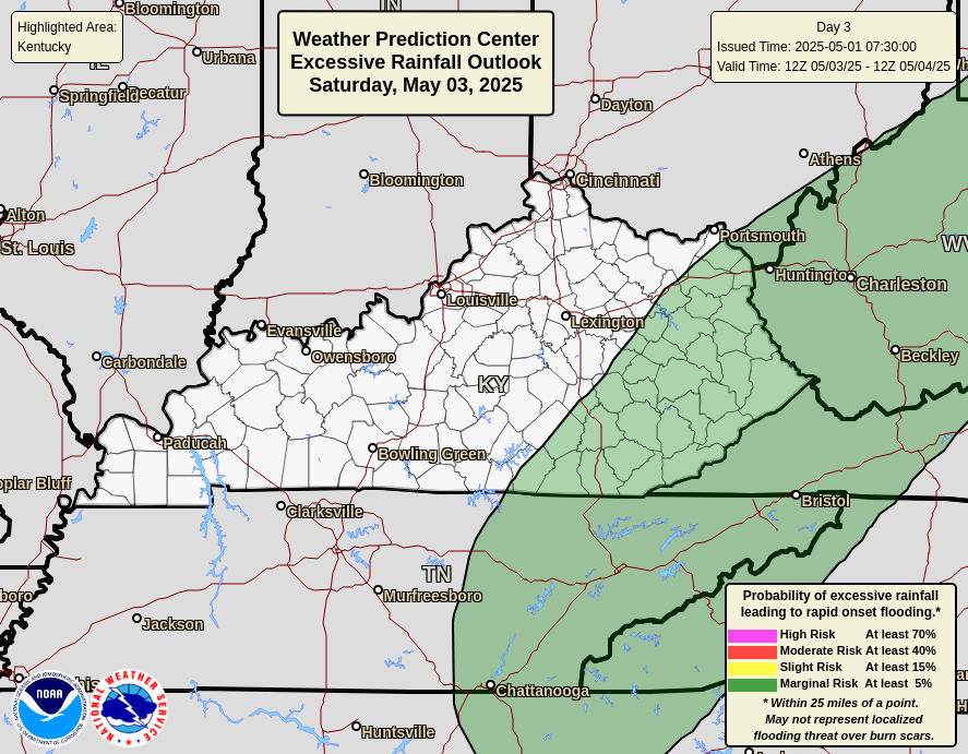
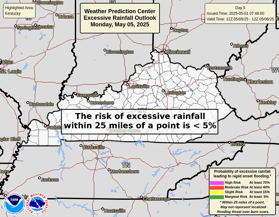
The Weather Prediction Center is highlighting the chance for excessive rains across Kentucky in the coming days…

It’s also important to note not everyone gets the storms or heavy rain at the exact same time. Remember, this is a cumulative thing.
I will have updates as needed today and on my Meteorologist Chris Bailey Facebook Page
Until then, here are your storm tracking tools for the day…


Current watches

Possible Watch Areas

Make it a great Sunday and take care.
