Good Wednesday to one and all. Rounds of showers and storms continue to push across the state today, bringing the potential for pockets of wind damage and local high water issues. Looking down the road toward the weekend and early next week we find the tropics playing a roll in the pattern.
Let’s start with the current setup. Here’s a breakdown of what to expect:
- A few rounds of showers and storms rumble through from southwest to northeast today.
- This won’t be all day rains by any means with several dry hours between storms.
- A few of the storms may be strong and there’s a low-end severe storms risk.
- Damaging wind is the primary threat.
- Another round or two of showers and storms will rumble in tonight and Thursday with the focus shifting more toward the east and southeast.
- Storms will be loaded with lightning and torrential rains.
- Another 1″-3″ of rain will be common through Thursday with locally higher amounts.
- Areas getting in on these higher amounts run the risk of local flash flooding issues developing.
Here’s a look at today’s Severe Weather Outlook from the Storm Prediction Center…

The low-end wind damage potential continues to be the primary focus of today’s severe potential…

We did manage a quick tornado spin up in northern Kentucky Monday and there’s another low-end potential today…

Large hail really isn’t a calling card of these storms…

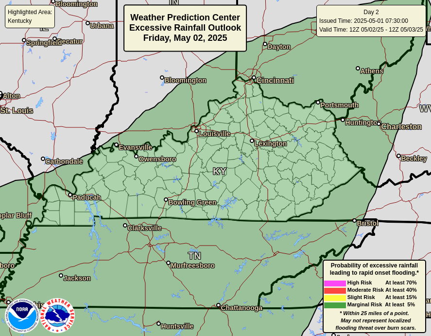
The Weather Prediction Center continues to put much of the state in the Slight Risk for excessive rainfall today…
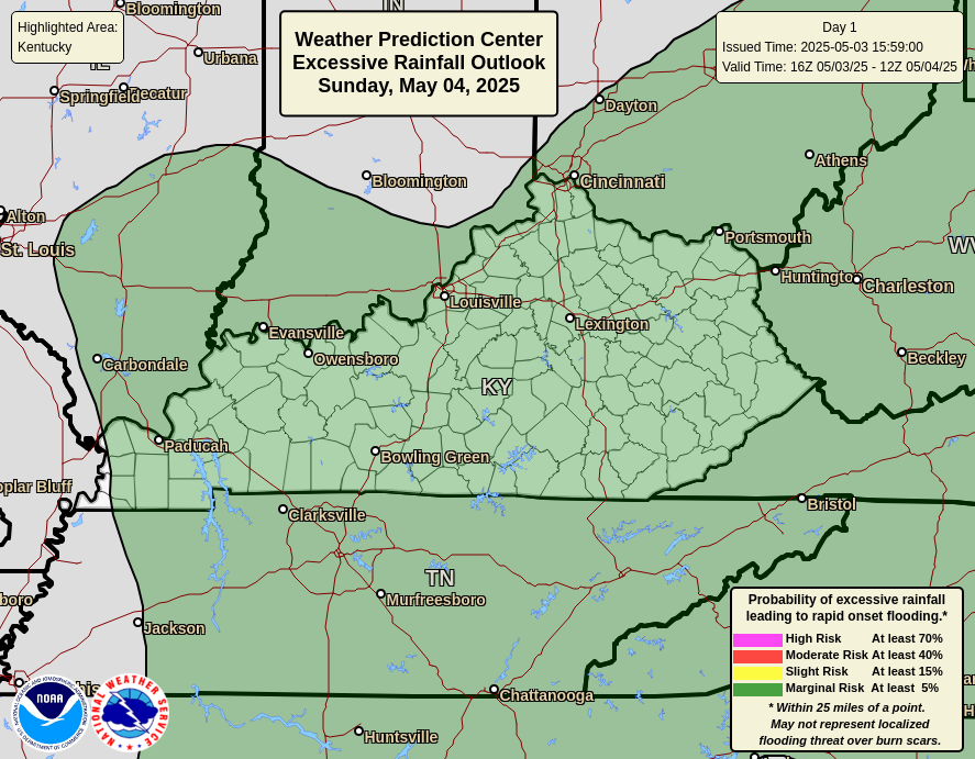
That threat starts to fade toward the east and southeast as we get into Thursday…
A lingering shower or two will be noted behind all this in the southeast for Friday as some nice air takes shape. Can we keep this calm all weekend? That’s the million dollar question as an upper low spinning to our southeast may get forced back to the northwest, giving us some rain.
The EURO is showing this later in the weekend and early next week as a tropical system comes really close to impacting the southeast…
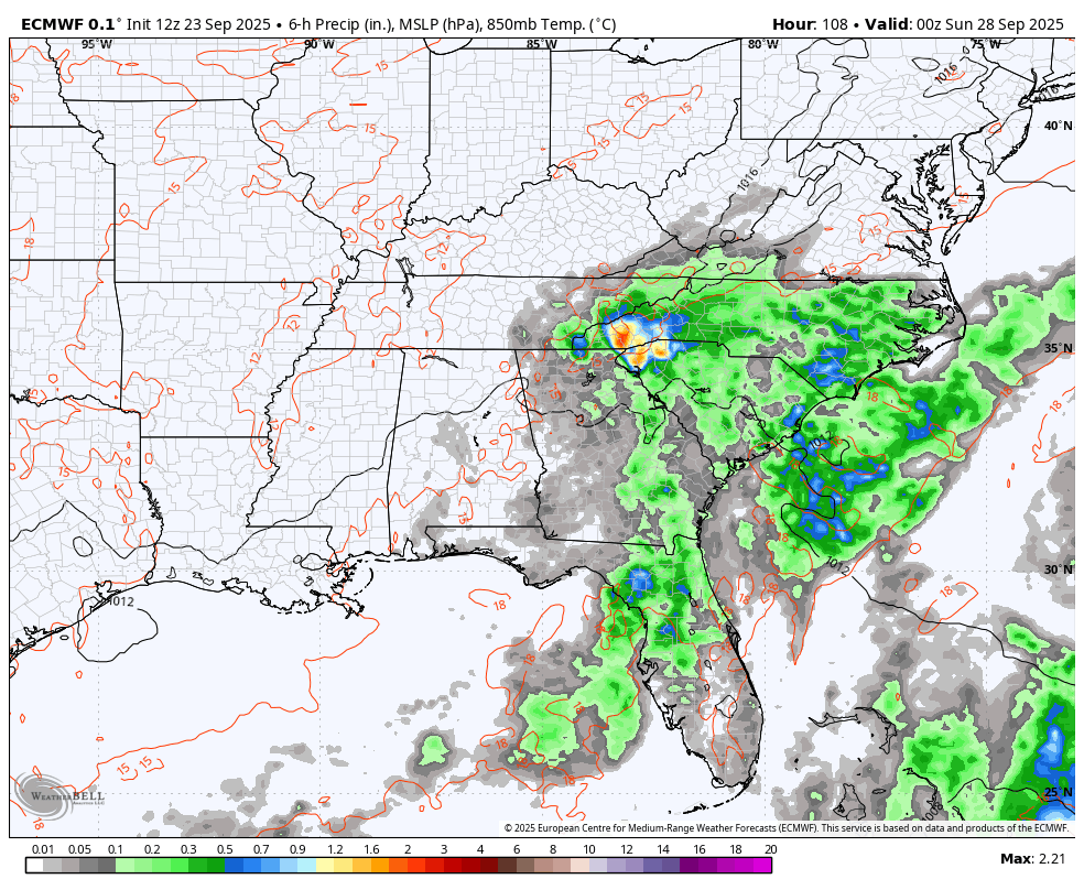
That’s one of two systems likely to become named storms over the next few days and both may be off the east coast…

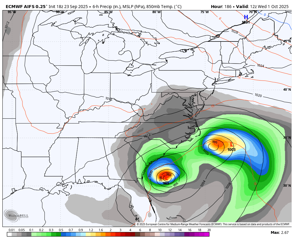
The EURO AI is fun to watch (doesn’t mean it’s right) as it merges two systems into one off the east coast and then drops in a huge cutoff low into our region in early October…
As usual, I have your storm tracking tools for the day…


Current watches

Possible Watch Areas

Make it a wonderful Wednesday and take care.

Detailed Tropical outlook :
https://climateimpactcompany.com/u-s-early-notes-tropics-activate-expect-busy-october-relentless-warm-pattern-2/
If this comes about, widespread precipitation in our area State will continue to be well below normal and above normal in temperatures throughout. Thanks to La Nina for destroying our usual Fall like weather. Maybe this will all change for Fall and Winter 2026 – 27 with a phase to ENSO / El Nino increasing. Sorry for the negativity, but I hope the Farmer’s Almanac prediction for the upcoming Winter to be a lot of interesting Snowstorms for Kentucky.
So weird. Looking at the radar you just see very light showers, but it’s straight up POURING rain at the moment. Like what you would see with the color chart on the radar being yellow/reddish rainfall rates.