Good Saturday, everyone. It’s another pleasant late September day for most of the region as our attention turns toward the southeastern seaboard as a developing tropical system takes center stage. As a matter of fact, we have twin tropical systems, but only one is a threat to the coast.
Before we get there, there’s still quite a bit of moisture spinning to our east and southeast today and some of this may get pushed back west. That could bring some showers and rumbles of thunder into far southeastern Kentucky.
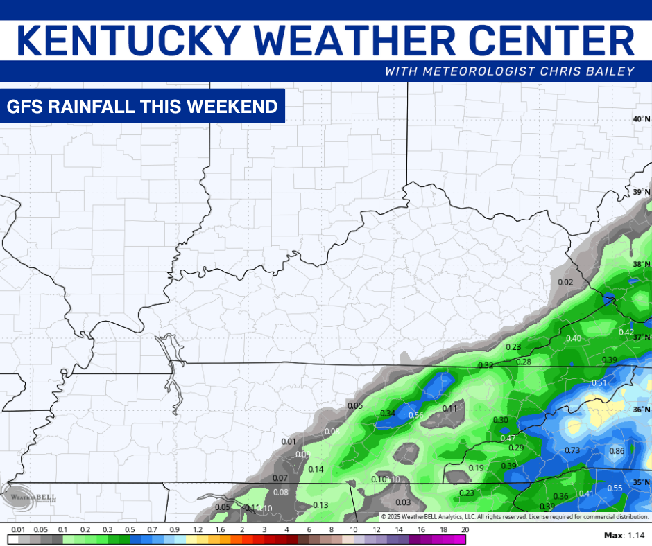
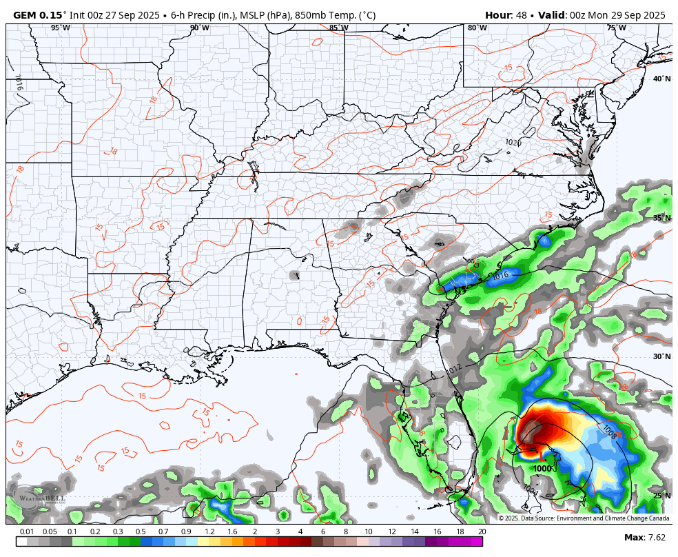
Here’s a look at where the GFS thinks the rains will be this weekend…
Ok, let’s focus on the tropics. We have Hurricane Humberto and the soon to be Imelda fairly close to one another…

Tropical Depression 9 will become Tropical Storm Imelda this weekend as it churns into the Bahamas. This is forecast to become a hurricane before it heads toward South Carolina early next week. The current thinking is Imelda may slow down just before it gets to the coast…

This trend is also showing up on the latest spaghetti plots from the hurricane models…
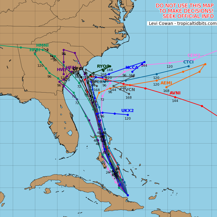
This system may very well get to the coast and stall with both an inland solution and a turn back to sea solution on the table.
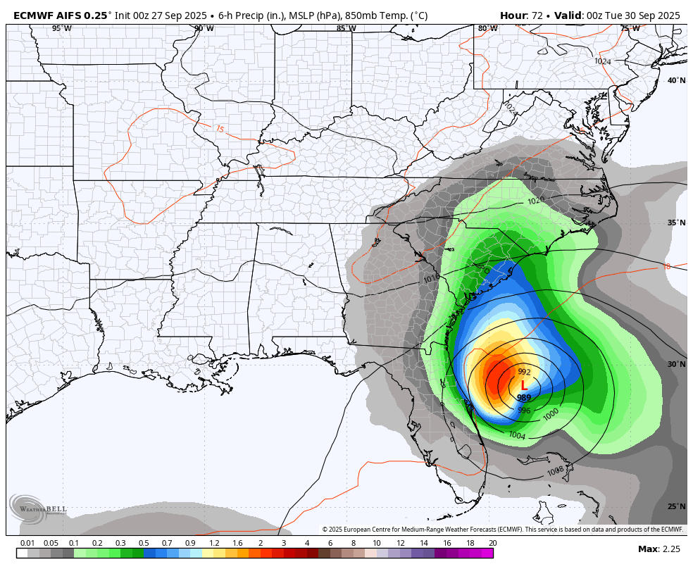
The EURO AI had been a stall and out to sea, but the latest run is now a South Carolina hit with rain coming all the way back into our region…
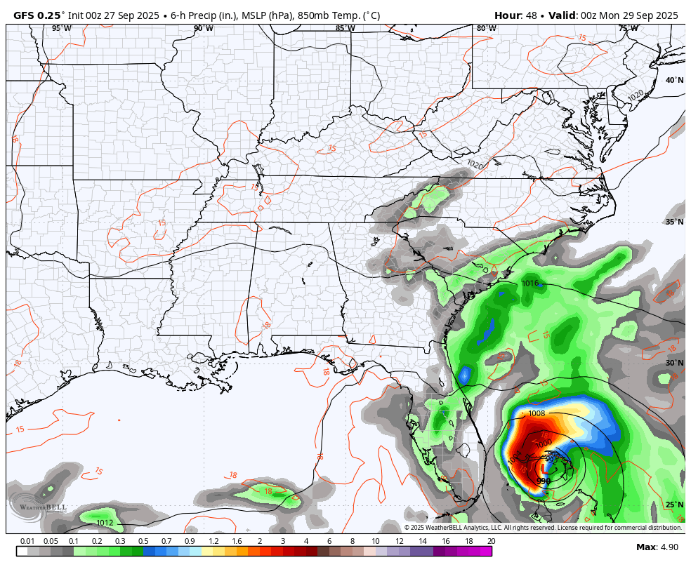
The latest GFS was showing something similar to that, but it now gives us a stall and turn out to sea solution…
The Canadian is much closer to a landfall before it turns out to sea…
 Both models take this storm into the middle of the Atlantic and then turn it around and aim it at the northeastern part of the country deep into the first week of October. Why do I get the feeling that Imalda may be one of those storms that has some twists and turns with it?
BTW… If this system does stall and turn out to sea, we wouldn’t get any impact at all from it and our temps would be rather warm for the week ahead.
How much of an impact will Hurricane Humberto have on the track of Imelda? I suspect the models are still trying to figure that out, especially since Humberto has strengthened much more than forecast and now looks to become a CAT 5 storm even as it stays a fish storm…

That’s a monster of a storm!
I have you all set to track any shower or storm that makes a run at southeastern Kentucky today…


Have a great Saturday and take care.

Thanks Chris. The impact in our area would be the Warmer and Drier scenario. I am grateful for the Rains this past week, which could help our Fall foliage color throughout the State. I wish our late Summer weather pattern would end. Much too warm for the beginnings of October. I remember the October 1976, which was the Coldest on record in Vanderburgh, County Indiana, followed by a very Cold and Snowy Winter 1977.
The years that are similar to this year are 2020, 2023, and 2024. All La Nina years. Maybe next year we will have a weak El Nino, which would increase our chances for more Snowy days throughout State. However, NOAA is forecasting a weak La Nina this Winter, that could produce the same, if we have a more Southern storm track. We shall see.
Models now turning the tropical stuff away from the coast.
Jeff, just found the latest on Tropical Cyclone Imelda. Looks like the upper level Southwesterlies will carry Imelda away from the Southeast coastline.
Here’s the link:
https://climateimpactcompany.com/tropical-feature-imelda-approaches-but-does-not-reach-south-carolina-coast-in-a-forecast-change-2/