Good Sunday to one and all. It’s another winner of a weather day for most of the region, but the far southeastern part of the state continues to deal with shower and storm chances. Elsewhere, all eyes are on Imelda and some changes showing up into early October.
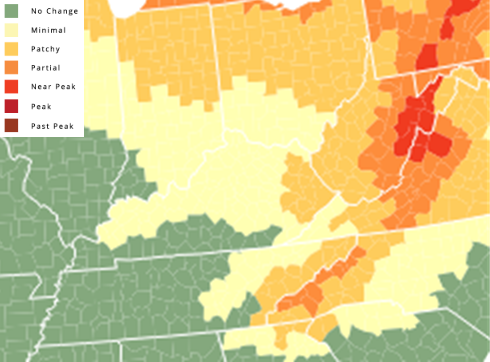
Before we get to the weather part of the program, check out the how the early fall colors are looking across our region…
Temps are pleasant today, ranging from the mid 70s to low 80s with a mix of sun and clouds.
Speaking of clouds, the view off the southeastern part of the country is a sight to behold with twin tropical troubles spinning. Imelda is developing and should become a hurricane as Hurricane Humberto surged to Cat 5 status…

The monster that is Humberto may impact Bermuda, but will be another fish storm…

Imelda is churning through the Bahamas and will brush the Atlantic Coast of Florida as it spins to just off the Georgia/South Carolina coast in a few days from now…

The latest from the Hurricane Models show this storm stalling and taking a hard right before getting to the coast…
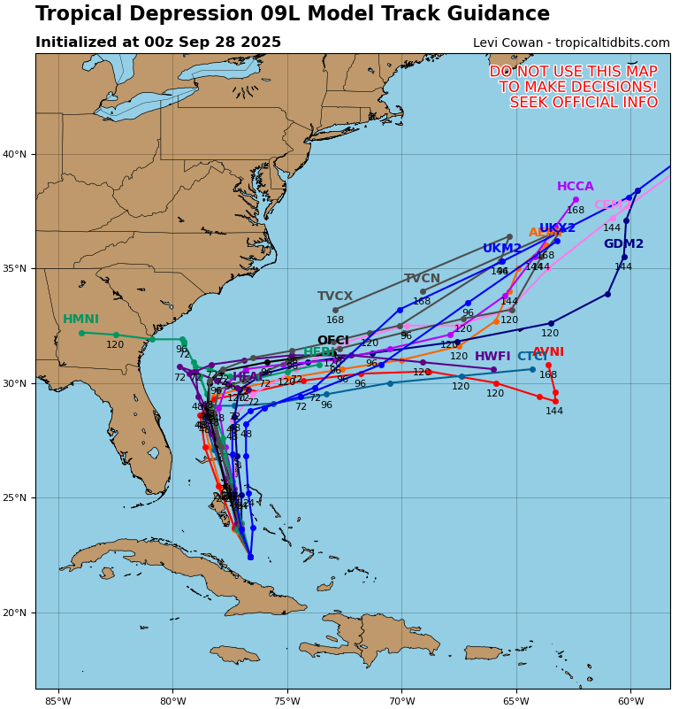
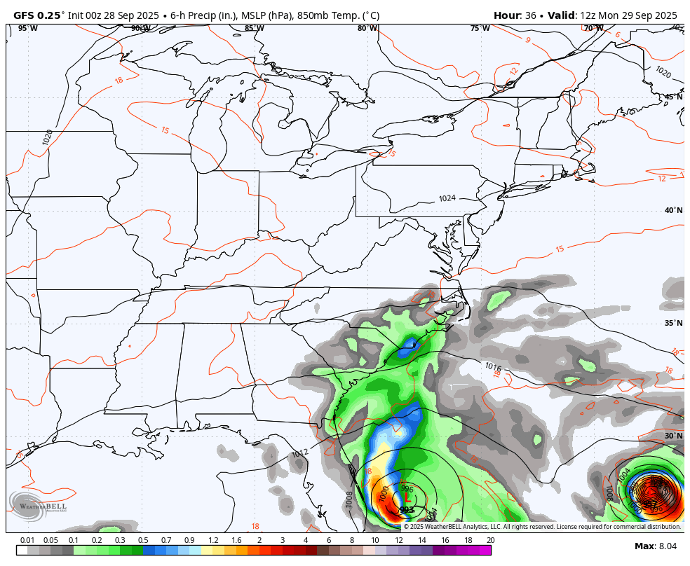
That looks like little sister Imelda wants to follow her big brother Humberto right on out to sea. It’s more than likely that Humberto is actually pulling little sis along for the ride. You can see this playing out on the latest GFS…
All of this leaves us with warmer than normal temps to end September and kick off the month of October. A few things to watch for over the next few weeks:
- The tropics are going to stay active, and we have to watch the Gulf.
- The pattern across the lower 48 becomes more active with systems moving across the country.
- We see the EPO trying to go negative about the same time as the MJO goes into Phase 2. That combo could bring a shot of real deal fall chill in week 2 of the month.
I leave you with your Kentucky Weather Radars to track any of the showers and storms sneaking into the far southeast..

Have a great Sunday and take care.

I know time goes by faster as you get older but for me I feel like it’s moving in slow motion.
It’s funny they call it a fish storm when most fish actually AVOID hurricanes:
Large mobile marine animals like dolphins, whales, and sharks avoid the turbulent surface waters of hurricanes by swimming to calmer, deeper parts of the ocean to wait out the storm. While some smaller fish may find shelter in crevices or below the surface, many other marine animals, especially slow-moving ones and those fixed to the seabed like coral, are unable to escape and face deadly conditions from the storm’s powerful waves and currents.
Mark, hope you don’t mine me posting the following link :
https://oceanservice.noaa.gov/facts/hurricanes-sea-life.html
Thanks Chris. I don’t quite understand the MJO. Trying to learn though. Here’s the link for (SON) :
https://www.cpc.ncep.noaa.gov/products/precip/CWlink/MJO/Composites/Temperature/SON/combined_image.png
I would call it a Sea Storm, but ” Fish Storm ” is much more humorous. LOL…
Typically the last 80° high is in the first half of October. I will enjoy it.
A whole string of 80 degrees or above temperatures are in my local forecast, but the nights and early morning temperatures in the 50’s and 60’s will prevail. Also, dryness returns due to Tropical activity. We need the Gulf to open up with lots of moisture coming our way, but the westerlies won’t let that happen.