Good Monday to one and all. September is ending on a warm note and that carries us into the start of the tenth month of the season. This happens as we watch a super busy tropical setup with twin troubles in the Atlantic.
Listen, I’m a fan of the 80s when it comes to the decade…

I’m not a big fan of temps in the 80s this time of year. Unfortunately, I’m just the messenger in all this and have no real weather powers.
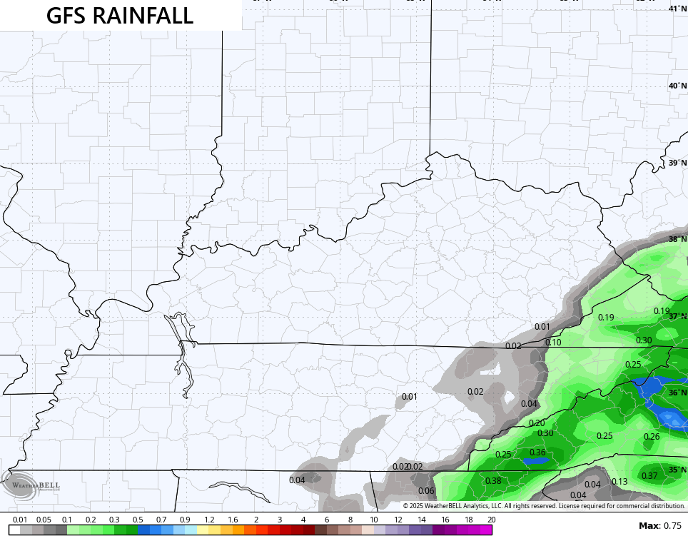
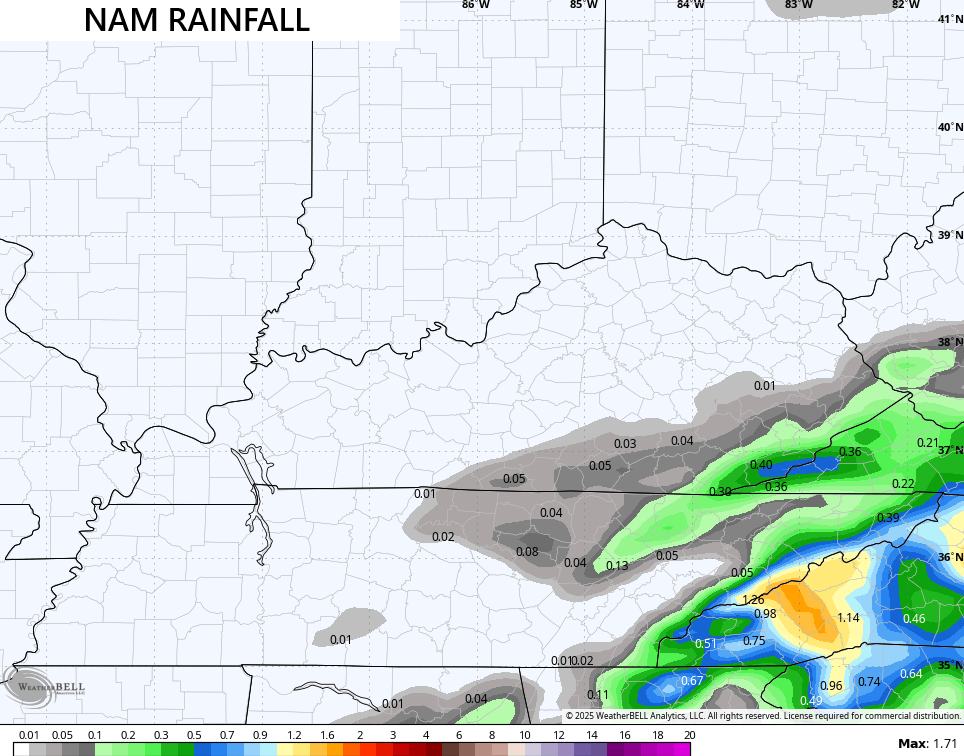
Before we get to Imelda and Humberto, there’s some juice pushing out ahead of this across the Carolinas and west into the Appalachian Mountains. Some of this may get into eastern Kentucky later today or into Tuesday. The models are showing measurable rainfall in this area…
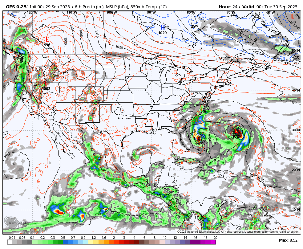
Hurricane Humberto continues to be a monster as Imelda gets set to become a hurricane. The twin spins on the tropical satellite images are pretty amazing to see…


This has turned into a game of follow the leader and the leader is Humberto. This powerful storm looks to curve around Bermuda and out into the middle of the Atlantic..

As soon as Humberto makes the turn toward the east-northeast, Imelda does the same, but at a latitude that may impact Bermuda…

This forecast animation gives us a great view of how those two zip out together…
As you can see, it’s clearly a game of follow the leader. After typing that, this song is now in my head so now I have to put it in your heads…
Go aggravate everyone around you by singing that song over and over.
Our next true cold fronts may not arrive around here until next week. This is something the EURO AI is showing well…
Here are your southeastern Kentucky isolated storm tracking radars for the day…

Have a magnificent Monday and take care.

Speak for yourself, Chris lol! I love 80s.
Jeff, looking now like this late Summer weather may hold through the middle of the October month. Enjoy while we have it.
Thanks Chris. Your making me feel very old with this morning’s blog. I hate temperatures in the 80’s in October, but this is what we have to live with, as the Earth’s temperatures continue to warm. For me the 1950’s and 60’s were the best decades in terms of a more simple, care free life, and we had more changeable weather. Beautiful, colder and frosty Autumns followed by Winters with mild days followed by huge Snowstorms especially in February and March 1960. In March 1960 we had two major Snowstorms, which began my interest in Meteorology.
March 1960 Snowstorm events Louisville, Kentucky link :
https://www.wlky.com/article/belskis-blog-march-1960-a-snow-lovers-dream/31269298
Hope this doesn’t happen :
https://climateimpactcompany.com/ag-market-global-alert-expanding-midwest-to-south-u-s-drought-brazil-dryness-continues-and-some-wet-weather-possible-for-the-black-sea-drought-region-2/