Good Tuesday to one and all. It’s the final day of September and we are sending the month out on a warm note. This warm air will hang tough into the start of October… A month that is likely to average above normal for temps in our region.
The 80s are ruling the weather roost today and into the next several days. The numbers do back off a bit by the end of the week and weekend as lows come way down into the upper 40s to low 50s, but all of this is still above normal.
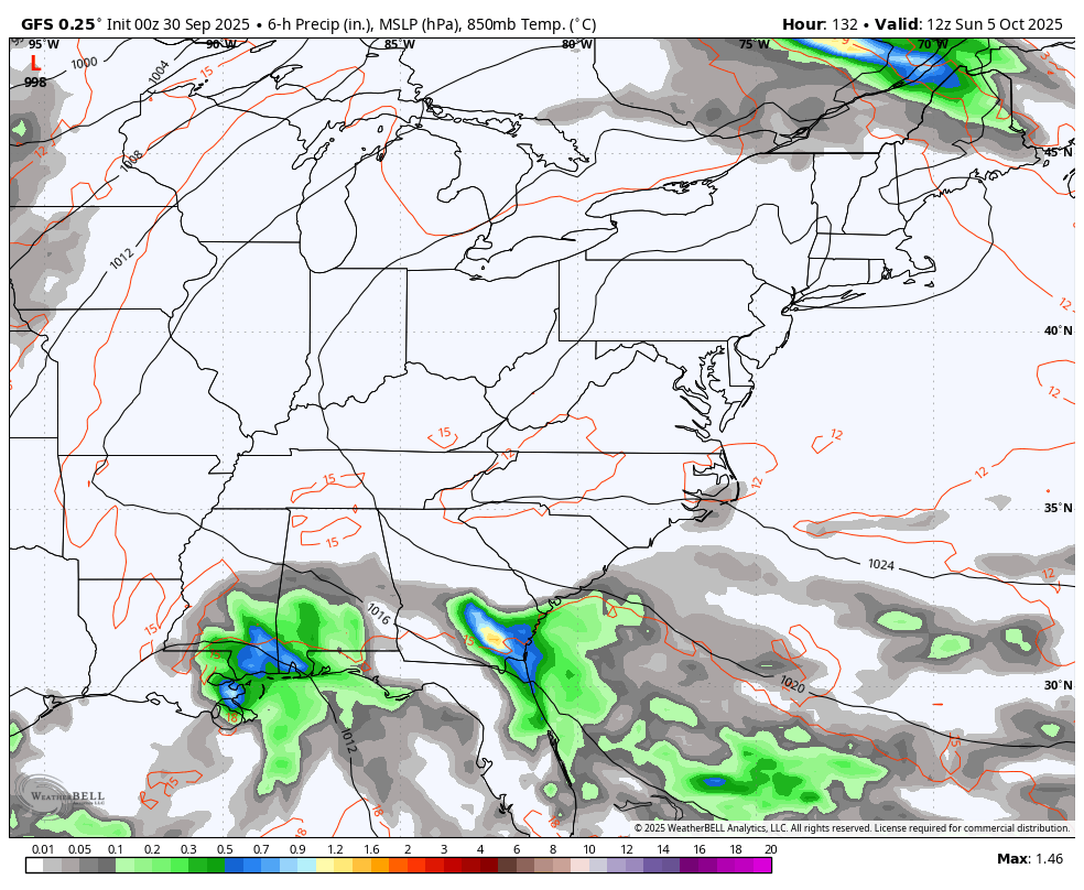
A few showers and storms sneak into the far southeastern corner of Kentucky today, but that’s about it.
Skies are mainly dry for the rest of the state and during the bulk of the next week. That looks to change by early next week and I’ll get to that in a moment.
The twin tropical troubles are spinning off the southeastern seaboard…

Humberto is leading the way as it curves east into the open waters of the Atlantic…

Imelda follows but may smack Bermuda as it tries to catch up to big brother Humberto…

Tropical moisture down in the Gulf tries to lift to the north late this weekend or early next week and may interact with a cold front dropping in from the northwest…
Here are your southeastern Kentucky isolated storm tracking radars for the day…

Have a terrific TMonday and take care.

Thanks Chris. Looks like a very abnormal beginnings of October, but hopefully the weather pattern will turn more “Autumn like” by month’s end. The September statistics for Taylor County : Maximum temperature 91.8 degrees. Minimum temperature 45.9 degrees. Precipitation accumulative 5.47 inches. According to the Kentucky Mesonet.
Beautiful satellite of the twin storms. I can’t remember if I ever seen twin Tropical storms before. Very weird weather patterns happening these days. Tropical cyclone Imelda is forecast to become a Hurricane sometime soon. Hopefully, it won’t be a problem for Bermuda, but if I was there I would be leaving now. Hurricane Humberto is still a powerful Sea Storm.
Imelda’s Meteorological discussion :
https://www.weatherstreet.com/hurricane/2025/Imelda.htm
Humberto’s Meteorological discussion :
https://www.weatherstreet.com/hurricane/2025/Humberto.htm
I am grateful for one last round of warmth, as cold will hit hard soon.
After reading several articles, dosen’t appear the warm dry weather will change to colder Autumn weather anytime soon. I didn’t believe in ” Global Warming ” for a longtime, but I know that it is happening now. This doesn’t mean that we won’t have Snowy days. Actually, the Snowstorms may be more intense. That’s good news for Snow Lovers. Bad news, there may be more Tornado Outbreaks, and intense Severe Weather( Thunderstorms ) with unusual amounts of precipitation( Flooding,) and Long Droughts, like we are having now.