Good Wednesday to one and all. If you’re looking for crisp fall weather now that the calendar has flipped to October… Keep on looking. It’s a warm start to the tenth month of the year as we look ahead toward changes taking shape next week. Those changes involve a couple of cold fronts sweeping into the region.
Before we get to the local weather, let’s get the latest on our twin tropical troubles. Humberto and Imelda continue to play a game of follow the leader with the leader going out into the Atlantic. The satellite shot on these two has been nothing short of amazing looking…

Humberto is about to become extratropical…

Imelda looks to slam Bermuda on its way deep into the Atlantic…

Wamer than normal temps carry us through the upcoming weekend and into early next week. That’s when some juice from the Gulf gets pulled northward into the region ahead of a cold front dropping in from the northwest. The end result is our next threat for showers and a few thunderstorms…
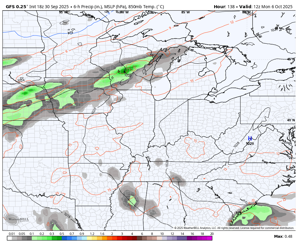
Temps drop to normal or a bit below behind that front…
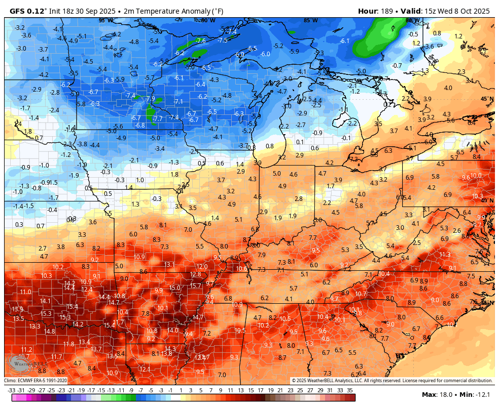
The potential is there for another system to sweep in just after that…
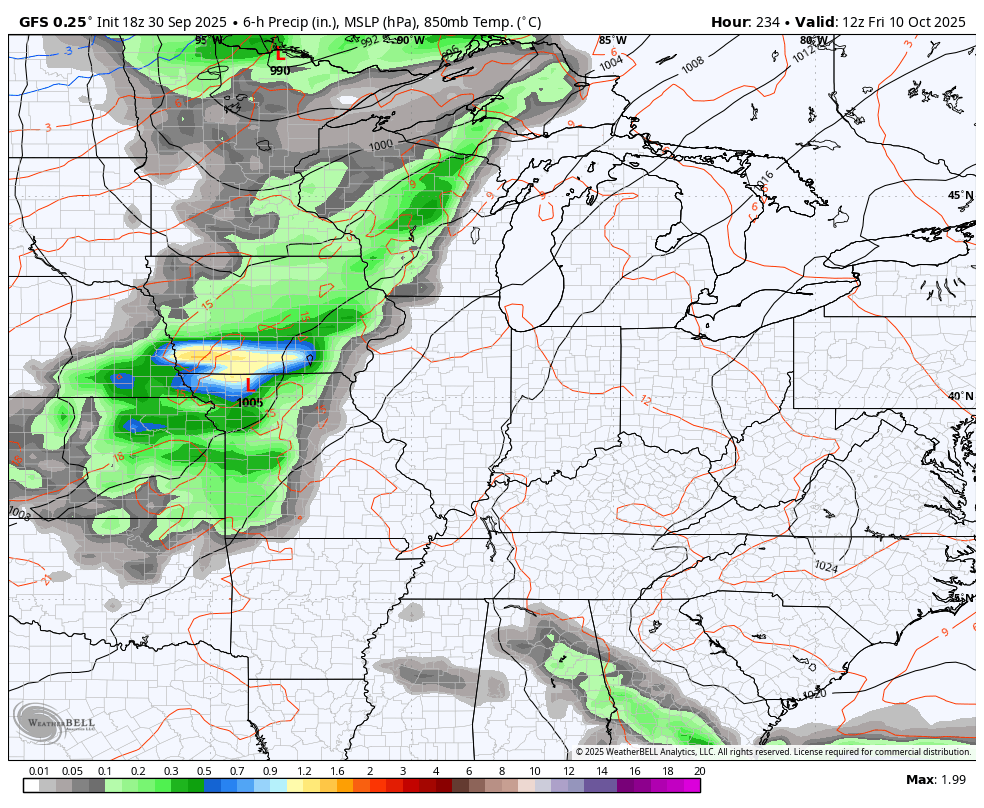
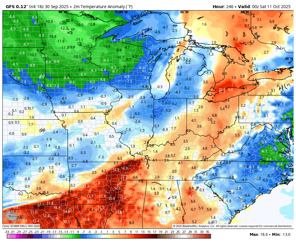
Some honest to goodness crisp temps should come in behind that…
Of course, all of that is dependent upon what, if anything, happens in the tropics that could impact the overall pattern across the country.
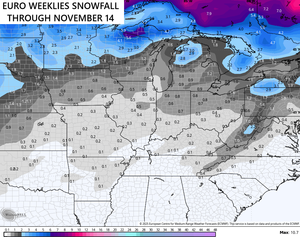
It’s the time of year we start looking toward the cold weather season just about upon us. Once again, we find the EURO Weeklies with the chance for some early November flake action…
We. Are. Almost. There.
I have your Kentucky Weather radars for you to track absolutely nothing…

Have a wonderful Wednesday and take care.

This later part of the year has been SO WEIRD. The tropics were totally DEAD, yet our weather was also dead boring, just before the tropics start, we had that one week of rainy weather (thank goodness) then the tropics pick up and it turns around and we go back to the string of what feels like endless days of tranquil weather.
Thanks Chris. Seems like Mother Nature will not let go of Summer. The late start of the Tropical storm season is definitely the cause. The storms that have formed in the Tropical Atlantic have been unusually large and intense storms, and most became Hurricanes. Oceans around the World are much too warm, which is causing pressure systems to become larger and stronger, thus longer and stronger weather events. Could be a very interesting Autumn and Winter when the Tropical Atlantic storm season finally succumbs to the declining day length. We shall see as time advances.
It is interesting weather times.
I think the climates of earth are changing for good.
How anyone can look at ocean temps and say it’s just a cycle or temporary thing is beyond comprehension.
Latest outlook for Fall and Winter from the Climate Company. It appears now that the warmer than normal temperatures will be the dominate pattern, but February and March may be cold. Here’s the link :
https://climateimpactcompany.com/u-s-medium-range-increasing-signs-of-cooler-west-some-rain-into-the-midwest-central-east-staying-warm-2-2/