Good Thursday, everyone. It’s another warm one out there today and that hangs tough through the upcoming weekend. Things change for the better by early next week as rain chances go up and our temps come down. If we play our cards right, the first patchy frost threat of the season shows up by next weekend or so.
The 80s are a thing through the weekend… Blah, Blah Blah.
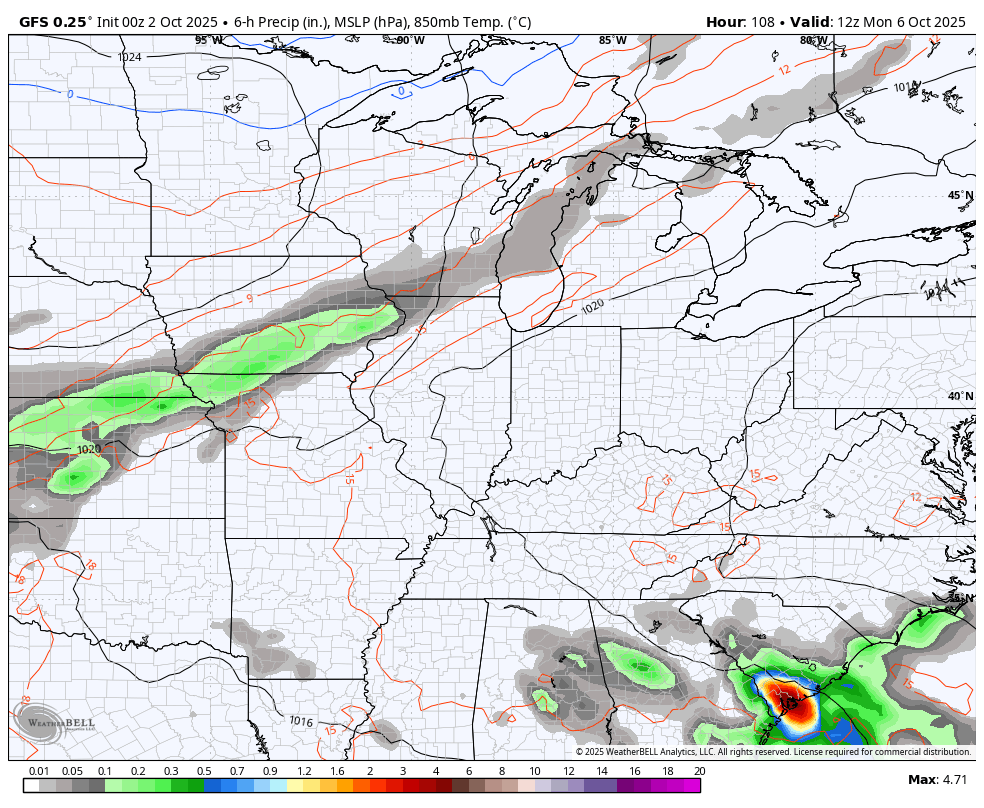
There is the chance for scattered showers and storms going up later today and tonight across the western half of the state. This comes from a small disturbance sliding through this part of the state.
Here are your Kentucky Weather radars for you to track whatever is out there…

Moisture starts to stream in here from the south late Sunday into Monday, giving us the chance for some scattered showers and storms to start the week. The threat for widespread showers and storms increases Tuesday and Wednesday as a cold front drops in from the northwest…
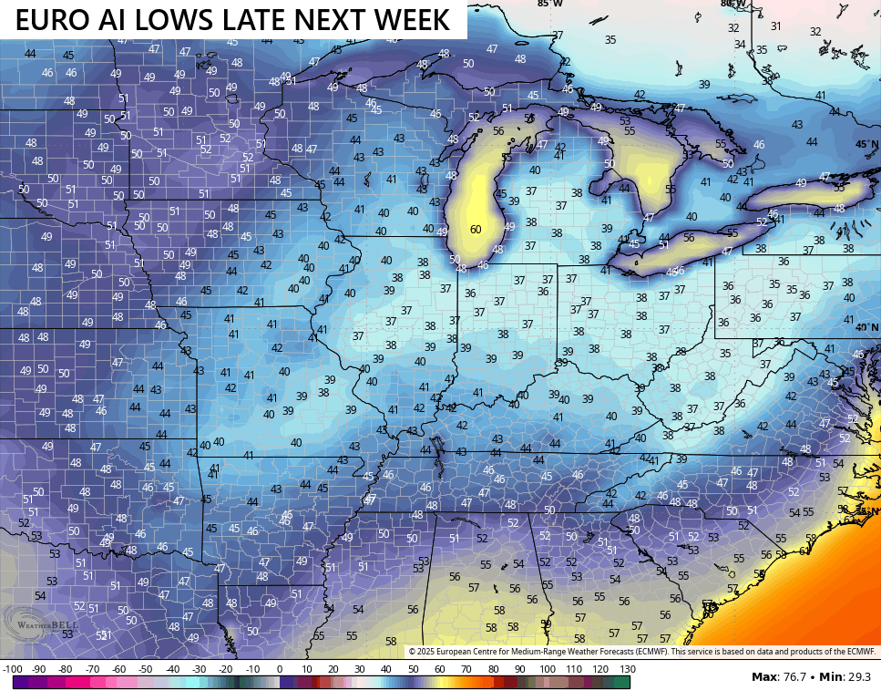
Temps come crashing down behind that with our first blast of October chill settling in. Temps may go well below normal for a few days…

The models are indicating the chance for patchy frost later next week or into next weekend…

The EURO AI is similar…
Have a great Thursday and take care.

Thanks Chris. I bet your getting tired of the same old same old, as I am. At least there is a change on the horizon in the way of a cold front. Just hope there is enough moisture to give all areas a good soaking. A good frost would be welcome after the rains. Anymore, one doesn’t really know what will happen in this strange weather pattern we are currently in.
Chris it’s not a big deal with the 80s.
Eighties are alright Jeff, but not in October. Im ready for highs in the fifties and sixties, and lows in the thirties and forties. Rainy, cold days with maybe a surprise Snowstorm in early November.
It’s interesting you say “Rainy” as if that’s normal, when hasn’t Oct always been our driest month even when the weather was “normal”?
Mark, these days “normal” seems to be the exception, not the rule!