Good Friday to one and all. We are rolling into the first weekend of October on a very warm note across the Commonwealth, but some changes are brewing for next week. Those changes mean a true fall cold front slams in here with some much-needed rains and a more typical October feel.
Temps today through the weekend are generally from the upper 70s to the middle 80s. Boo… and I’m not talking about the October version of that…

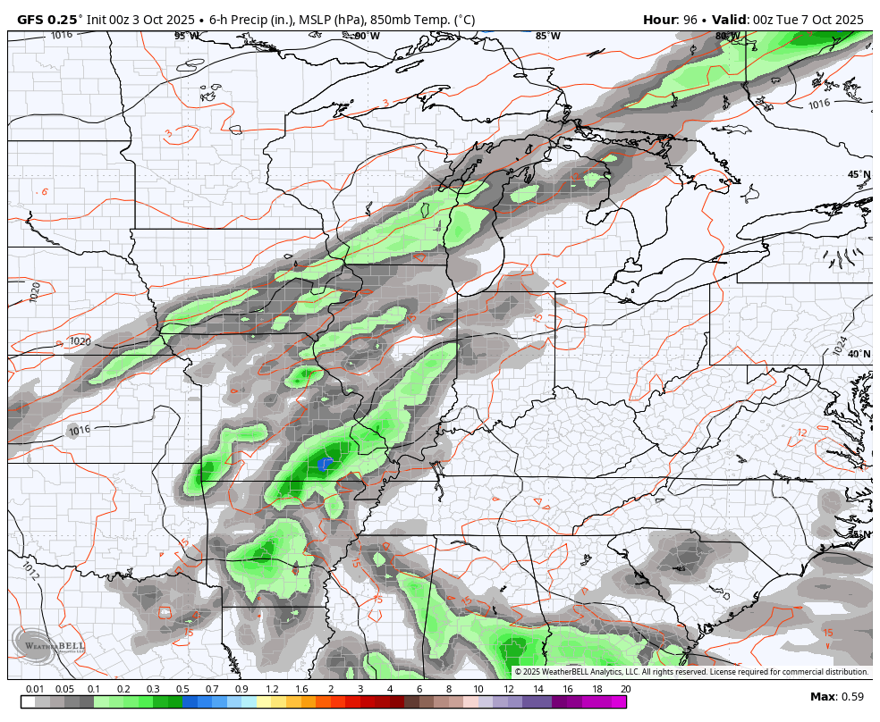
Scattered showers and storms begin to bubble up on Monday ahead of a cold front dropping in from the northwest Tuesday and Wednesday. That brings additional waves of showers and storms with chilly winds dropping in behind it…
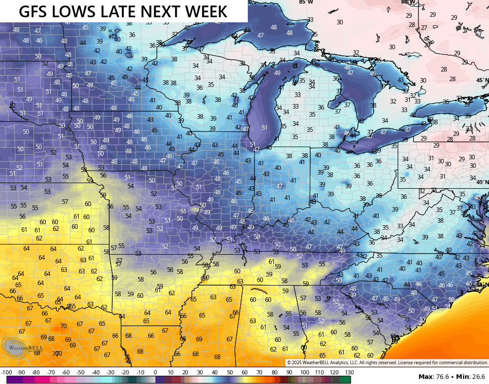
Temps turn below normal for the second half of next week. Can we get it chilly enough for a kiss of frost by Thursday or Friday morning? We would need clear skies to get down to those levels, but some models are suggesting this as a possibility…
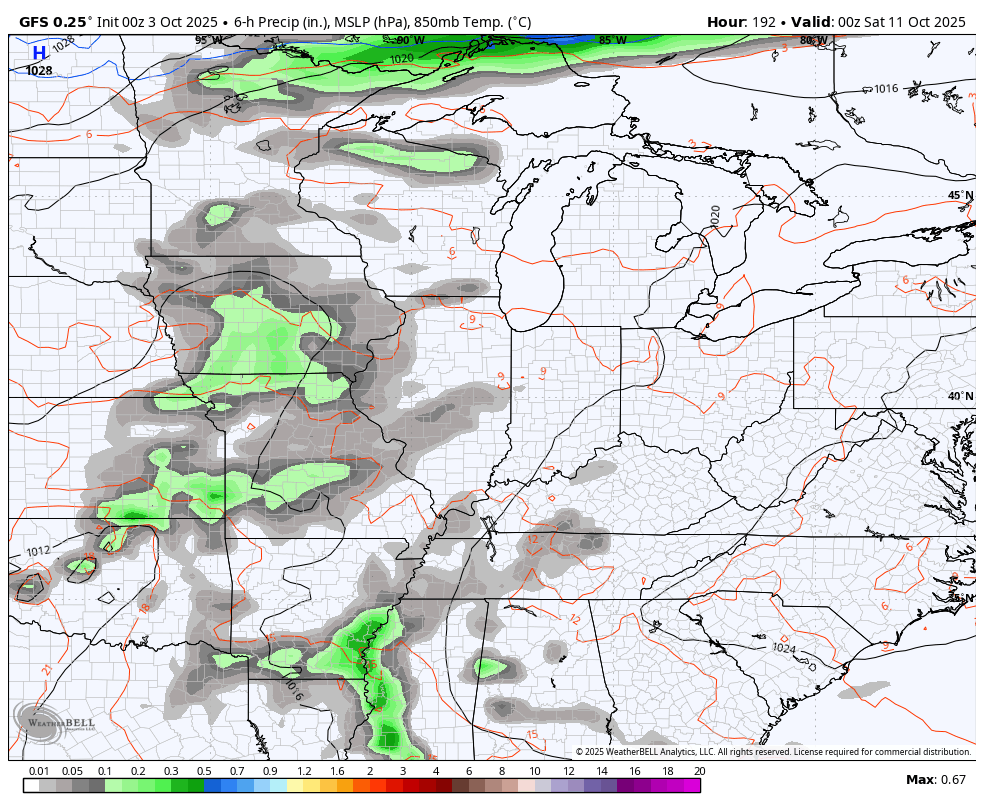
The potential is there for another system to drop in behind that next weekend, but this is dependent upon what happens in the tropics…
As the pattern starts to change up later in the month and into the first half of November, we are likely to get back into a pretty active setup. As I look ahead to this time frame, I’m thinking we have a few severe weather opportunities and the chance for some early November flakes.
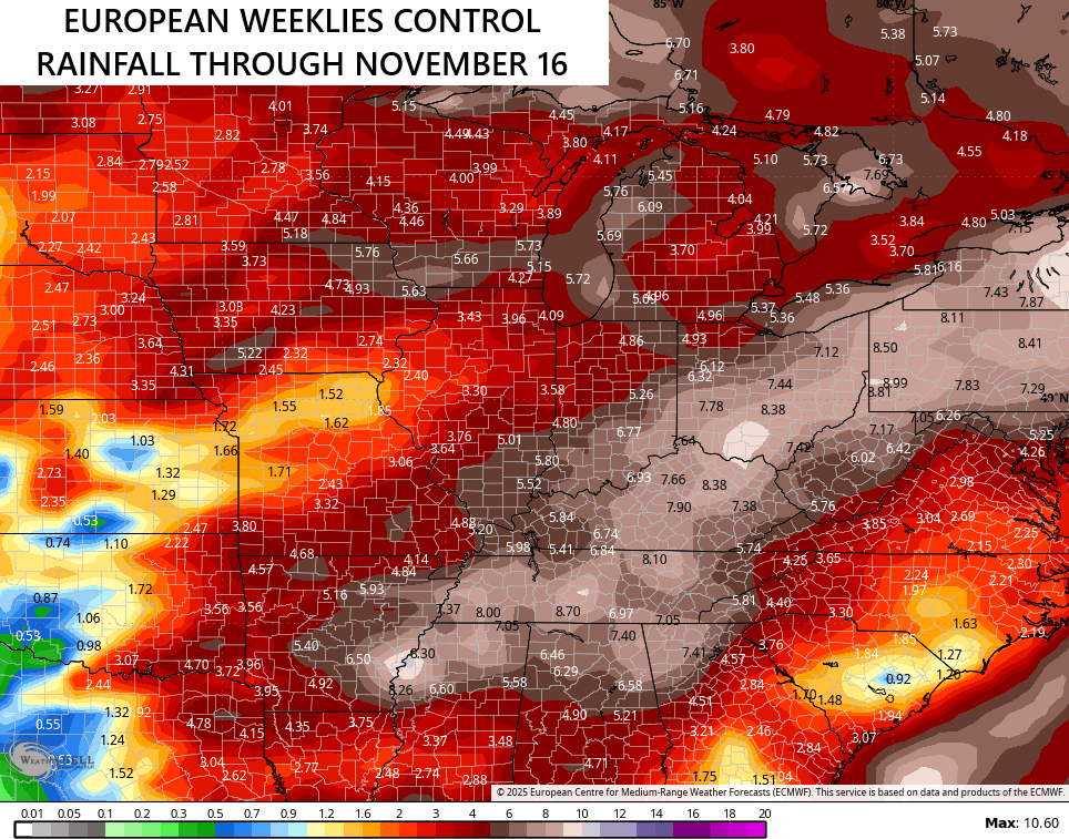
The EURO Weeklies are seeing this active setup with the rainfall bullseye in our region…
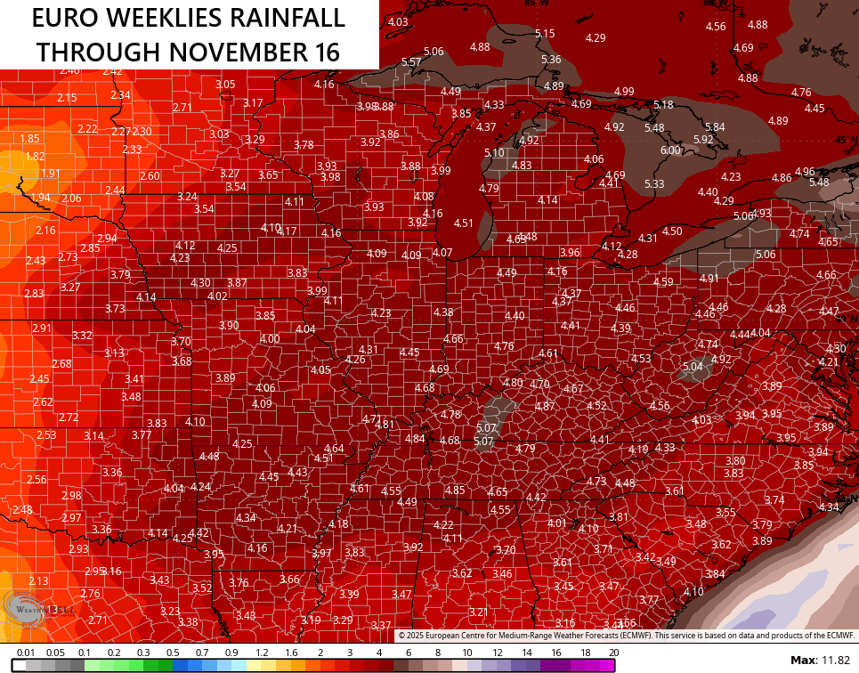
The Euro Weeklies Control sees even more action…
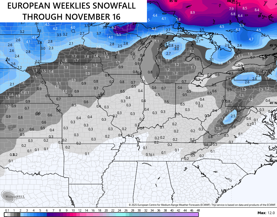
I would expect the chance for some first half of November flake chances and the average snowfall from the EURO Weeklies continues to like this idea…
Here are your Kentucky Weather radars for you to track whatever isolated shower or storm in western Kentucky early today…

Have a fantastic Friday and take care.

You say boo, but I say yay. 🙂
Skeptical of the rainfall prediction.
It sounds like you want 80s/90s with oppressive humidity year round, with maybe some rain thrown in there and there so it won’t get too dry?
I had a Cousin on my Father’s side of our Family, that was sensitive to cool / cold weather. She felt better when it was hot and humid. It is a condition that some people have. The condition has a medical name, but I can’t recall it. My Brother, on the other hand can’t stand hot and humid weather. Go figure…
You call Kentucky humidity oppressive? Go to New Orleans in July like I did then get back to me.
Never been to New Orleans, and the way you make it sound Jeff. No thanks, I’ll take your word for it.
Thanks Chris. Very low chances for any beneficial Rains in my local forecast, but the cool down looks to happen later next week. I would be surprise if any frost forms in my area. I’m very disappointed that most of my weather sites didn’t have any information this morning, as they are Government controlled sites. Very sad that this is happening in our Great Country.
Those model Snowfall forecast for November is pretty pathetic for our area, but we don’t live in the area of the Country that receives very much Snow in November. If we had a weak El Nino with a positive PDO plus a negative EPO, our area would have an increase in chances for larger Snowstorms from the Southwest rather than the Northwest.
Historically, the PDO has maintained a predominantly positive or negative state for 20 to 30 years on average. It flipped to negative in 2019, and in September of 2025 it reached a record -4.0 sigma, which is the most negative monthly value recorded since 1950, and is, in fact, a 170 year low. The PDO value is a major influencing factor on ENSO, so based on its current state, plus the current sea surface temperature anomaly values, The current state is ENSO Neutral, with a trend toward La Nina, which is likely to strengthen to moderate by mid-winter, before returning to neutral in early spring.
Very much agree on the PDO readings, and the impact it has on ENSO phases.
I went on the archives to October 3rd 2020, and you can see how different the weather was back then compared to October 3rd 2025 :
https://kyweathercenter.com/?p=44001
Adding to the above : The Oceans of the World have warmed significantly since 2020. This is disrupting our seasonal climates. I’m more worried about Severe Weather ( Tornadoes ) this Fall and Winter, where I’m located in South Central Kentucky.
So many traditional measures are either no longer valid, or they don’t effect other measures the way they did in the past, mostly due to our warming atmosphere. With a PDO value of -4 and Sea Surface Temperature Anomaly readings like we see in the attached chart, I would expect us to be in a strong La Nina, instead of ENSO Neutral phasing to weak La Nina as we are today.
https://www.ospo.noaa.gov/products/ocean/sst/anomaly/
Most likely Joe, that will happen this Fall and Winter.
The ( MJO ) I don’t quite understand this oscillation, ” is currently weak and disorganized, with no strong, organized signal. ” This may be one of the reason why the Gulf has been so quiet this Tropical Cyclone season ?