Good Saturday, everyone. Warmer than normal temps roll on for the weekend, but big changes are set to blow in early next week. That’s when a strong fall cold front brings beneficial rains and more typical temps for the middle of October. This also kicks off a much more active pattern.
Temps today and Sunday are warm. You summer freaks happy out there?
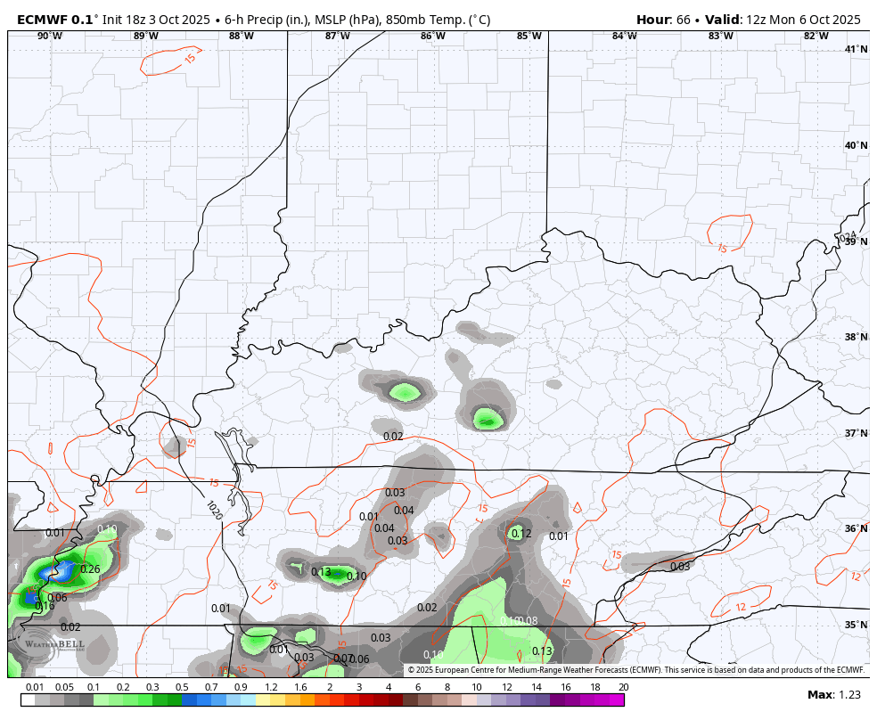
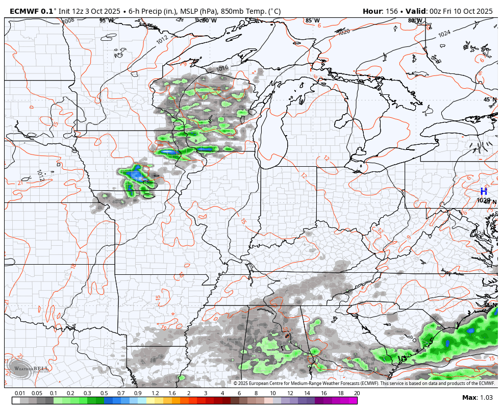
Moisture increases from the south Sunday night and Monday with scattered showers and thunderstorms showing up. This action really increases Tuesday through early Wednesday as our cold front shows up.
Watch the increase in showers and storms on this animation starting at 8pm Monday and going through 2pm Wednesday…
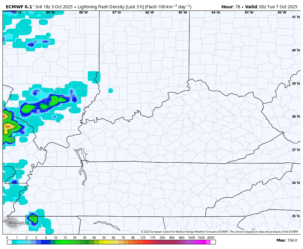
Thunderstorms may be a little noisy on Tuesday as the EURO shows a pretty good increase in the amount of lightning…
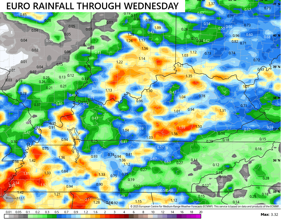
Much-needed rains shows up during this time with several locations picking up an inch or two of rain. The models, as usual, differ a bit on placement of the higher totals…
Temps come way down behind that front with many areas staying in the 60s Wednesday and Thursday.
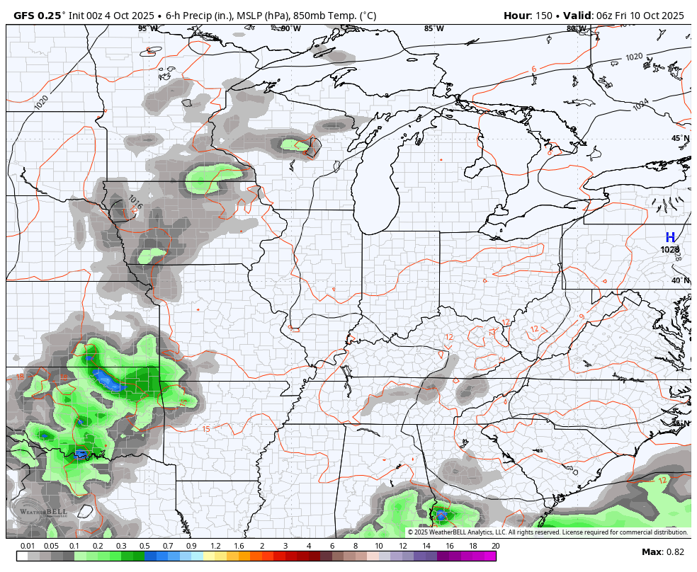
Another system looks to drop in later Friday into next weekend, bringing more in the way of showers and some storms along for the ride. Here’s the EURO…
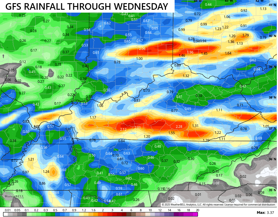
The GFS has a weaker version of this but it should trend stronger…
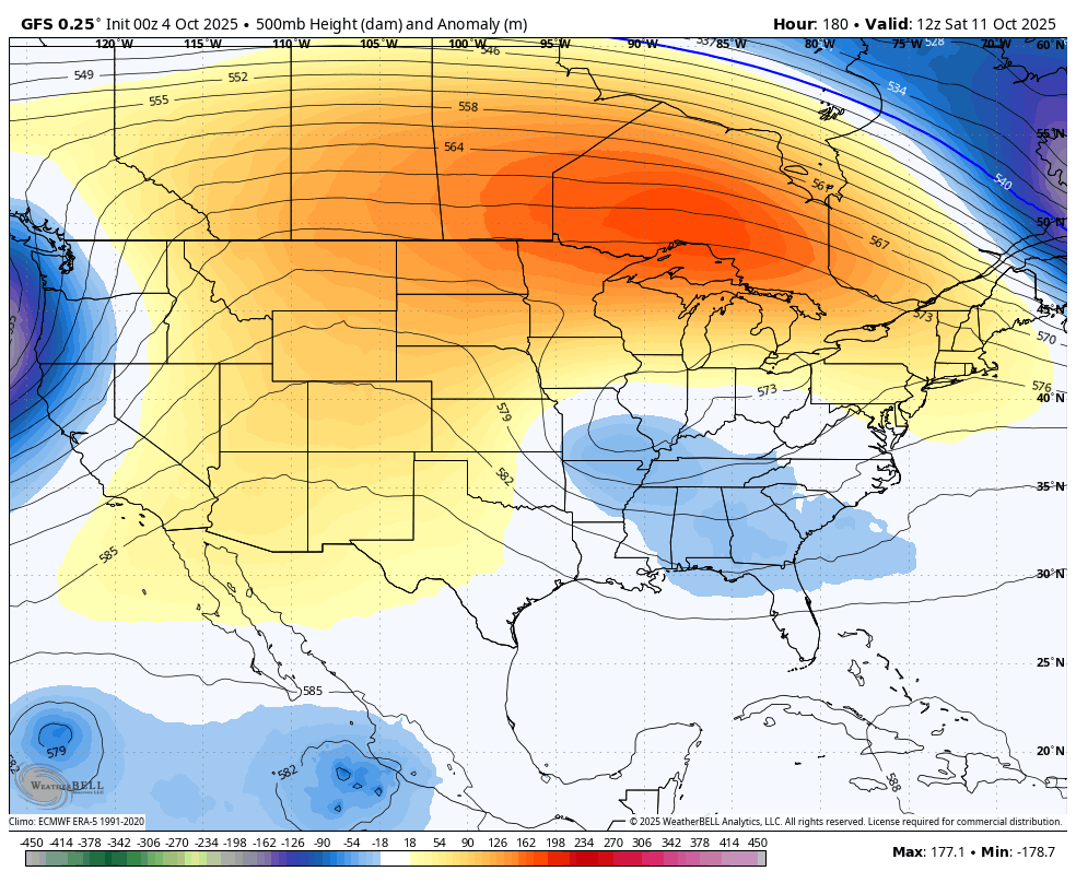
The overall pattern is one becoming more conducive for dips in the jet stream and the GFS is showing this well…
The tropics are likely be run on the active side this month and will play a role in the overall pattern across the country. The National Hurricane Center is watching a system near Florida and another one well out into the Atlantic…

Make it a great day and take care.

“I hope you summer freaks are happy”…..that kind of comment is beneath you, Chris.
Summer freaks? How?
It’s just another way of saying “people who are crazy about summer”
I mean, If I was a summer freak I wouldn’t have taken offense to that.
I used to be addicted to a couple of soap operas and got called a soap opera freak. LOL
That being said – I’m so glad the weather is changing. I hope the tropics don’t mess everything up
Guys, get over it. However, I would have phrased it like this : Thoses who like late Summer weather are going to enjoy today and tomorrow. I just think Chris wants Autumn weather to start, and I agree with that. It’s early October though, and we have plenty of days left for changes.
Be strong Jeff not soft
You first
It’s a given, that Tropical activity will delay seasonal changes, but this year’s activity continues to hang on. Possibly due to ENSO / neutral slowly phasing into another Fall and Winter La Nina, but the PDO reading is slowly making a change towards the positive for late Winter. I hope, but that will not change the warming temperatures of our planet.
“Summer freaks” sounds just like Chris! And one of the reasons I love his blog!! Keep it up!! And I am a summer freak, but I am also excited about some cooler temps! Happy weekend!
Lame
Here in the Chicago Metro Area, we just got done with a very dry and warm September. O’Hare Airport recorded only .49 inches of rain for the entire month, making it the seventh driest September in Chicago history. The month finished three degrees above normal, despite the fact that the first nine days of the month averaged nearly eight degrees per day below normal.
Today will be our 25th day in a row above normal, and will come close to record-breaking temperatures this weekend, with highs predicted to be near 90 both days. The humidity remains low, so it doesn’t feel as warm as it would in the summer with the higher humidity.
Enjoy the warm, sunny weather this weekend. This may be the last weekend in the 80s until next April or May.
Mike, It’s beginning to get dry here again. In September, we had a week of rainy weather, that amounted to 3.75.” Now were back in this long playing drought, but October is our driest month. Hopefully, all of us will receive the ” much needed rain ” next week, and cool off to more seasonable temperatures.
Unfortunately, the PDO is in too far into the negative to make any noticeable change, especially considering that it closed out September at a record-setting -4.0 sigma. The increase in atmospheric warming has reached a point where it has begun to distort many previously reliable indices, like Madden-Julian, and we’ve all seen the effect that relatively small increases in global temperatures has had on the reliability of mid and long range forecast models.
What I read Joe, is that the MJO is completely disorganized, without any signals to make a change. Maybe as we get closer to the Winter months, the signals will show up. This Oscillation is very useful in forecasting long range events. I don’t completely understand this Oscillation, but it is a Tropical Oscillation that rides the Equator, Eastward every 30 to 60 days, changing weather events around the Globe. Also, where is the Polar Vortex going to be located this Winter. I read that it may be just North of Siberia and may be weak, driving frigid Arctic air over Siberia. Siberia already has a Snow pack started, and it’s very early for that to happen. In the meantime, the warming of the Earth’s Oceans are accelerating.
Joe, here’s the link to the current PDO readings, and readings going way back to the1800’s. You can see the changes, as the years go by. Seems we are stuck in the negative since 2019, but it is forecast to go positive next year. We shall see.
https://www.ncei.noaa.gov/access/monitoring/pdo/