Good Sunday, everyone. Late summer temps are hanging tough out there today as we track a fall cold front that’s ready to put an end to the 80s. This front will also touch off rounds of showers and thunderstorms that will put down beneficial rains along and ahead of it.
Scattered showers and storms show up from south to north Monday, but not everyone sees rain by any means. This action looks to have better coverage in the west and central parts of the state.
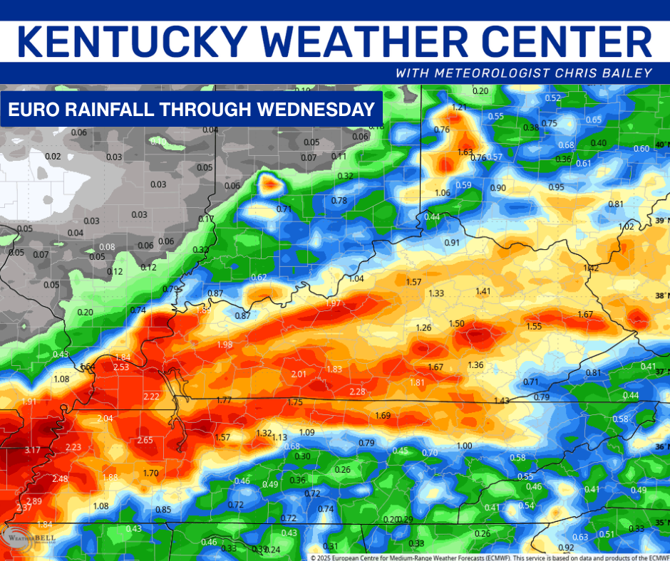
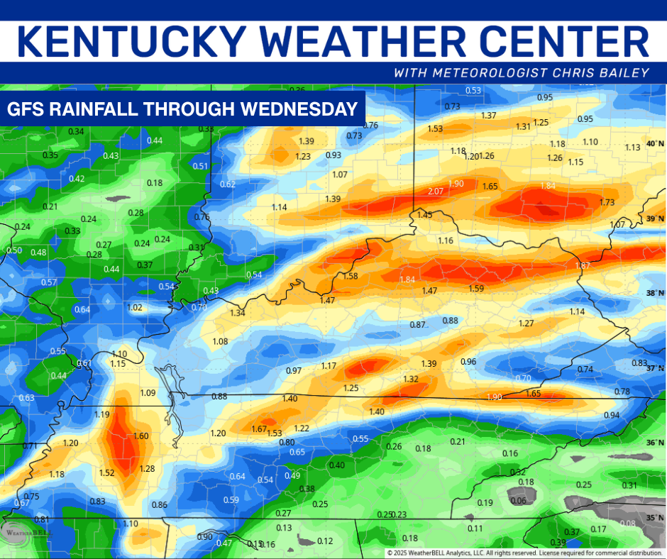
Showers and storms then increase quickly on Tuesday as our front settles into the region. This action takes us into Tuesday night and early Wednesday leaving a general 1″-2″ of rain for much of the state. Locally higher amounts will also be possible.
The models agree on this but differ some on the placement…
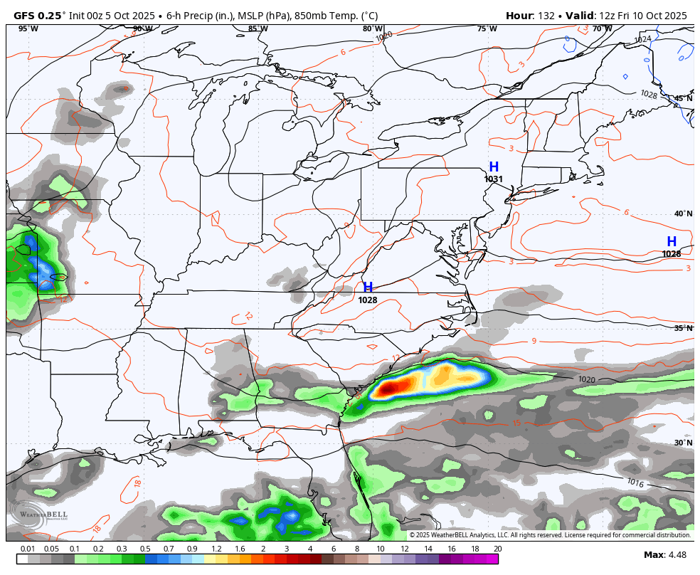
Temps come down to normal or a touch below normal for the rest of the week. Another system dives in late week and into the weekend, but the models are leaving us with questions on how strong this is and how much of an impact we will see.
The GFS is keeping scattered stuff going around here for the weekend with a bigger system spinning to our southeast…
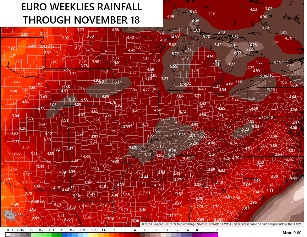
The tropics will likely become a player again in the coming weeks, but the extent of how much of a player is to be determined. The National Hurricane Center is tracking a system in the Gulf and another well out in the Atlantic…

Regardless of the tropics, the overall pattern is turning more active in our part of the world. The average rainfall from the EURO Weeklies through the middle of November is seeing this…
Have a sensational Sunday and take care.

Thanks Chris. We can only hope and pray, that every area receives the “much needed Rains. ” The cold front is only going to reduce our temperatures for just a few days. Then, It’s back to above normal temperatures a week from today. UGH ! We will not change the overall weather pattern until the Tropical activity in the Atlantic ceases to exist. It’s more like September than October weather, but it’s still early in the month. If this weather pattern continues to the end of the month, with only minor changes, the chances for ” real deal ” Autumn weather may go into our Winter months. The ” real deal ” Winter weather may come in February and March. A very late Winter. I remember we had late Winter weather back in the year 1960, so this has happened before, but it’s been years.