Good afternoon, everyone. I wanted to drop by for a quick update on the increasing potential for heavy rains in the coming days. Our system rolling in Monday through early Wednesday is looking pretty darn juicy.
Scattered showers and storms develop Monday with widespread showers and storms from Monday night through Tuesday night. Most of this will be out of town by midday Monday as much cooler fall winds kick in.
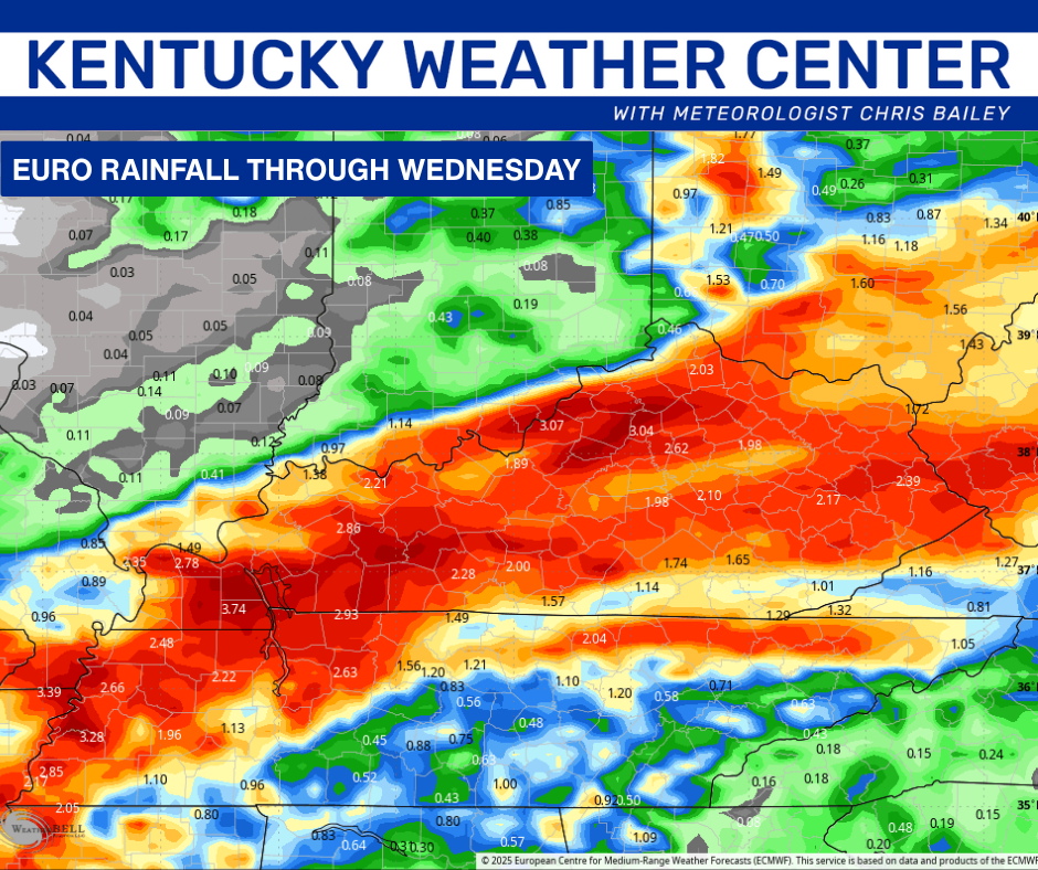
This animation from the EURO starts at 8am Monday morning and goes through 8pm Wednesday evening…
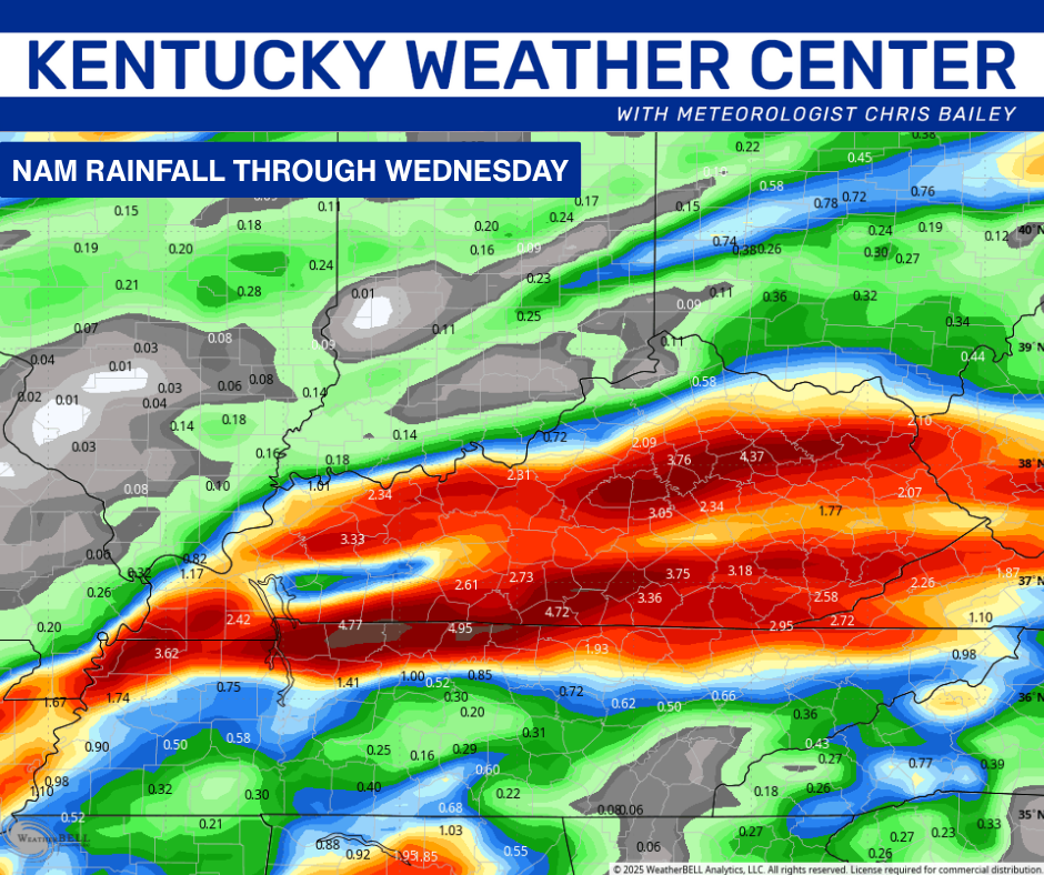
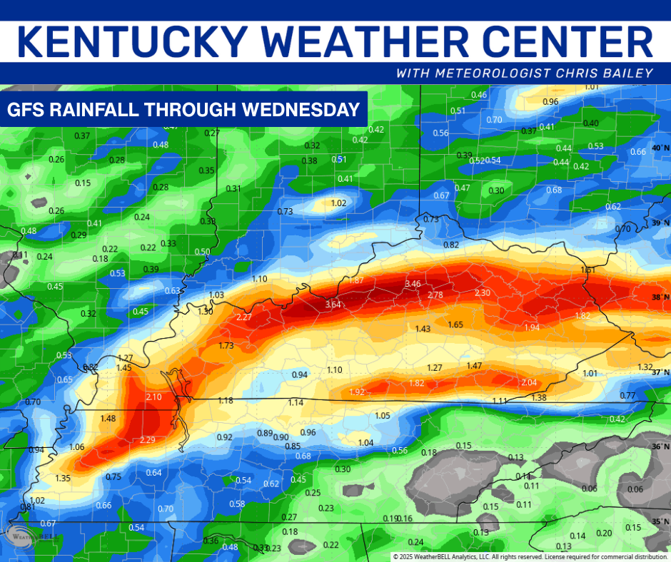
Torrential rains are likely during this time and the models are increasing the amounts with all the models now showing some areas of 3″+ rains. Take a look at the latest runs…
Local high water issues will be possible, so keep that in mind.
Cool fall winds will be blowing Wednesday through the end of the week with highs mainly in the 60s and lows in the low and mid 40s for Thursday and Friday.
I’ll update all that later tonight. Enjoy the rest of your Sunday and take care.

I think you meant to say “most of this will be gone by midday Wed” (not Monday)