Good Monday, everyone. Scattered showers and storms are ramping up across the region today and will really crank on Tuesday. That’s when heavy rains may cause local high water issues across Kentucky as a fall cold front sweeps through.
Here’s a breakdown:
- Scattered showers and storms increase today, especially across central and western Kentucky.
- Locally heavy rains will show up from time to time, but this isn’t especially widespread.
- Rounds of showers and storms move in tonight and last through Tuesday night. These will be fairly widespread.
- These storms will be loaded with torrential rains and can put down a quick few inches of rain.
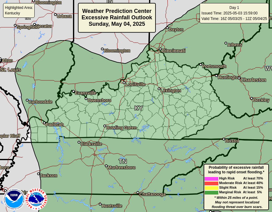
- Overall, a general 1″-3″ of rain looks likely through Wednesday morning. A few spots will come up shy of this, but a few areas may go above and beyond.
- Local high-water issues are possible at any point through Wednesday morning.
- These storms will also be pretty loud and may contain gusty winds, but severe weather isn’t anticipated.
- Lingering showers hang around into Wednesday with this stuff winding down from northwest to southeast.
- Cool fall winds will blow behind our cold front.
The Weather Prediction Center is highlighting central and western Kentucky for excessive rains today…
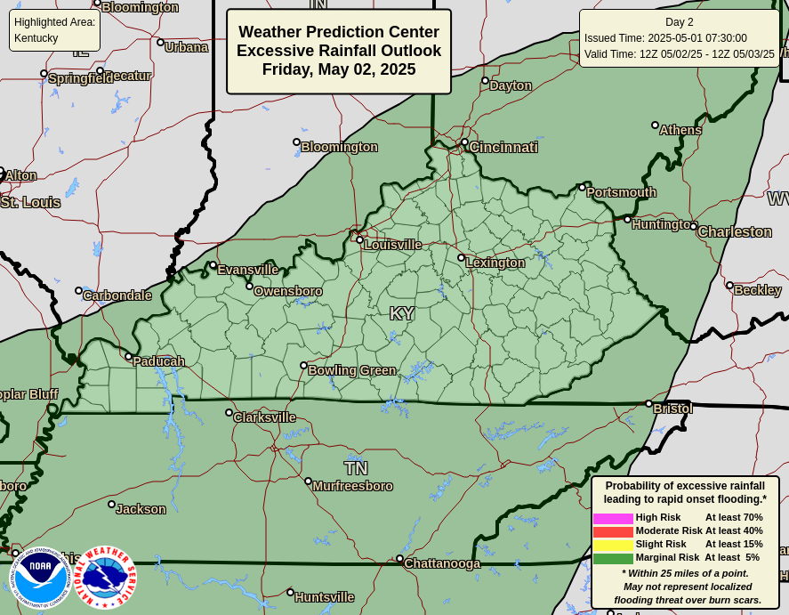
That area then focuses across the rest of the state on Tuesday…
Highs generally run in the 60s starting Wednesday. Thursday morning lows are growing colder as we get closer with some areas with the shot at upper 30s…

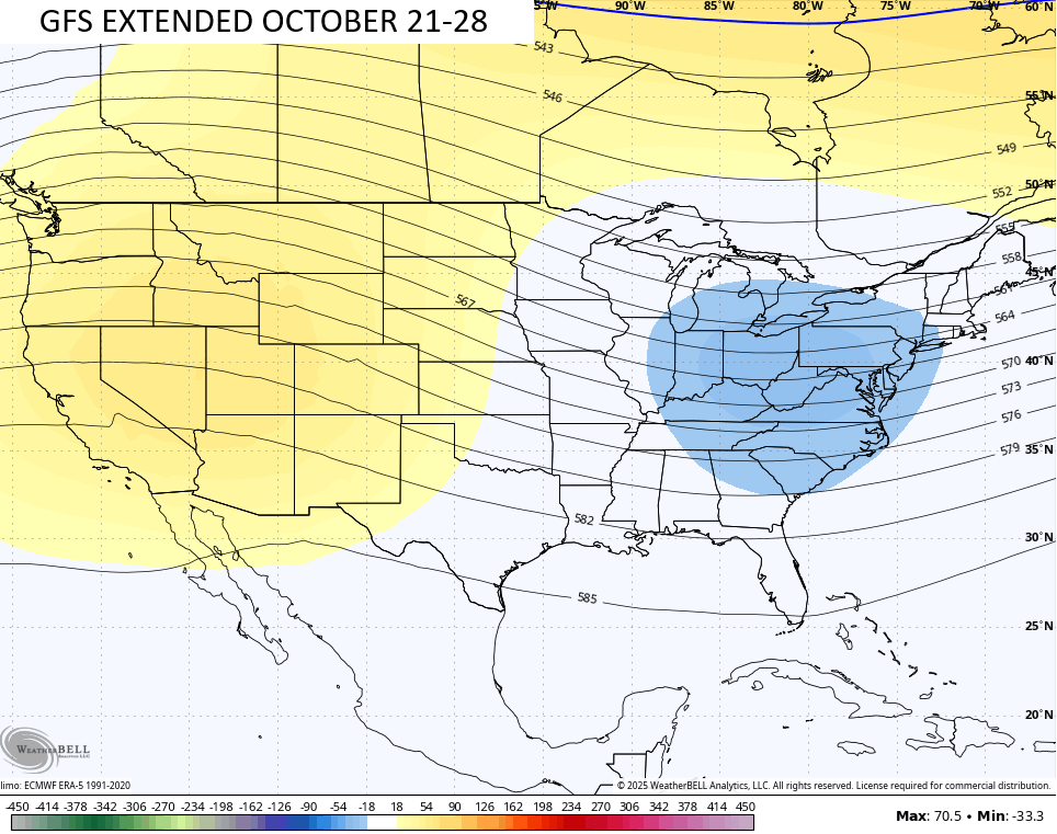
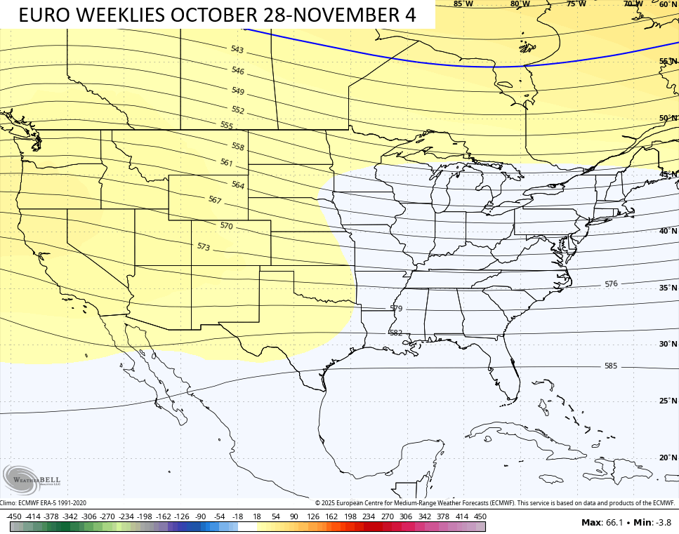
Looking farther down the road toward the end of the month, the GFS Extended and the EURO Weeklies are both liking the idea of a deep trough into the east. They just vary by a few days…
In the tropics, the National Hurricane Center is watching the system way out in the Atlantic…

I will throw you another update later today. Until then, I have your storm tracking tools to start the week…


Make it a magnificent Monday and take care.

Thanks Chris. Hoping this forecast for widespread soaking rains holds true, but I wonder if the various models are factoring in what is going on in the Tropics, which is the big player in what weather type we may receive.
On another weather topic, the North Atlantic Oscillation ( NAO ) is forecast to phase to strongly negative in the coming days. If this action comes into play, ” real deal ” Autumn weather will arrive, with much cooler, frosty mornings, and end Tropical Cyclone development, hopefully for the rest of the year.
Correction to the above: A strong negative NAO would increase Tropical activity, especially in the Gulf. We are not out of the Tropic’s influence just yet. For our area, our chances for Snowstorms increases, if the EPO, NAO, and the AO phase to the negative in November, December, January, and particularly February. We shall see as the months go by.
Enjoying a beautiful 76° day as I stop for fuel and lunch 2700 ft up in the Maryland mountains in Grantsville.