Good evening, folks. I wanted to drop by for a quick update on the potential for high water issues as we head into Tuesday and Tuesday evening. This happens as low pressure zips through the area just ahead of a cold front.
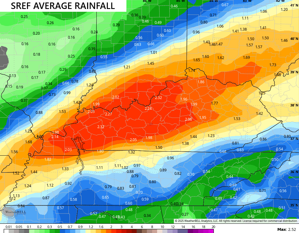
The forecast models have been pretty beefed up with the corridor of heavy rains that will likely fall along and just to the north of the track of our low. The average of the 26 members of the Short Range Ensemble Forecast model looks like this…
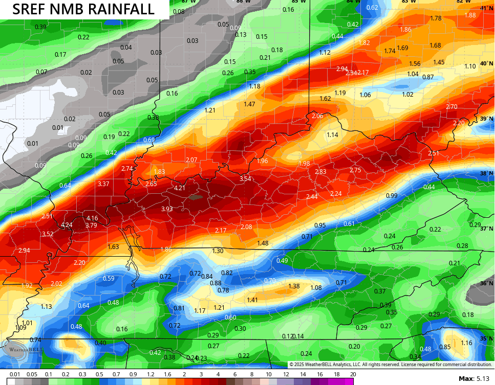
One of the individual runs shows locally higher amounts…
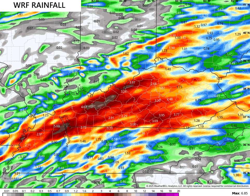
The WRF is going with even higher amounts with pockets of 5″+ rains…
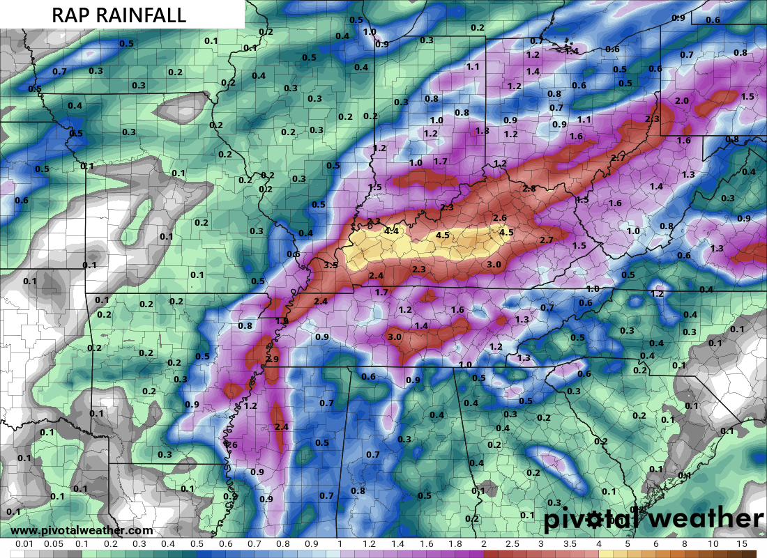
The RAP has something similar…
Local flash flooding is a good bet for the corridor of heaviest rains.
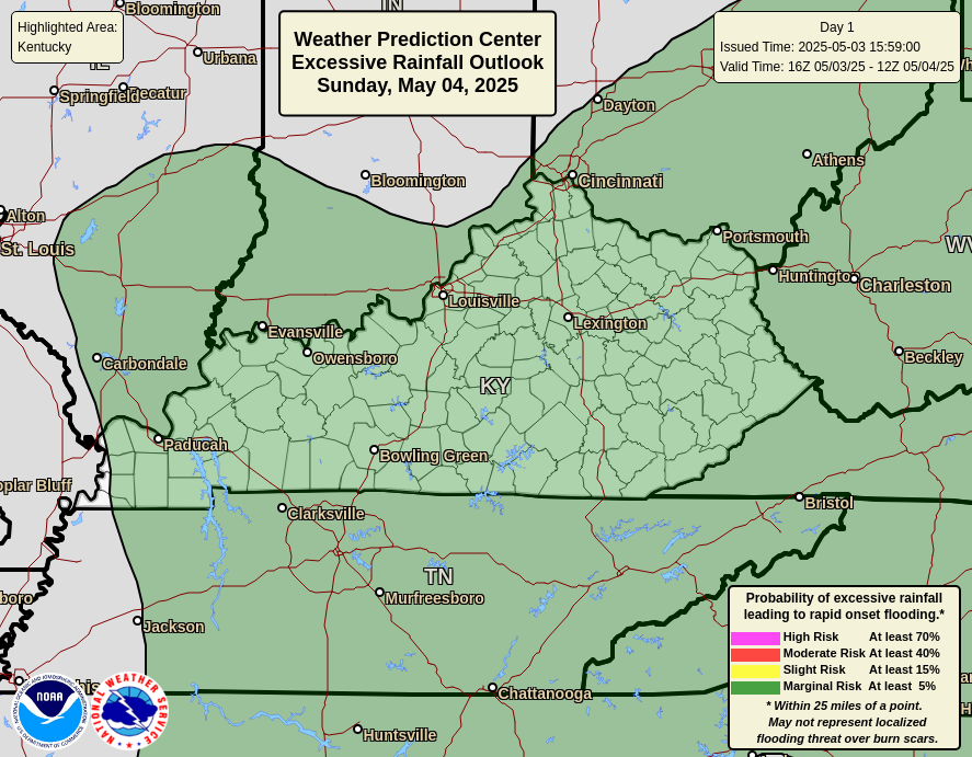
The Weather Prediction Center is highlighting areas of western and central Kentucky for local high water issues tonight…
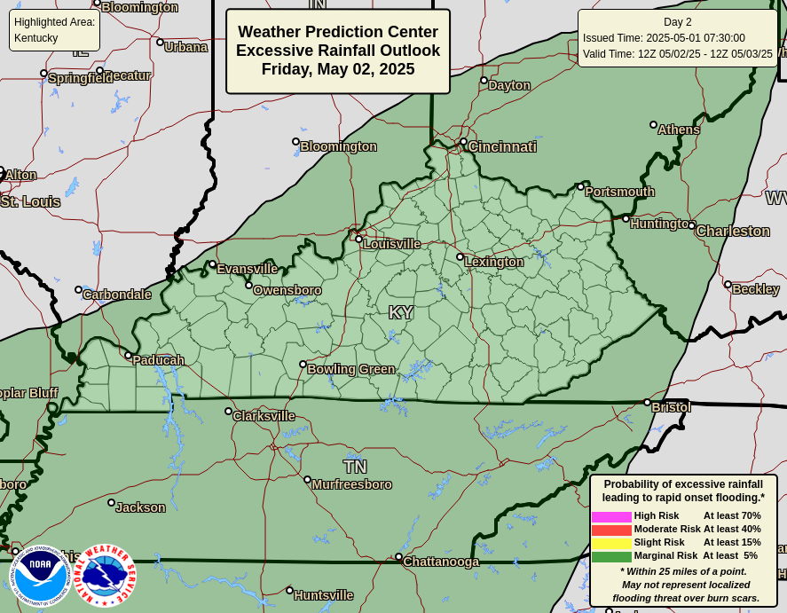
That threat then focuses across most of central and eastern Kentucky for high water concerns for Tuesday…
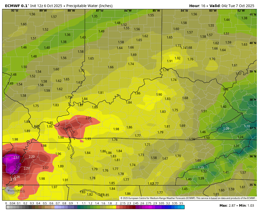
The amount of moisture we are seeing with this system is very out of the ordinary. Precipitable Water values going above 2″ in October usually comes from the leftovers of a tropical system, but that’s what we will see Tuesday.
This animation from the EURO shows the big surge in Tuesday moisture being followed by crazy dry fall air…
I have your storm tracking tools to start the week…


Make it a great evening and take care.
