Good Wednesday, everyone. The historic rains are now gone and now we are settling into a great fall pattern. Gorgeous weather looks to be with us through the upcoming weekend before the jet stream gets active into next week.
That corridor of torrential, flooding rains set up right along the Interstate 64 Corridor. Check out the rainfall totals from the Kentucky Mesonet…

For Lexington, Tuesday was one of the wettest days in recorded history…
In the more than 52,000 days we’ve been keeping weather records for Lexington, today was the 9th wettest day of them all. Historic! #kywx pic.twitter.com/K6ZwkzpSfm
— Chris Bailey (@Kentuckyweather) October 8, 2025
Morning showers across the southeast will move away as partly sunny skies takes control across the entire region. Northeast winds in the 65-70 degree range for central and eastern Kentucky and 70-75 in the west.
Highs then come down into the 60s for Thursday with awesome skies. Speaking of the skies, if clear skies are noted Thursday and Friday mornings, temps have a chance to hit the upper 30s in some of the colder valleys. The WRF did a really good job with the record cold lows we had in late August and early September and it’s the coldest of the bunch for tomorrow morning…

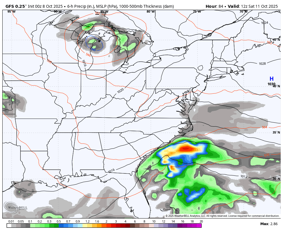
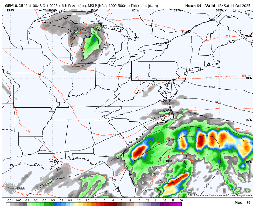
The weekend looks good as a big system spins along the east coast. There’s still an upper level system dropping in from the northwest that has a chance to interact with this slow-moving storm. How those two tango is likely a work in progress on the models.
GFS…
CANADIAN…
The tropics have a system of interest way down in the southern Gulf and Jerry out in the Atlantic…

Jerry will become Hurricane today, but will also be a fish storm as it stays well away from the USA…

The EURO Weeklies have been showing the potential for early season flakes in the first part of November and now we find the GFS Extended doing the same…

When you see the model suggesting some snows across the Appalachian Mountains and southern Appalachian Mountains, that’s a sign the model is seeing some cold northwest winds.
I leave you with your daily dose of tracking toys…


Make it a wonderful Wednesday and take care.

YES! I’m so glad we got a good and proper rain after that LONG string of boring dryness. Now I can open the windows as before I was kind of wondering if I should with the dusty air from it being so dry. Who would have thought the 9th wettest day EVER would happen in our DRIEST month? LOL
Glad the rain is gone for now.
The storm was a real nothing-burger, as my PWS in central Warren County picked up a measly 0.26 inches of rain.
Sorry about your nothing-burger Joe. I wish I could share some of the 4.62 that my PWS recorded.
Sad, that areas of South Kentucky didn’t receive enough rain to rid us of the Drought. High temperatures after this North Pacific cool down will again soar into the upper seventies and low eighties. A weather pattern we have been in for several months with very few breaks.