Good Sunday, everyone. It’s another great fall day across the region and we have a lot more of that for the week ahead. The pattern does look to change up and become much more later next weekend into the second half of October.
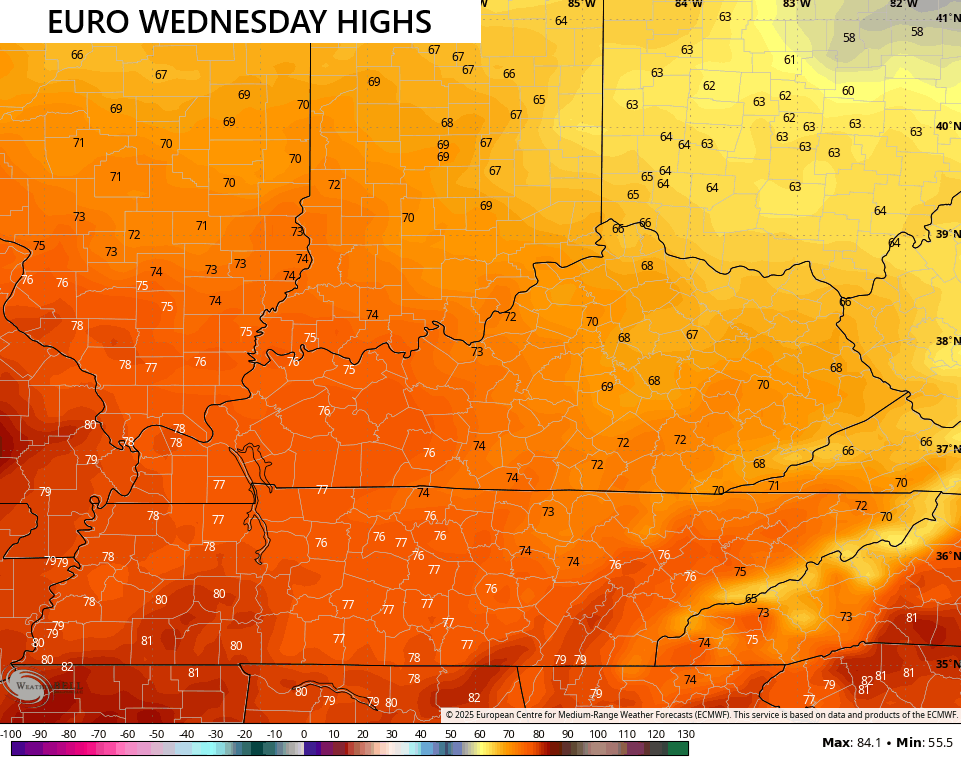
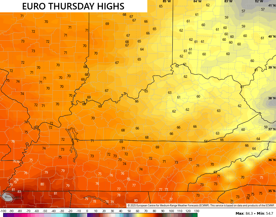
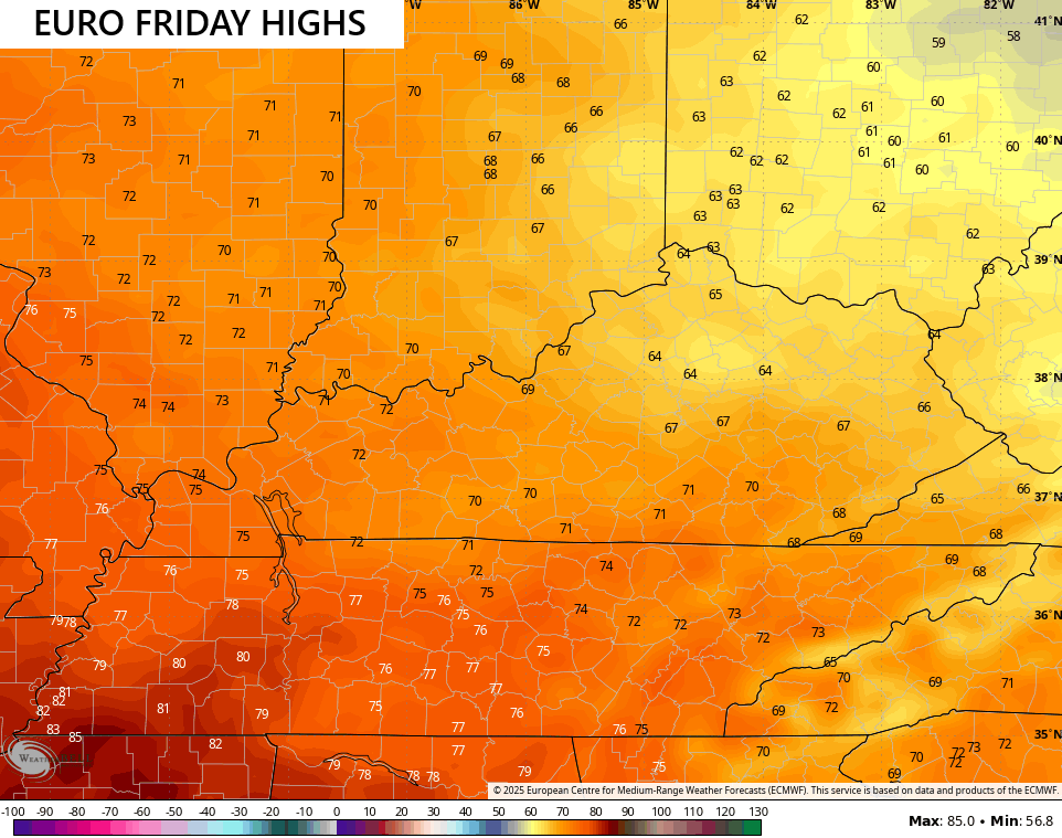
Temps are mild for the next few days as we get ready for a backdoor cold front to sweep in here on Wednesday. This front is dry, but it ushers in some seasonably cool days and chilly nights for the end of the week…
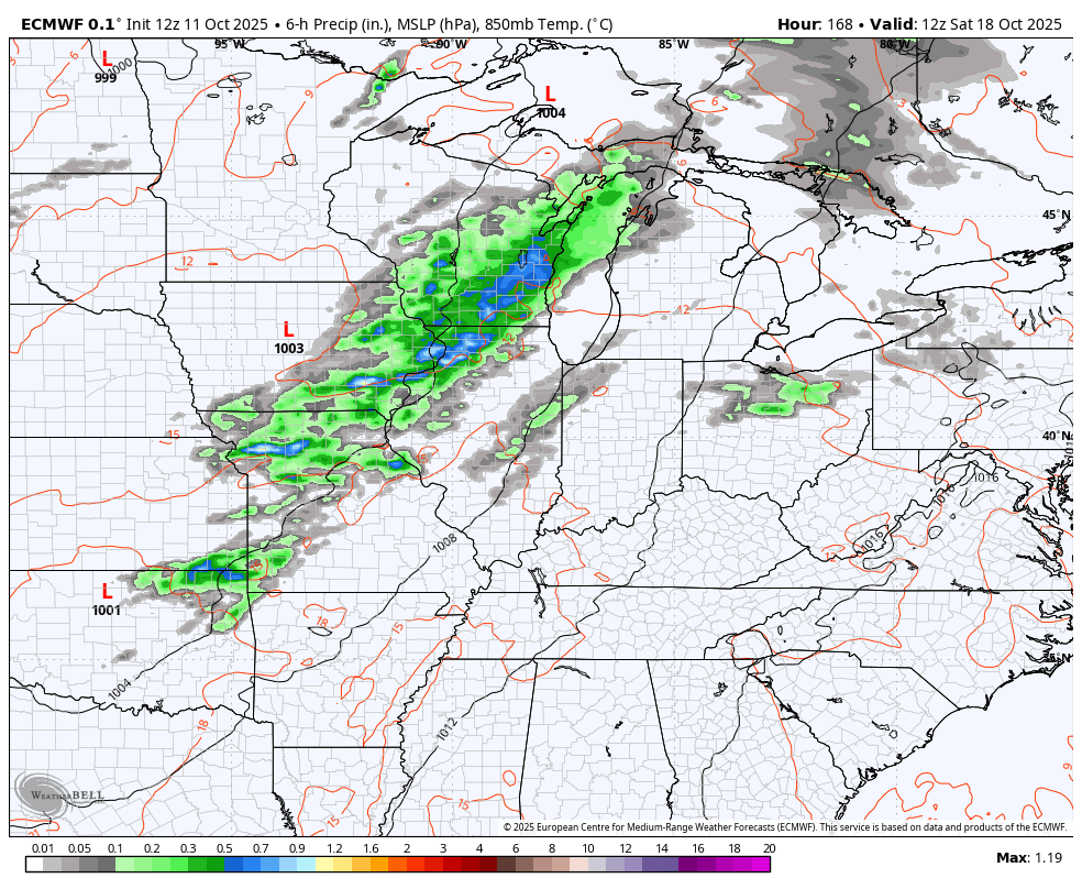
The pattern starting next weekend looks to feature bowling ball type systems rolling across the country, bringing the potential for strong storms, heavy rains, gusty winds and big time temp swings.
The EURO gives us a good look at two powerful storm systems. The first arriving next weekend into early the following week with the second one right behind it…
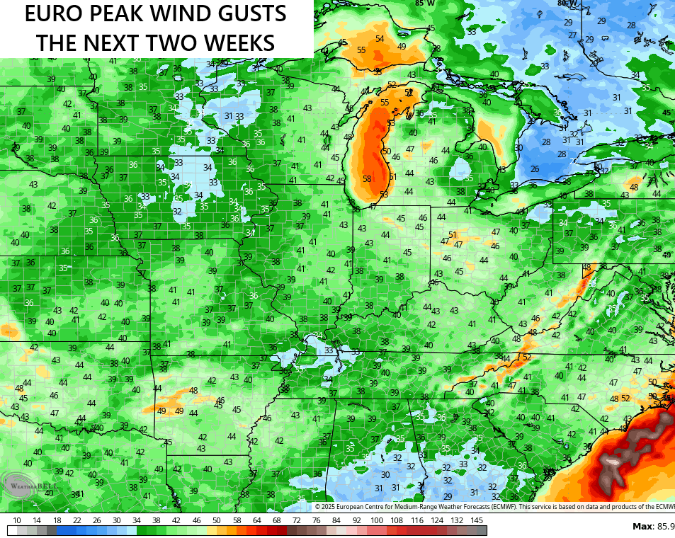
Check out the peak wind gusts the model is seeing with those systems…
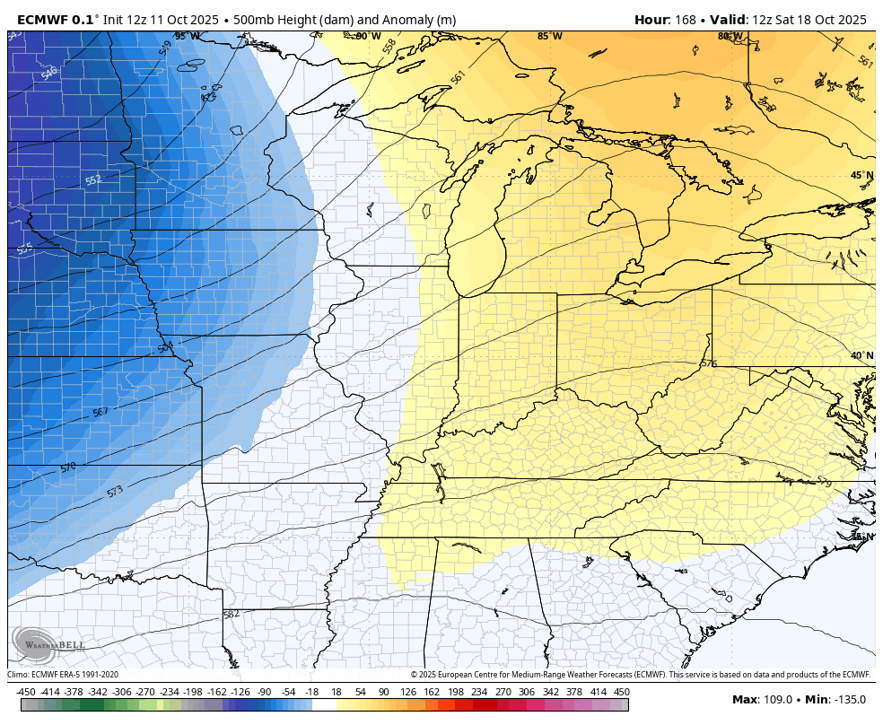
Check out how these storm systems look in the upper levels. This is potent…
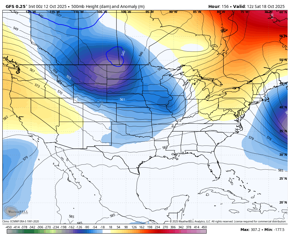
The GFS has a similar overall look with these big systems crossing the country…
I may throw you another update later today. Until then, make it a great Sunday and take care.

Thanks Chris. I’m beginning to get use to the bright, Sunny and mild days. I do miss those frosty mornings of the Autumns we had in past years. Brought out the colors of Autumn. The trees around my home, still as green as they were in September. Some trees have just dried up, and have lost their foliage. Might as well get use to the New Normal.
Hoping the high pressure ridge breaks down over the entire area, so all areas may receive widespread rains, like the Euro model shows. That doesn’t happen until late next weekend according to the NWS. A long time off. A lot can happen in 8 days.
The words ” severe weather ” makes me very nervous. Is this going to be our main weather type in every month of the year now.