Good Tuesday, everyone. Calm weather continues across our part of the world, but this appears to be the calm before the storms. A series of fall storm systems looks to arrive in the region over the next few weeks with the first sweeping through this weekend.
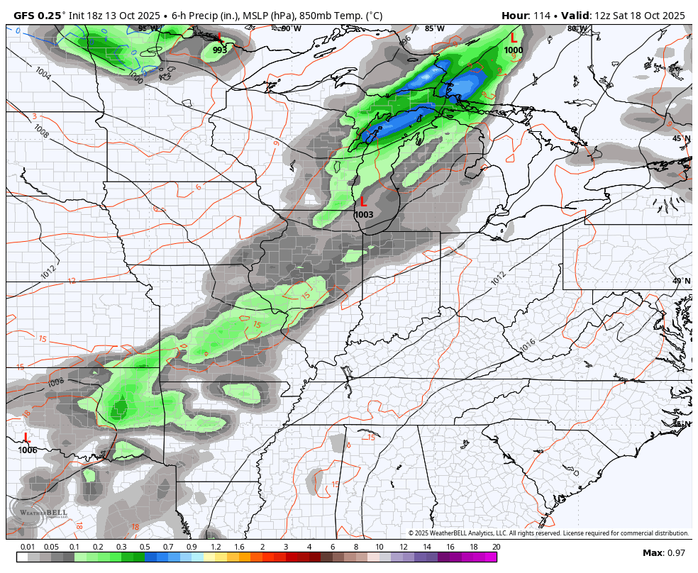
A potent storm system rolls from the Rockies and into the northern Plains this week. That drags a cold front toward us as another low pressure develops along the boundary. This low then spins into our region from the west over the weekend…
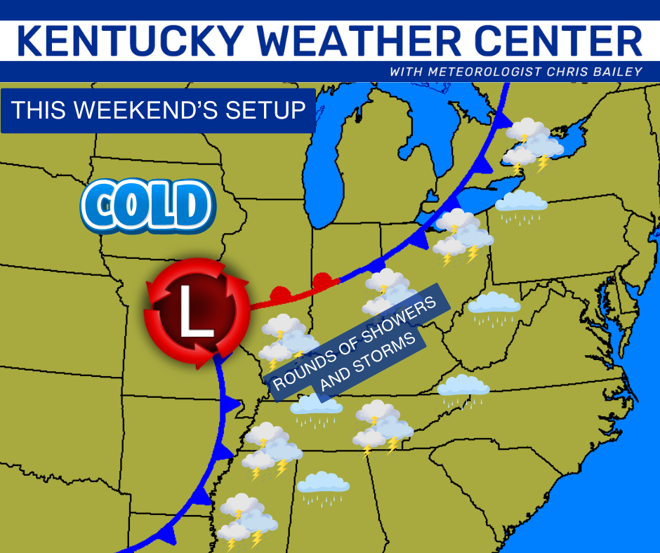
That low will spawn all kinds of showers and thunderstorms along and ahead of the low from late Saturday through the first half of Sunday…
That run of the GFS is spiting out a swatch of healthy rain amounts…
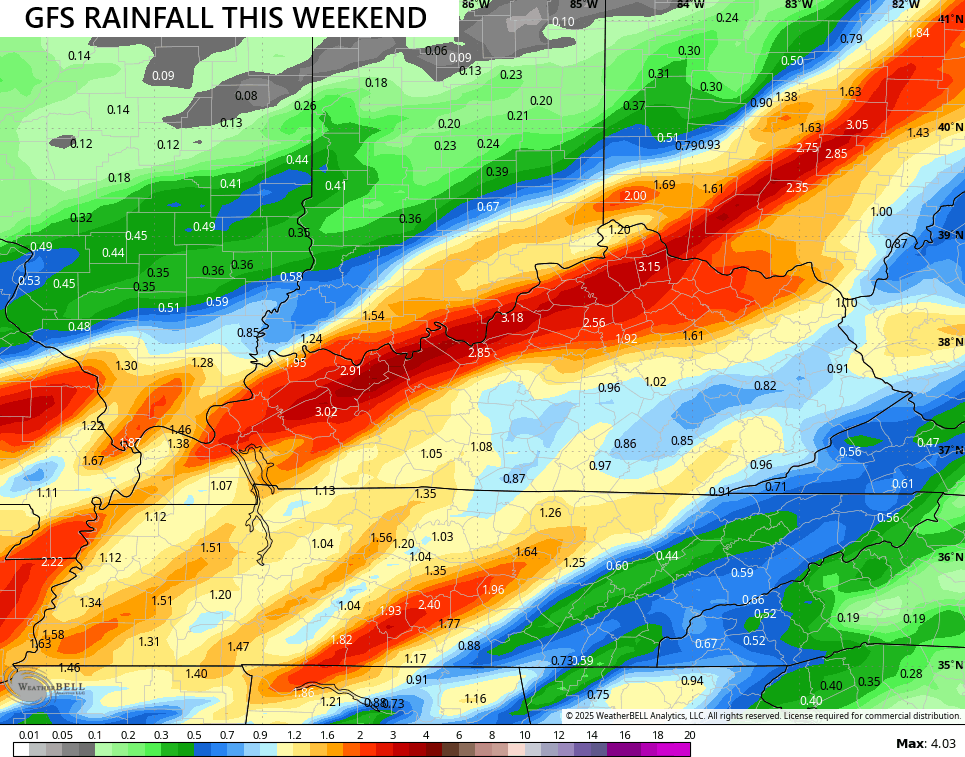
That may be a tad overcooked, but thunderstorms will be able to put down torrential rains in some areas.
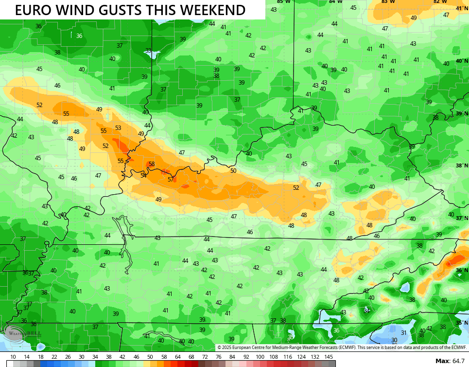
This looks like a windy storm system with some pretty good wind gusts ahead of the low and right behind it. The models are seeing this potential…
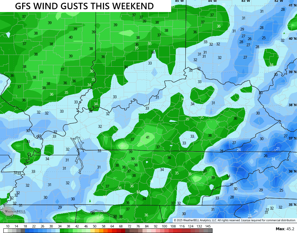
The EURO has a swath of some big time winds behind the departing low…
In addition to the wind and rain, some of the storms could even be strong or severe late Saturday into Saturday night. The best chance is across the west and that’s where the Storm Prediction Center is already highlighting the threat…

Below normal temps push in behind this boundary with the potential for another system to follow that up a few days later.
This pattern may very well bring frost with it at some point next week.
I’ll throw you another update this evening. Make it a terrific Tuesday and take care.

Frost, you say? Could my last mowing be this week?
Frost slows down but doesn’t stop my lawn from growing. In fact, lawns will continue to grow whenever the temperature is above 45°F.
One thing the frost will stop are mosquitoes, thankfully!!
And a hard frost will take care of the midges that are causing EHD in our deer population.