Good evening, everyone. I wanted to drop by for a quick update on the active setup for the upcoming weekend. That big storm system is still set to bring a lot of rain, wind, strong storms and falling temps to our region.
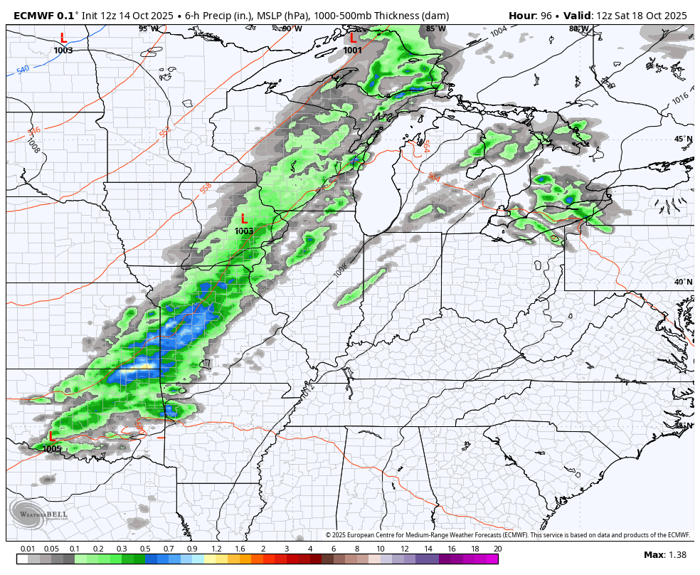
The Storm Prediction Center continues to highlight areas of western Kentucky for the threat for severe storms on Saturday…

That threat diminishes the farther east the system gets Saturday night and early Sunday.
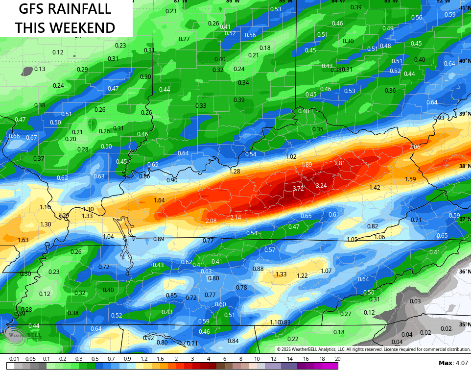
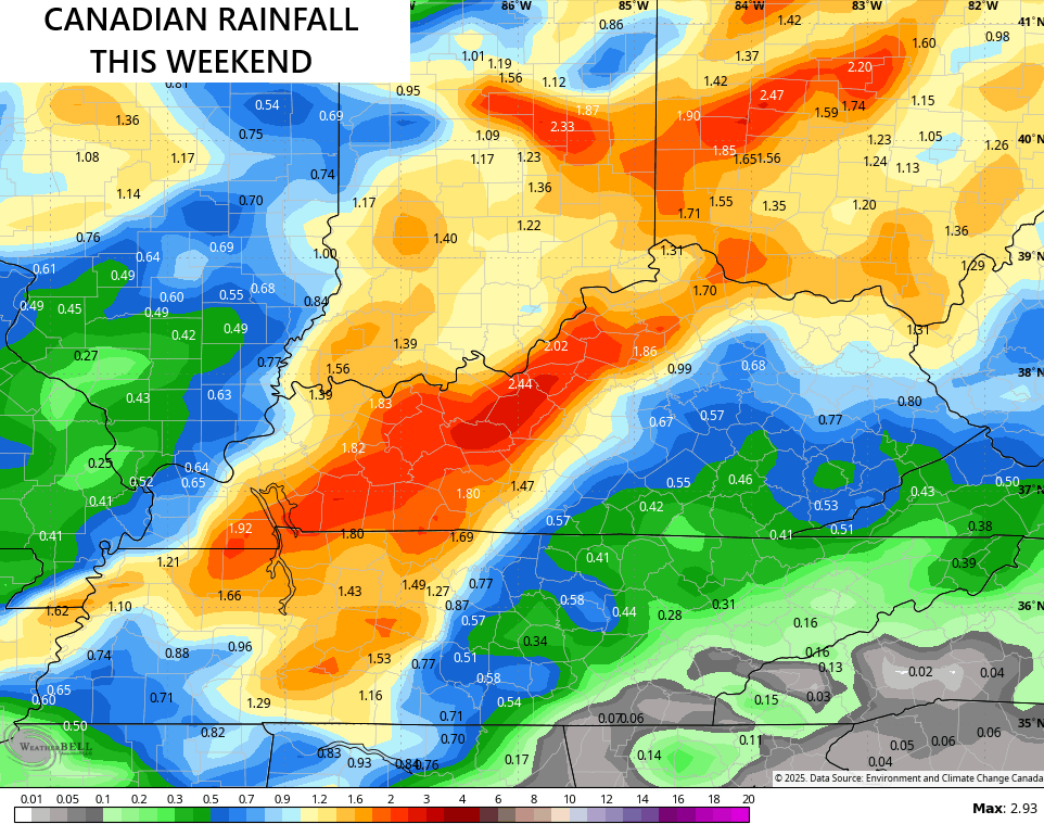
Heavy rains are likely over the weekend, and the models are a little more aggressive with the amounts of rain they expect to fall. The GFS and Canadian Models both have an area of 2″-3″ of rain but they disagree on where…
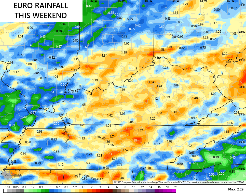
The EURO is a lighter and more spread out with an inch or two of rain for most…
This system unleashes some typical fall chill and will be followed up by another system a few days later…
Enjoy the evening and take care.
