Good Wednesday to one and all. It’s another winner of a weather day across Kentucky, but the winds of change are starting to blow. These winds will blow a big fall storm system into town this weekend, kicking off an active second half of October.
The weak front out there today knocks the numbers down behind it for central and eastern Kentucky Thursday and part of Friday. After that, it’s all about the weekend system.
Let’s break it down:
- Low pressure rolls out of the Rockies into the High Plains Friday into Saturday. That drags a cold front toward Kentucky as a wave of low pressure develops along it.
- The timing brings showers and storms into the west Saturday afternoon. Much of central and eastern Kentucky stay rain and storm free during the daytime.
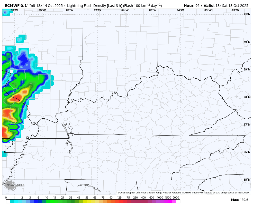
- Some of the storms across the west may be a bit on the strong side with a few severe storms possible.
- Showers and storms then push eastward Saturday evening and last into Sunday. The farther east you are, the soggier your Sunday should be.
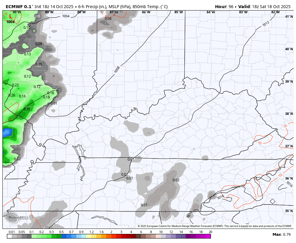
- A half to 2″ of rain appears likely, with locally higher amounts.
- Winds are gusty with this whole setup. Gusts of 30-35mph will be possible ahead of the front Saturday. Winds along the front may gust to 40mph and they may do that again behind the front on a west/northwest wind Sunday.
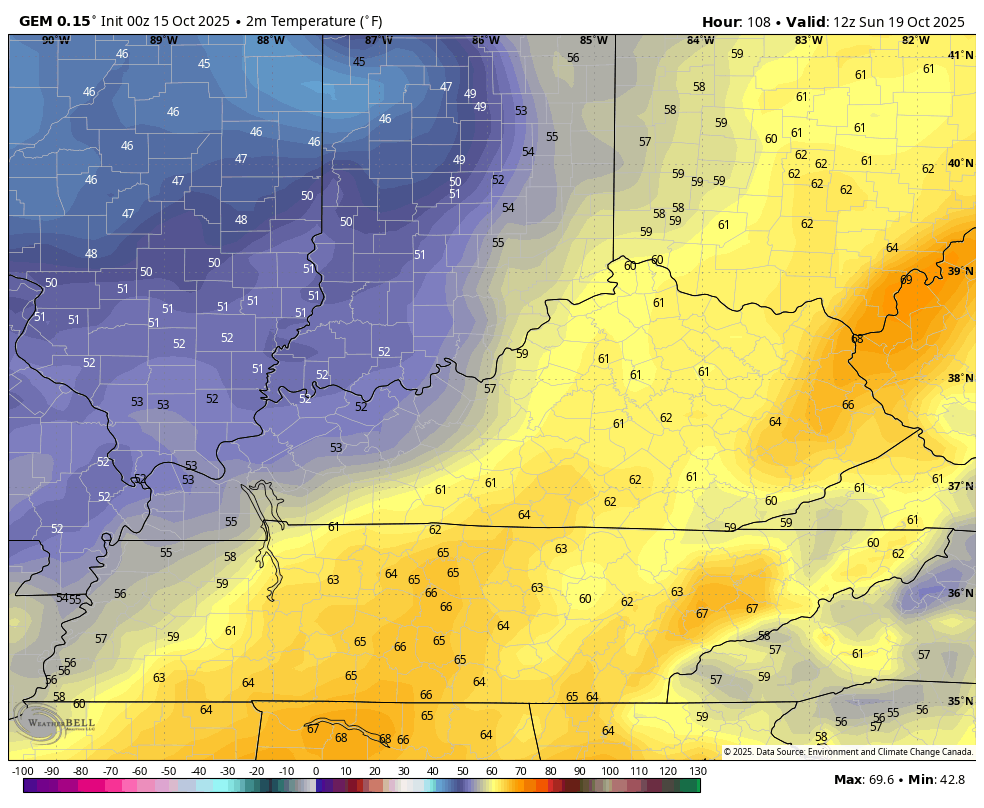
- Temps Sunday are down into the low and mid 60s and may drop into the upper 50s during the afternoon for those areas with lingering rains.
- Seasonably chilly air will be with us Monday with lows in the upper 30s and low 40s and highs of 60-65.
In terms of the Saturday Severe Weather Outlook, the Storm Prediction Center is highlighting the potential in the west…

Here’s the whole evolution of this system from the Euro. Our animations tarts Saturday morning and ends Monday morning…
Check out the lightning density from this same model run…
In terms of the wind gusts, some of the model runs really ramp up the potential. The GFS has some 50mph wind gusts…

We also have quite the temperature swing coming. Highs Saturday can hit 80 on a strong southwest wind. Those temps may drop through the 50s Sunday and into the upper 30s by Monday morning.
This temp animation goes from 8am Sunday to 8am Monday…
Another system drops in behind that by Tuesday or Wednesday of next week. As all this is happening, let’s watch the Caribbean for one last tropical potential.
The signal has been there for a little while for a late month trough to dig into the eastern half of the country in the last week of the month. The Canadian Ensembles even see some flake action nearby in the closing days…
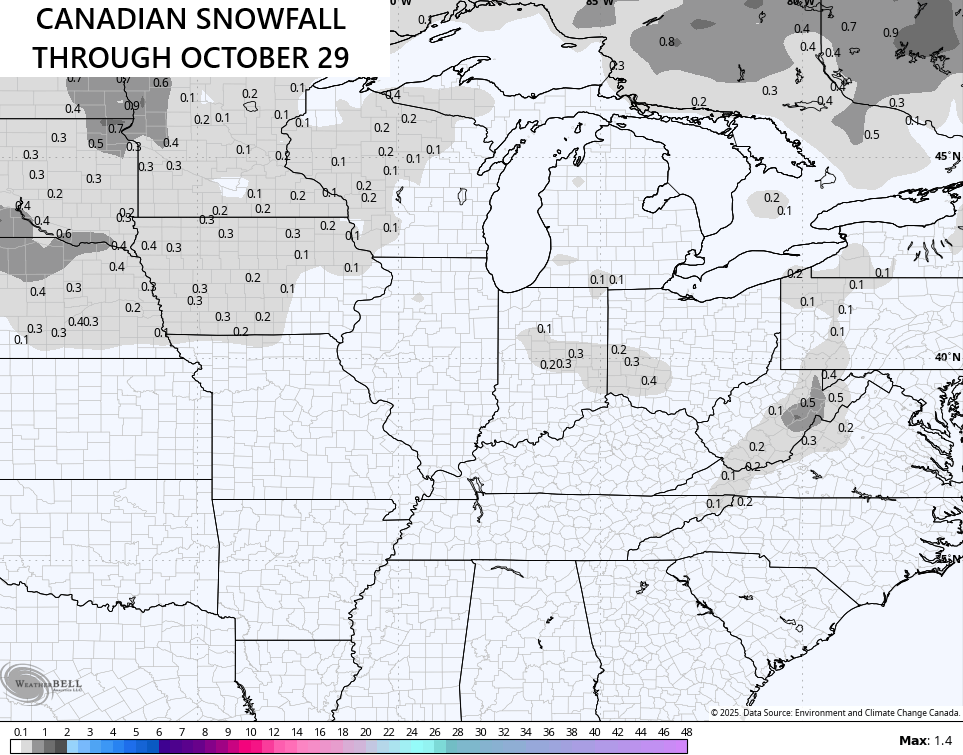
The latest GFS did it a little better with some flakes into the state…

It’s beginning to look a lot like… Halloween. ❄️
I’ll update things later today. Make it a wonderful Wednesday and take care.

I don’t think we see snow here just yet, but the potential seems fun.
Have before back in the 90’s never know
There has been snow flurries on Halloween within the last 17 years….I feel like probably around 10 years ago. My oldest is 17 and I can distinctly remember trick or treating with snowflakes spitting here in BG. I can also remember being ridiculously hot!! Fall in KY…fun and full of surprises!
Wind will be the primary threat, and hopefully we can squeeze out some badly needed rain. The lack of precip and very low soil moisture levels in central Warren County means that the potential for trees being uprooted is very low.