Good Thursday to one and all. Gorgeous weather continues out there today and will hang tough into the start of the upcoming weekend. From there, the pattern gets very active with the first in a series of systems arriving over the weekend.
This storm system will have highs in the low 80s ahead of it, and lows reaching the upper 30s behind it.
Here’s the latest breakdown:
SATURDAY
- Central and eastern Kentucky look dry.
- Storms roll into western Kentucky during the afternoon, and some could be strong or locally severe.
- Highs reach the upper 70s and low 80s across the entire state.
- Southwest winds start to crank and may reach 30mph-35mph in the west and central by late afternoon.
SATURDAY NIGHT
- Showers and storms arrive from west to east.
- A few strong storms will be possible across the western half of the state.
- Winds will absolutely crank and may hit 40mph or a little greater.
- Locally heavy rains will be noted.
SUNDAY
- Early day rumbles of thunder fade to the east as gusty showers continue.
- The rain ends from west to east during the afternoon and evening.
- Winds will still be gusty and may reach 40mph at times, even as they become westerly and northwesterly.
- Temps drop into mid and upper 50s for central and eastern Kentucky.
SUNDAY NIGHT and MONDAY
- Clearing skies kick in from the west during the evening.
- Winds slowly calm down but are still up there.
- Temps are chilly with upper 30s and low 40s by Monday morning.
- Partly sunny skies will be noted Monday with highs ranging from the upper 50s to middle 60s across the state.
This animation from the EURO shows the progression of our system starting at 5pm Saturday and ending 8am Monday…
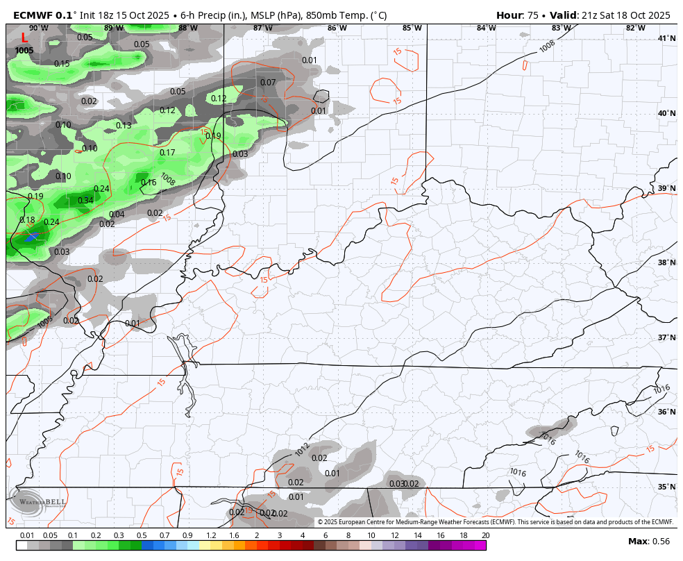
The Storm Prediction Center continues to focus on far western Kentucky for the Saturday severe storms potential…

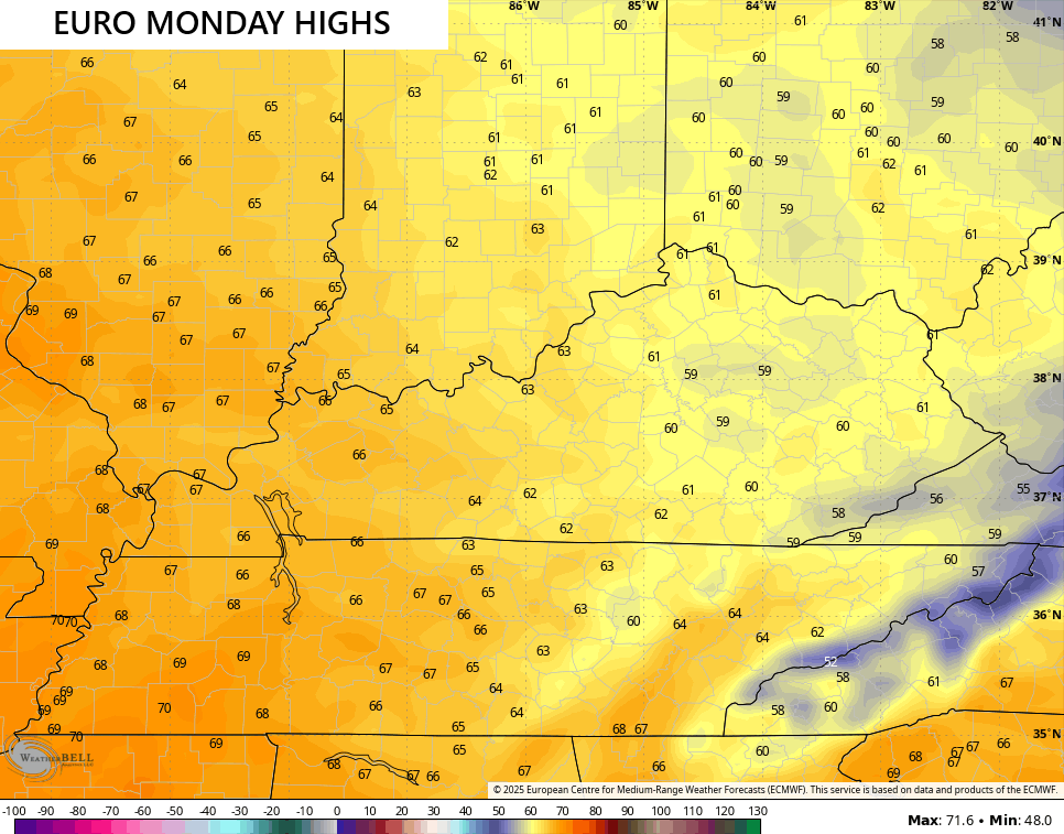
Here’s a look at the Monday highs from the EURO…
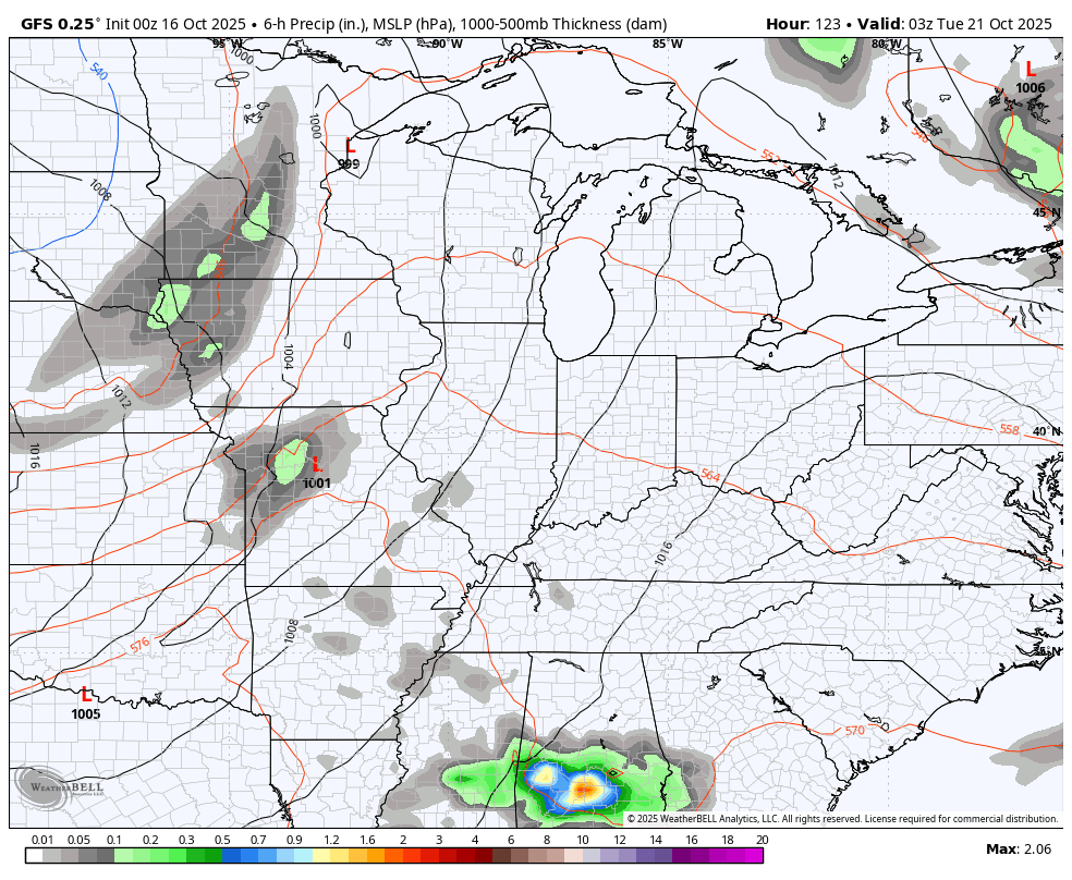
Another system drops in here later Tuesday into Wednesday with some very chilly air behind it. Here’s the GFS…
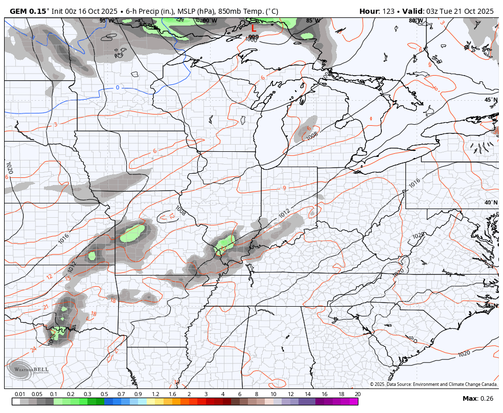
The Canadian looks a little like a winter setup…
I wonder if Snowshoe, WV can get in on the first flakes of the season next week? Hmm
A true frost threat may show up around these parts behind all that.
The pattern continues to point toward a deep trough digging into the eastern half of the country in the days leading up to Halloween. That’s something to watch as is the potential for tropical development in the Caribbean.
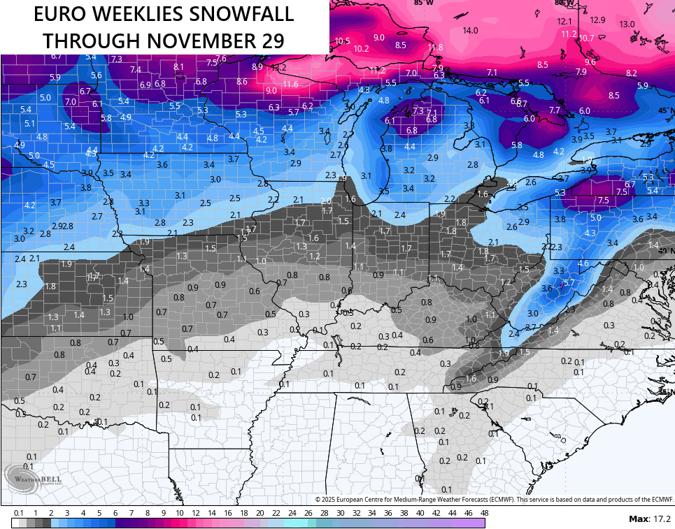
The latest from the EURO Weeklies are optimistic on my November flakes…
So are the GFS Extended which don’t go out as far…
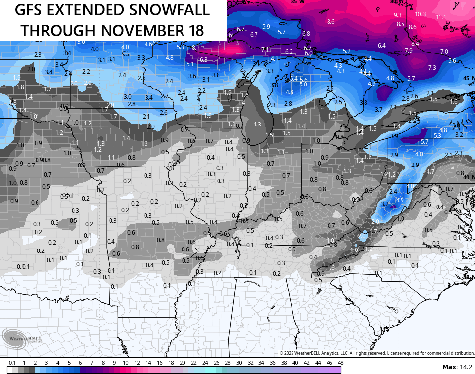
The upslope look in the snowfall along the Appalachian Mountains suggests some pretty strong and cold northwest winds from time to time. We saw this last November and last year continues to be my number 1 analog for the upcoming winter!
I’ll have another update for you crazy kids later today. Enjoy your Thursday and take care.
